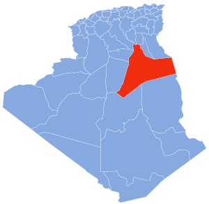
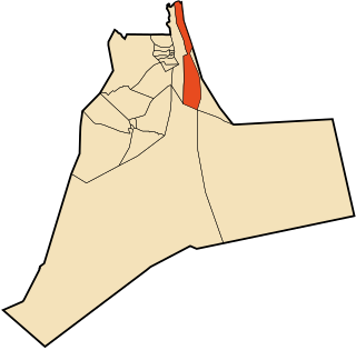
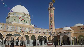
El Oued, Souf or Oued Souf is a city, and the capital of El Oued Province, in Algeria. The oasis town is watered by an underground river, hence its name is El Oued which enables date palm cultivation and the rare use of brick construction for housing. As most roofs are domed, it is known as the "City of a Thousand Domes".

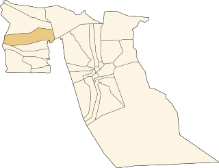
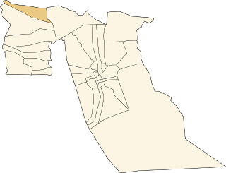
Bayadha is a town and commune, coextensive with Bayadha District, in El Oued Province, Algeria. According to the 2008 census it has a population of 32,926, up from 26,535 in 1998, with an annual growth rate of 2.2%. Most of the commune's population lives in the urban area of the provincial capital El Oued.

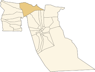
Taghzout is a town and commune in Guemar District, El Oued Province, Algeria. According to the 2008 census it has a population of 13,934, up from 11,147 in 1998, with an annual growth rate of 2.3%. Taghzout is adjacent to the town of Guemar, and is 13 kilometres (8.1 mi) from the provincial capital, El Oued.

Debila is a town and commune, and the capital of Debila District, in El Oued Province, Algeria. According to the 2008 census it has a population of 25,158, up from 20,088 in 1998, and an annual growth rate of 2.3%.

Djamaa is a town and commune in El Oued Province, Algeria. According to the 2008 census it has a population of 50,916, up from 37,438 in 1998, with an annual growth rate of 3.1%.
El M'Ghair, also called El Meghaïer or Mhraïer, is a town and commune, and capital of El M'Ghair District and El M'Ghair Province, Algeria. According to the 1998 census it has a population of 49,793, up from 40,228 in 1998, and is the second largest town in the province after Djamaa. Its annual population growth rate is 2.2%.
Hamraia is a town and commune in Reguiba District, El Oued Province, Algeria. According to the 2008 census it has a population of 5,172, up from 3,938 in 1998, with an annual growth rate of 2.8%.

Hassani Abdelkrim is a town and commune in Debila District, El Oued Province, Algeria. According to the 2008 census it has a population of 22,755, up from 17,207 in 1998, with a population growth rate of 2.9%.

Hassi Khelifa is a town and commune, and capital of Hassi Khelifa District in El Oued Province, Algeria. According to the 2008 census it has a population of 31,784, up from 25,118 in 1998, with an annual growth rate of 2.4%.

M'Rara is a town and commune in Djamaa District, El Oued Province, Algeria. According to the 2008 census it has a population of 7,999, up from 5,976 in 1998, with an annual growth rate of 3.0%.

Oued El Alenda is a town and commune in Mih Ouensa District, El Oued Province, Algeria. According to the 2008 census it has a population of 6,830, up from 5,839 in 1998, with an annual growth rate of 1.6%. The town is 17 kilometres (11 mi) southwest of the provincial capital El Oued, on the N16 highway connecting it to Touggourt.
Oum Touyour is a town and commune in El M'Ghair District, El Oued Province, Algeria. According to the 2008 census it has a population of 11,069, up from 9,735 in 1998, with an annual growth rate of 1.3%, the lowest in the province.

Sidi Amrane is a town and commune in Djamaa District, El Oued Province, Algeria, 5 kilometres (3.1 mi) south of Djamaa. According to the 2008 census it has a population of 21,772, up from 18,732 in 1998, and an annual growth rate of 1.5%.

Sidi Aoun is a town and commune in Magrane District, El Oued Province, Algeria. According to the 2008 census it has a population of 12,235, up from 10,018 in 1998, and an annual growth rate of 2.1%. Sidi Aoun is connected by local roads to Hassani Abdelkrim and Debila, two towns just north-east of El Oued.

Sidi Khellil is a town and commune in El M'Ghair District, El Oued Province, Algeria. According to the 2008 census it has a population of 6,547, up from 5,524 in 1998, and an annual growth rate of 1.7%.
Still is a town and commune in El M'Ghair District, El Oued Province, Algeria. According to the 2008 census it has a population of 4,978, up from 3,545 in 1998, and an annual growth rate of 3.5%.

Tendla is a town and commune in Djamaa District, El Oued Province, Algeria. According to the 2008 census it has a population of 9,193, up from 8,033 in 1998, with an annual growth rate of 1.4%, the second-lowest in the province.

Megarine is a town and commune in Touggourt Province, Algeria, located just north of the city of Touggourt. According to the 2008 census it has a population of 13,751, up from 10,996 in 1998, and an annual growth rate of 2.3%.
Taibet is a town and commune, and the capital of Taibet District, in Touggourt Province, Algeria. According to the 2008 census it has a population of 20,174, up from 14,322 in 1998, and a growth rate of 3.6%.
Tamacine is a town and commune, and capital of Témacine District, in Touggourt Province, Algeria. According to the 2008 census it has a population of 20,067, up from 15,933 in 1998, and an annual growth rate of 2.4%. It is around 10 kilometres (6.2 mi) south of Touggourt. The Tugurt language is spoken by some residents of Tamacine.