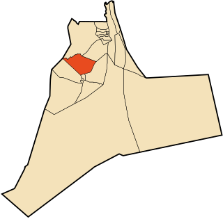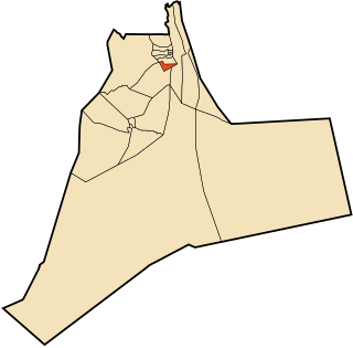
Touggourt is a district in Ouargla Province, Algeria. It was named after its capital, Touggourt. Apart from Ouargla District, it is the smallest, the most populated, and most densely populated district in the province. As of the 2008 census, the district had a population of 146,108.

Témacine is a district in Ouargla Province, Algeria. It was named after its capital, Témacine. It is one of the smallest districts in the province. As of the 2008 census, the district had a population of 34,607.

Taïbet is a district in Ouargla Province, Algeria. It was named after its capital, Taibet. As of the 2008 census, the district had a total population of 44,683.

Sidi Khouïled is a district in Ouargla Province, Algeria. It was named after its capital, Sidi Khouïled. As of the 2008 census, the district had a total population of 32,792. Most of the population of this district lives just to the west of the provincial capital, Ouargla.

El Borma is a town and commune, which is coextensive with El Borma District, in Tunisia. According to the 2008 census it has a population of 3,250, up from 1,997 in 1998. and an annual population growth rate of 4.9%, the second highest in the province. The town is located on the border with Tataouine Governorate, Tunisia.

N'Goussa is a town and commune, coextensive with the district of the same name, in Ouargla Province, Algeria. Some of its inhabitants speak the Ouargli language. As of 2008, the population of the town was 19,039, up from 13,344 in 1998, with an annual population growth rate of 2.2%. The town is on a local road, about 20 kilometres (12 mi) north of Ouargla on the way to El Hadjira further north.

Ain Beida is a town and commune in Sidi Khouïled District, Ouargla Province, Algeria. According to the 2008 census it has a population of 19,039, up from 14,500 in 1998, and an annual population growth rate of 2.8%. Ain Beida is just 6 kilometres (3.7 mi) from central Ouargla and is effectively a suburb of the city. It is also home to the Ain Beida Airport, Ouargla's principal airport.

Balidat Ameur is a town and commune in Ouargla Province, Algeria, located near the provincial capital of Ouargla. According to the 2008 census it has a population of 14,540, up from 12,135 in 1998, and a population growth rate of 1.9%. The commune is made of two areas, the main town of Balidat Ameur, and the village of Goug 7 kilometres (4.3 mi) to the southeast.

Benaceur is a town and commune in Taibet District, Ouargla Province, Algeria. According to the 2008 census it has a population of 10,330, up from the 1998 census when it had a population of 7,808. The annual population growth rate is estimated at 2.9%.

El Allia is a town and commune in El Hadjira District, Ouargla Province, Algeria. According to the 2008 census it has a population of 7,509, up from 6,530 in 1998, and an annual growth rate of 1.4%.

El Hadjira is a town and commune, and capital of El Hadjira District, in Ouargla Province, Algeria. According to the 2008 census it has a population of 14,965, up from 12,781 in 1998, and an annual population growth rate of 1.6%.

Hassi Ben Abdellah is a town and commune in Sidi Khouiled District, Ouargla Province, Algeria, located near the provincial capital, Ouargla. According to the 2008 census it has a population of 4,950, up from 3,693 in 1998, and an annual growth rate of 3.0%. The commune covers an area of 1,672 square kilometres (646 sq mi).

M'Naguer is a town and commune in Taibet District, Ouargla Province, Algeria. According to the 2008 census it has a population of 14,179, up from 11,243 in 1998, and an annual population growth rate of 2.4%.

Nezla is a town and commune in Touggourt District, Ouargla Province, Algeria. According to the 2008 census it has a population of 51,674, up from 40,524 in 1998, and an annual population growth rate of 2.5%. Nezla is part of the urban area of Touggourt, and forms much of the southern area of that city. Agriculture is the main industry of the region, along with some tourism. The Sidi Madhi Airport is found in Nezla commune, and serves Touggourt and the surrounding areas.

Rouissat is a town and commune in Ouargla District, Ouargla Province, Algeria. According to the 2008 census it has a population of 58,112, up from 37,814 in 1998, and a population growth rate of 4.5%. It is within the urban area of the provincial capital Ouargla, lying just to the south of the city center.

Sidi Khouiled is a town and commune, and capital of Sidi Khouiled District, in Ouargla Province, Algeria. It is located near the provincial capital, Ouargla. According to the 2008 census it has a population of 8,803, up from 4,309 in 1998, and has an annual population growth rate of 7.6%, the highest in the province.

Taibet is a town and commune, and the capital of Taibet District, in Ouargla Province, Algeria. According to the 2008 census it has a population of 20,174, up from 14,322 in 1998, and a growth rate of 3.6%.

Tebesbest is a town and commune in Touggourt District, Ouargla Province, Algeria, and forms a part of the urban area of Touggourt. According to the 2008 census it has a population of 35,032, up from 29,840 in 1998, and a population growth rate of 1.7%. It is a predominantly agricultural community, with dates being the main product.

Zaouia El Abidia is a town and commune in Touggourt District, Ouargla Province, Algeria. According to the 2008 census it has a population of 19,993, up from 15,381 in 1998, and has an annual population growth rate of 2.7%. It forms the northern part of the urban area of Touggourt.


