Tennessee State Route 186

Last updated

Tennessee 186.svg Secondary Tennessee 186.svg

State Route 186

Keith Short Bypass
Gibson Highway
Tennessee State Route 186
SR 186, signed in red, unsigned in blue
Route information
Maintained by TDOT
Length29.5 mi (47.5 km)
ExistedJuly 1, 1983 [1] –present
Major junctions
North endUS 45W.svg US 45W in Trenton
Major intersections
South endUS 45.svgUS 70.svg US 45  / US 70 in Jackson
Location
Country United States
State Tennessee
Counties Gibson, Madison
Highway system
Secondary Tennessee 185.svg SR 185 Secondary Tennessee 187.svg SR 187

State Route 186 (SR 186) is a state highway in the U.S. state of Tennessee. It runs from Trenton southward to Jackson, passing through the towns of Gibson and Three Way along the way. The southern portion serves as a western bypass for the city of Jackson, which is signed as U.S. Route 45 Bypass (US 45 Bypass).

Contents

U.S. Route 45 Bypass

By-pass plate.svg

US 45.svg

U.S. Route 45 Bypass

Keith Short Bypass
Route information
Maintained by TDOT
Length9.9 mi (15.9 km)
Major junctions
South endUS 45.svgUS 70.svg US 45  / US 70 in Jackson
Major intersectionsBusiness plate.svg
US 412.svg
US 412 Bus. in Jackson
I-40.svgUS 412.svg I-40  / US 412 in Jackson
North endUS 45.svg US 45 in Jackson
Location
Country United States
State Tennessee
Counties Madison County
Highway system
US 45W.svg US 45W Secondary Tennessee 45.svg SR 45

U.S. Route 45 Bypass (US 45 Bypass), also known as Keith Short Bypass, is an approximately 10 mile expressway bypass for US 45 in Jackson, Tennessee. It has the unsigned designation of State Route 186 (SR 186) for its entire length.

US 45 Bypass signage in Jackson, Tennessee Us45jackson-400.jpg
US 45 Bypass signage in Jackson, Tennessee

Route description

US 45 Bypass begins at an intersection with US 45 (SR 5/Highland Avenue) and US 70 (SR 1/E Chester Street) in downtown. It goes north as a four-lane divided highway, concurrent with US 70/SR 1, to leave downtown and pass through industrial areas to have a signalized intersection with State Street. It then curves to the north and US 70/SR 1 immediately split off and go east along Airways Boulevard towards McKellar-Sipes Regional Airport. US 45 Bypass continues through suburban neighborhoods to pass through a business district before having an interchange with Hollywood Drive. It then has a signalized intersection with US 412 Bus (SR 20/North Parkway) before widening to a six-lane at-grade boulevard. It then passes through another business district before having a partial cloverleaf interchange with I-40/US 412 (Exits 80 A/B) and reducing to four lanes. Temporarily becoming a limited-access highway, US 45 Bypass immediately has an interchange with Vann Drive and Country Club Lane, where it widens back to six lanes. It passes Union University before having at-grade intersections with Union University Drive/Channing Way, Oil Well Road, Old Humboldt Road, and Ashport Road. US 45 Bypass then comes to an end at an interchange with US 45 (SR 5/N Highland Avenue) and Passmore Lane a short distance later, with unsigned SR 186 continuing north along US 45/SR 5.

Major intersections

The entire route is in Jackson, Madison County.

mikmDestinationsNotes
0.00.0US 45.svgEast plate.svg
US 70.svg
US 45 (Highland Avenue/SR 5) / US 70 east (E Chester Avenue/SR 1 east) Henderson, Huntingdon
Southern terminus of US 45 Bypass and unsigned SR 186; southern end of US 70/SR 1/SR 186 concurrency; south end of expressway
0.91.4State StreetAt-grade intersection
1.52.4West plate.svg
US 70.svg
Airport Sign.svg US 70 west (Airways Boulevard/SR 1 west) Brownsville
Northern end of US 70/SR 1 concurrency; at-grade intersection; provides access to McKellar-Sipes Regional Airport
3.0–
3.3
4.8–
5.3
Hollywood DriveInterchange
3.65.8Business plate.svg
US 412.svg
US 412 Bus. (North Parkway/SR 20)
At-grade intersection; north end of expressway
4.7–
5.0
7.6–
8.0
I-40.svgUS 412.svg I-40  / US 412  Memphis, Nashville I-40/US 412 exit 80 A/B; Cloverleaf interchange; south end of expressway
5.1–
5.5
8.2–
8.9
Vann DriveInterchange
5.58.9Country Club LaneInterchange; southbound and northbound exits only
6.19.8Union University Drive/Channing Way - Union University At-grade intersection
6.610.6Oil Well RoadAt-grade intersection
8.012.9Old Humboldt RoadAt-grade intersection
8.613.8Ashport RoadAt-grade intersection
9.4–
9.9
15.1–
15.9
US 45.svg US 45 (N Highland Avenue/SR 5/SR 186 north) / Passmore Lane – Downtown, Three Way, Humboldt, Milan Interchange; northern terminus of US 45 Bypass; northern end of SR 186 concurrency
1.000 mi = 1.609 km; 1.000 km = 0.621 mi

Route description

Gibson County

SR 186 begins as a 2-lane secondary highway in Gibson County in Trenton at an intersection with US 45W slightly southeast of downtown and is known as Gibson Highway. It goes southeast through farmland to have an intersection with SR 420 to enter the town of Gibson, where it passes through downtown and has an intersection with US 79/US 70A/SR 76. (It is known as Main Street in Gibson). From here, SR 186 continues south (as just Highway 186) through farmland to have a short concurrency with SR 187 and have an intersection with SR 152 before crossing into Madison County.

Madison County

SR 186 runs south through farmland to enter Three Way, and has an intersection and becomes concurrent with US 45E/SR 43, where it becomes a four-lane divided highway, as well as an unsigned primary highway. They go southwest and almost immediately come to an interchange with US 45W/SR 5, where SR 43 ends and US 45E and US 45W merge to become US 45, which SR 5 and SR 186 follow south. They continue south as a six-lane divided highway for about 1 mile (1.6 km) before coming to an interchange with Highland Street, where US 45/SR 5 branch off and SR 186 follows US 45 Bypass. US 45 Bypass/ SR 186 (also known as the Keith Short Bypass) continue south around the western side of the city of Jackson through suburban areas as a 4 to 6 lane expressway, where it has interchanges with Vann Drive, I-40/US 412 (Exit 80 A/B), an at-grade intersection with US 412 Bus/SR 20, and an interchange with Hollywood Drive. US 45 Bypass/SR 186 then come to an intersection and become concurrent with US 70/SR 1, where it makes a sudden sharp turn to the east to enter downtown, where it becomes an at-grade surface route before US 45 Bypass and SR 186 both come to an end at an intersection with US 45/SR 5.

The portion of SR 186 from Three Way to Downtown Jackson is unsigned.

Future

The city of Jackson along with TDOT is planning on re-routing SR 186 (along with US 45 Bypass) away from downtown. Under the current plans, it would extend the bypass south across the South Fork of the Forked Deer River and connect it with US 45 in South Jackson. It would route through traffic away from the central business district and give another crossing for South Jackson commuters. [2]

Major intersections

CountyLocationmikmDestinationsNotes
Gibson Trenton 29.547.5US 45W.svg US 45W (Highway 45 Bypass/SR 5) Humboldt, Dyer Northern terminus; SR 186 begins as a secondary highway
Gibson West plate.svg
Secondary Tennessee 420.svg
SR 420 west Fruitland
Eastern terminus of SR 420
US 79.svgUS 70A.svg US 79  / US 70A (SR 76) Humboldt, Milan
West plate.svg
Secondary Tennessee 187.svg
SR 187 west
Northern end of SR 187 concurrency
East plate.svg
Secondary Tennessee 187.svg
SR 187 east Milan
Southern end of SR 187 concurrency
Secondary Tennessee 152.svg SR 152 (Medina Humboldt Highway) Humboldt, Medina
Madison Three Way North plate.svg
US 45E.svg
US 45E north (SR 43 north) Medina, Milan
Morthern end of US 45E/SR 43 concurrency; SR 186 becomes an unsigned primary highway
Begin plate.svg
US 45.svg
North plate.svg
US 45W.svg
US 45 begins / US 45W north (SR 5) Humboldt
Interchange; southern terminus of SR 43; US 45E and US 45W merge to form US 45; northern end of US 45/SR 5 concurrency; north end of expressway
Jackson Begin plate.svg
By-pass plate.svg
US 45.svg
South plate.svg
US 45.svg
US 45 Byp. begins (Keith Short Bypass) / US 45 south (N Highland Avenue/SR 5 south) / Passmore Lane – Downtown
Interchange; northern terminus of US 45 Bypass; southern end of US 45/SR 5 concurrency; northern end of US 45 Bypass concurrency
Ashport RoadAt-grade intersection
Old Humboldt RoadAt-grade intersection
Oil Well RoadAt-grade intersection
Union University Drive/Channing Way - Union University At-grade intersection
Country Club LaneInterchange; southbound and northbound exits only
Vann DriveInterchange
I-40.svgUS 412.svg I-40  / US 412  Memphis, Nashville I-40/US 412 exit 80 A/B; Cloverleaf interchange; south end of expressway
Business plate.svg
US 412.svg
US 412 Bus. (North Parkway/SR 20)
At-grade intersection; north end of expressway
Hollywood DriveInterchange
West plate.svg
US 70.svg
Airport Sign.svg US 70 west (Airways Boulevard/SR 1 west) Brownsville
Northern end of US 70/SR 1 concurrency; at-grade intersection; provides access to McKellar-Sipes Regional Airport
State StreetAt-grade intersection
0.00.0US 45.svgEast plate.svg
US 70.svg
US 45 (Highland Avenue/SR 5) / US 70 east (E Chester Avenue/SR 1 east) Henderson, Huntingdon
Southern terminus of US 45 Bypass and unsigned SR 186; southern end of US 45 Bypass/US 70/SR 1 concurrency; south end of expressway
1.000 mi = 1.609 km; 1.000 km = 0.621 mi

See also

Related Research Articles

<span class="mw-page-title-main">U.S. Route 45</span> Highway in the United States

U.S. Route 45 is a major north-south United States highway and a border-to-border route, from Lake Superior to the Gulf of Mexico. A sign at the highway's northern terminus notes the total distance as 1,297 miles (2,087 km).

<span class="mw-page-title-main">U.S. Route 45E</span> U.S. Highway in Tennessee

U.S. Route 45E (US 45E) is a 61.23-mile-long (98.54 km) state highway in West Tennessee, connecting Jackson with South Fulton via Milan and Martin. For the majority of its length, it runs concurrently with unsigned State Route 43 (SR 43) for most of that highway’s length except for short segments at Martin and South Fulton, where it is cosigned with SR 216 and SR 215, respectively.

<span class="mw-page-title-main">U.S. Route 45W</span> U.S. Highway in Tennessee

U.S. Route 45W is a 62.33-mile-long (100.31 km) United States Numbered Highway in West Tennessee, connecting Jackson with South Fulton via Humboldt, Trenton, Rutherford, and Union City. For the majority of its length, it runs concurrently with unsigned State Route 5.

<span class="mw-page-title-main">Tennessee State Route 22</span> State Highway in Tennessee

State Route 22 is a 172.8-mile long (278.1 km) south-to-north state highway in the western part of Tennessee, United States. It begins at the Mississippi state line in McNairy County, where the roadway continues as Mississippi Highway 2. It ends at the Kentucky state line in Lake County, when it crosses into the Kentucky Bend, a detached portion of Fulton County, Kentucky. The monument for the 1862 Battle of Island Number Ten in the American Civil War is located on SR 22, about 3 mi (4.8 km) north of Tiptonville.
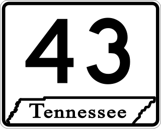
<span class="mw-page-title-main">Tennessee State Route 43</span> State highway in Tennessee, United States

State Route 43 is a south to north highway in Tennessee that is 56.79 miles (91.39 km) long. It begins in Madison County and ends in Obion County. State Route 43 is little-known by the general public by this designation as it is overlain by U.S. Route 45E for most of its length; the "43" designation is seen largely on mileposts. Two short sections of this route at Martin and South Fulton is fully signed. SR 43 from its southern terminus to Milan is designated as a Strategic Highway Network connector route servicing the Milan Arsenal.

<span class="mw-page-title-main">Tennessee State Route 5</span> State highway in Tennessee, United States

State Route 5 is a 120-mile-long (190 km) north–south state highway in the western part of the U.S. state of Tennessee. Except for the section northwest of Union City, it is entirely concurrent with U.S. Route 45 and US 45W.

<span class="mw-page-title-main">Tennessee State Route 20</span> State highway in Tennessee, United States

State Route 20 (SR 20) is a 143.04-mile (230.20 km) long east–west primary state highway that begins in Dyersburg and ending near Summertown. SR 20 is unsigned and concurrent with U.S. Route 412 (US 412) for its entire length, except for a short section between Hohenwald and Summertown. Along its route, SR 20 traverses parts of both Middle Tennessee and West Tennessee.

<span class="mw-page-title-main">U.S. Route 70A (Tennessee)</span> U.S. Highway in Tennessee

U.S. Route 70 Alternate is a 61.7-mile-long (99.3 km) alternate route to US 70 between Brownsville, and Huntingdon in West Tennessee. Signage along this route, and on most maps, show it as US 70A and not US 70 Alternate.

<span class="mw-page-title-main">Tennessee State Route 76</span> Highway in Tennessee

State Route 76 (SR 76) is a state highway in Tennessee, traversing the state in a northeast-southwest axis from east of Memphis to north of Nashville. SR 76 is unique in that it actually changes its cardinal directions in Clarksville at the junction with US 41A and US 41A Bypass.

<span class="mw-page-title-main">U.S. Route 412 in Tennessee</span> U.S. Highway in Tennessee

In Tennessee, U.S. Route 412 stretches for 181.93 miles (292.79 km) through the farmland of West Tennessee and the hills of Middle Tennessee, starting at the Missouri state line near Dyersburg and running to an interchange between I-65 and SR 99 in Columbia.

<span class="mw-page-title-main">U.S. Route 45 in Tennessee</span> U.S. Highway in Tennessee

U.S. Route 45 (US 45) in Tennessee extends from the Mississippi state line to the Kentucky state line in West Tennessee, passing through the cities of Selmer, Henderson, Jackson, and South Fulton. Between Three Way and South Fulton, the highway is split into US 45W and US 45E.

<span class="mw-page-title-main">Tennessee State Route 54</span> Highway in Tennessee

State Route 54 is a west–east rural highway in West Tennessee, which runs from Covington to just north of Paris.

<span class="mw-page-title-main">Tennessee State Route 215</span> State highway in Tennessee, United States

State Route 215 (SR 215) is an unsigned, east–west, state highway entirely within the city limits of South Fulton, Tennessee, although the direction is more northwest to southeast as it curves around the southwest part of the city. It is better known as US 45E and is briefly US 51 near the Kentucky state line. The route serves as a bypass for South Fulton. The northwestern portion is a four-lane divided highway and the southeastern portion is a four lane undivided highway with a center left turn lane.
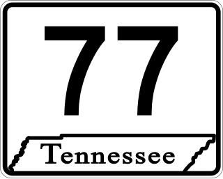
<span class="mw-page-title-main">Tennessee State Route 77</span> Highway in Tennessee

State Route 77 (SR 77), is an east–west state highway in the U.S. state of Tennessee. The 84.86-mile-long (136.57 km) route traverses the flat farmland of West Tennessee.

<span class="mw-page-title-main">Tennessee State Route 105</span> Highway in Tennessee

State Route 105 is a 44.34-mile-long (71.36 km) east–west state highway in West Tennessee. It traverses mainly rural areas and farmland.
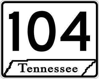
<span class="mw-page-title-main">Tennessee State Route 104</span> State highway in Tennessee, United States

State Route 104 is a 114.43-mile-long east–west state highway in West Tennessee.

<span class="mw-page-title-main">Tennessee State Route 152</span> State highway in Tennessee

State Route 152 is a 36.88-mile-long (59.35 km) east-west state highway traversing the flat farmland of West Tennessee.

<span class="mw-page-title-main">Tennessee State Route 216</span> State highway in Tennessee, United States

State Route 216 is a 17.7-mile-long (28.5 km) east–west state highway in West Tennessee, connecting Rives with Martin.
<span class="mw-page-title-main">Tennessee State Route 367</span> State highway in Tennessee, United States

State Route 367, also known as College Street, is a short 4.80-mile-long (7.72 km) north-south state highway located entirely in the city of Trenton, Tennessee.

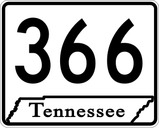
<span class="mw-page-title-main">Tennessee State Route 366</span> Highway in Tennessee

State Route 366 is the unsigned designation for the 5.48-mile-long (8.82 km) northern beltway around the city of Humboldt in Gibson County, Tennessee. Throughout its length, the highway is signed as U.S. Route 45W, US 70A Bypass, and US 79 Bypass.

References

Template:Attached KML/Tennessee State Route 186
KML is not from Wikidata
  1. "The Road To 100 Years" (PDF). Tennessee Road Builder. Vol. 17, no. 5. September 2014. p. 22. Retrieved April 6, 2019.
  2. http://www.tdot.state.tn.us/us45/default.htm