
U.S. Route 411 (US 411) is an alternate parallel-highway associated with US 11. It extends for about 309.7 miles (498.4 km) from US 78 in Leeds, Alabama, to US 25W/US 70 in Newport, Tennessee. US 411 travels through northeastern Alabama, northwestern Georgia, and southeastern Tennessee. It is signed north-south, as with most highways that have odd numbers, but the route runs primarily in a northeast-southwest direction, and covers a more east-west mileage than it does north-south. Notable towns and cities along its route include Gadsden, Alabama; Rome, Georgia; Cartersville, Georgia; Maryville, Tennessee; Sevierville, Tennessee, and Newport, Tennessee.
State Route 56 is a 160.6-mile-long (258.5 km) state highway that runs south to north in Middle Tennessee, from the Alabama state line near Sherwood to the Kentucky state line near Red Boiling Springs.

State Route 22 is a 172.8-mile long (278.1 km) south-to-north state highway in the western part of Tennessee, United States. It begins at the Mississippi state line in McNairy County, where the roadway continues as Mississippi Highway 2. It ends at the Kentucky state line in Lake County, when it crosses into the Kentucky Bend, a detached portion of Fulton County, Kentucky. The monument for the 1862 Battle of Island Number Ten in the American Civil War is located on SR 22, about 3 mi (4.8 km) north of Tiptonville.

State Route 66 is a state-maintained highway in eastern Tennessee, including a six-lane divided highway known as Winfield Dunn Parkway in Sevier County, a four-lane expressway in Hamblen and Jefferson counties and a two-lane rural collector through mountainous terrain continuing to the northeast terminus in Hancock County.

State Route 69 is a state highway in West and Middle Tennessee that runs parallel to the Tennessee River for the majority of its length. SR 69 carries both primary and secondary highway designations and is routed through rural areas.

U.S. Route 27 in Tennessee runs from the Georgia state line in Chattanooga to the Kentucky state line in Isham. It forms the informal border between the Eastern and Central Time Zones of the state. However, it stays in the Eastern Time Zone.

State Route 8 is a 75.43-mile-long (121.39 km) north–south state highway in East and Middle Tennessee. It connects the cities of Chattanooga and McMinnville via Signal Mountain and Dunlap.
State Route 13, in the United States, is a south–north route from the Alabama border in Wayne County to the Kentucky border in Montgomery County. The entire route is located in western Middle Tennessee.

State Route 15 is a west–east route from Memphis to Monteagle. For much of its route it has an unsigned concurrency with U.S. Route 64. SR 15 does travel through the southern part of all 3 Grand Divisions of the state: West Tennessee, Middle Tennessee, and East Tennessee.

In Tennessee, U.S. Route 412 stretches for 181.93 miles (292.79 km) through the farmland of West Tennessee and the hills of Middle Tennessee, starting at the Missouri state line near Dyersburg and running to an interchange between I-65 and SR 99 in Columbia.

U.S. Route 441 stretches for 83.28 miles (134.03 km) through the mountains of East Tennessee, connecting Rocky Top with Knoxville, Sevierville, Gatlinburg, and the Great Smoky Mountains National Park, crossing into North Carolina at Newfound Gap. Near its northern terminus, US 441 crosses over Norris Dam and passes through Norris Dam State Park.

State Route 32 is a state highway in East Tennessee. For most of its route, it is an unsigned companion route concurrent with U.S. Route 25E. The highway stretches 89 miles from the North Carolina state line to the Tennessee-Kentucky state line near the town of Cumberland Gap.

State Route 53 (SR 53) is a north–south state highway that traverses six counties in Middle Tennessee. It is 113.5 miles (182.7 km) long.

U.S. Route 231 in Tennessee runs north–south for 121.15 miles (194.97 km), entirely in Middle Tennessee, that starts south of Fayetteville at the Alabama state line, and ends north of Westmoreland at the Kentucky state line. For the majority of its length, between the Alabama state line and Trousdale County, it is concurrent with unsigned State Route 10.
State Route 128 (SR 128) is a state highway in western and western Middle Tennessee.
State Route 114 is a north–south state highway that traverses six counties in the western grand division of Tennessee. The 96.49-mile-long (155.29 km) route travels from Clifton Junction to an area south of Paris via Scotts Hill, Lexington, and the Natchez Trace State Park.

State Route 142 is a 24.59 mile long east-west state highway in West Tennessee.
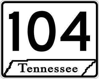
State Route 104 is a 114.43-mile-long east–west state highway in West Tennessee.

State Route 226, also known as Airport Road, is a 7.0-mile-long (11.3 km) north–south state highway in Hardin County, Tennessee.
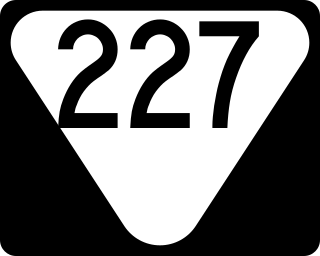
State Route 227 is a 32.3-mile-long (52.0 km) east–west state highway in extreme southern Middle Tennessee. It is the only state highway in Tennessee that both begins and ends at the Alabama state line, with one end at Cypress Inn and the other just across the state line from Lexington, Alabama.

