Territory of Quintana Roo

Last updated
Territory of Quintana Roo
Territorio de Quintana Roo
Territory of Mexico
1902–1974
Quintana Roo in Mexico (location map scheme).svg
Location of the Territory of Quintana Roo (red) in Mexico.
Capital Santa Cruz de Bravo (1902–1913)
Payo Obispo (1915–1974)
Area 
 1902
50,844 km2 (19,631 sq mi)
Government
  Type Territory of Mexico
Territorial governor 
 1971–1974
David Gustavo Gutiérrez  [ es ](last)
History 
 Established
16 January 1902
 First suppression
10 June 1913
 First reestablishment
28 June 1915
 Second suppression
14 December 1931
 Second reestablishment
11 January 1935
  Statehood
8 October 1974
Preceded by
Succeeded by
Flag of the Republic of Yucatan.svg Yucatán
Quintana Roo Flag of Quintana Roo.svg

The Territory of Quintana Roo (Spanish : Territorio de Quintana Roo) was a federal territory of Mexico that existed intermittently between 1902 and 1974, when it was granted statehood within the United Mexican States as Quintana Roo. [1]

Contents

History

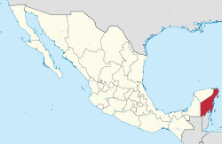
The territory was created on 16 January 1902 by decree of President Porfirio Díaz and its first political leader was General José María de la Vega. [2] The territory was named after an early Mexican patriot, Andrés Quintana Roo. Its capital was the city of Santa Cruz de Bravo, and it covered an area of 50,844 km². [3] The main motivation for creating the territory, among other factors, was so that the Mexican Federal Army could confront the indigenous Maya people in the Caste War of Yucatán, and pacify the region. [4] [5]

A decade later and in the midst of the Mexican Revolution, Yucatecan politicians alleged that the creation of Quintana Roo had been the product of the dictatorial regime of Porfirio Díaz and proposed that the territory be returned to them. In this way, on 10 June 1913 Venustiano Carranza (First Chief of the Constitutional Army), pressured by peninsular economic and political interests, decreed the reintegration of the territory into Yucatán. [3] [5]

After the events that occurred in 1915, in which Abel Ortiz Argumedo  [ es ] revolted in Yucatán with the intention of creating a new republic, added to the opposition of the indigenous Maya in this region, Carranza ordered that the territory be reestablished on 28 June of the same year. [3] Once the uprising in Yucatán was defeated, General Salvador Alvarado was sent to Santa Cruz de Bravo in order to calm the belligerent spirits of the Maya, who demanded the withdrawal of troops and the restitution of their lands; he gave them the town and the surrounding area. [3] [5] The Maya, then fearful of being target of attacks of this type again, destroyed the existing infrastructure and cut themselves off from the outside world. After this they never took up arms again. The capital was then moved to Payo Obispo. [3]

The territory was again suppressed on 14 December 1931 by President Pascual Ortiz Rubio, citing economic limitations in the treasury for its support, and was then annexed by the states of Yucatán (northern zone) and Campeche (southern zone). Due to the discontent of the residents, the Pro-Territory Committee of Quintana Roo was created, which after many protests achieved its restitution on 11 January 1935 under President Lázaro Cárdenas. [3] A year later, its capital Payo Obispo changed its name and became Chetumal. [5]

The economic and population growth that Quintana Roo experienced after the construction of the port of Cancún and the agricultural and agro-industrial development in the south, [3] allowed it to be elevated to the status of a state within the United Mexican States on 8 October 1974. [4]

See also

Related Research Articles

<span class="mw-page-title-main">Yucatán</span> State of Mexico

Yucatán, officially the Estado Libre y Soberano de Yucatán, is one of the 31 states which, along with Mexico City, constitute the 32 federal entities of Mexico. It comprises 106 separate municipalities, and its capital city is Mérida.

<span class="mw-page-title-main">Chetumal</span> Place in Quintana Roo, Mexico

Chetumal is a city on the east coast of the Yucatán Peninsula in Mexico. It is the capital of the state of Quintana Roo and the municipal seat of the Municipality of Othón P. Blanco. In 2020 it had a population of 169,028 people.

<span class="mw-page-title-main">Quintana Roo</span> State of Mexico

Quintana Roo, officially the Free and Sovereign State of Quintana Roo, is one of the 31 states which, with Mexico City, constitute the 32 federal entities of Mexico. It is divided into 11 municipalities, and its capital city is Chetumal.

<span class="mw-page-title-main">Cancún</span> City in Quintana Roo, Mexico

Cancún, often Cancun in English is a city in southeast Mexico on the northeast coast of the Yucatán Peninsula in the Mexican state of Quintana Roo. It is a significant tourist destination in Mexico and the seat of the municipality of Benito Juárez. The city is on the Caribbean Sea and is one of Mexico's easternmost points.

<span class="mw-page-title-main">Felipe Carrillo Puerto</span> Mexican politician (1874-1924)

Felipe Carrillo Puerto was a Mexican journalist, politician and revolutionary who became known for his efforts at reconciliation between the Yucatec Maya and the Mexican government after the Caste War. He was governor of the Mexican state of Yucatán from 1922 to 1924.

<span class="mw-page-title-main">Felipe Carrillo Puerto, Quintana Roo</span> Place in Quintana Roo, Mexico

Felipe Carrillo Puerto is the municipal seat and largest city in Felipe Carrillo Puerto Municipality in the Mexican state of Quintana Roo. According to the 2010 census, the city's population was 25,744 persons, mostly of Maya descent. The Sian Kaʼan Biosphere Reserve lies just east of the city.

<span class="mw-page-title-main">Municipalities of Quintana Roo</span>

Quintana Roo is a state in southeast Mexico established out of the Quintana Roo Territory in 1974 with seven municipalities, which has since grown into eleven municipalities. According to the 2020 Mexican census, it has the twenty-fourth largest population of all states with 1,857,985 inhabitants and is the 19th largest by land area spanning 44,705.2 square kilometres (17,260.8 sq mi).

<span class="mw-page-title-main">Costa Maya</span> Tourist region in Quintana Roo, Mexico

Costa Maya is a small tourist region in the municipality of Othón P. Blanco in the state of Quintana Roo, Mexico, the only state bounded by the Caribbean Sea to its east. This municipality is close to Chetumal on the border with Belize. The area was generally undeveloped but has been growing rapidly since construction of a large pier to accommodate cruise ships. Costa Maya is also the name of a subdivision near the village of Mahahual. The beach extends from Xcalak in the south to the southern border of Sian Ka'an in the north, a distance of approximately 100 kilometers (62 mi).

<span class="mw-page-title-main">Territorial evolution of Mexico</span>

Mexico has experienced many changes in territorial organization during its history as an independent state. The territorial boundaries of Mexico were affected by presidential and imperial decrees. One such decree was the Law of Bases for the Convocation of the Constituent Congress to the Constitutive Act of the Mexican Federation, which determined the national land area as the result of integration of the jurisdictions that corresponded to New Spain, the Captaincy General of Yucatán, the Captaincy General of Guatemala and the autonomous Kingdoms of East and West. The decree resulted in the independence from Spain.

<span class="mw-page-title-main">Time in Mexico</span> Time zones used in Mexico

Mexico uses four time zones:

<span class="mw-page-title-main">Republic of Yucatán</span> Country in southeastern Mexico (1823, 1841–48)

The Republic of Yucatán was a sovereign state during two periods of the nineteenth century. The first Republic of Yucatán, founded May 29, 1823, willingly joined the Mexican federation as the Federated Republic of Yucatán on December 23, 1823, less than seven months later. The second Republic of Yucatán began in 1841, with its declaration of independence from the Centralist Republic of Mexico. It remained independent for seven years, after which it rejoined the United Mexican States. The area of the former republic includes the modern Mexican states of Yucatán, Campeche and Quintana Roo. The Republic of Yucatán usually refers to the second republic (1841–1848).

<span class="mw-page-title-main">Index of Mexico-related articles</span>

The following is an alphabetical index topics related to the Mexico.

<span class="mw-page-title-main">Belize–Mexico border</span> International border

The Belize–Mexico border is an international border between Belize and Mexico. It is 250 km (160 mi) long and almost exclusively follows the course of the Hondo River. It separates Belize from the Mexican state of Quintana Roo.

<span class="mw-page-title-main">Salvador Alvarado</span> Mexican politician (1880–1924)

Salvador Alvarado Rubio was a general and politician during the Mexican Revolution. He was serving in the Constitutionalist Army under President Carranza. Alvarado was the Governor of Yucatán from February 1915 to November, 1918, and Secretary of the Treasury under President de la Huerta. There is a Salvador Alvarado Municipality in the State of Sinaloa, where he was born, named in his honor.

<span class="mw-page-title-main">José Siurob</span> Mexican politician

José María Siurob Ramírez y Gutiérrez better known as José Siurob Ramírez was a Mexican military general who participated in the Mexican Revolution. He was governor of the state of Querétaro, Guanajuato and the territory of Quintana Roo. He was also head of the Department of Public Health under President Lazaro Cardenas del Rio and at the same time head of the Central Federal District.

<span class="mw-page-title-main">Decauville railway Vigía Chico-Santa Cruz</span>

The Decauville railway Vigía Chico-Santa Cruz was a nearly 57 km (35 mi) long 600 mm gauge railway line, which was built during the Caste War of Yucatán at Santa Cruz in Mexico and operated from 1905 to 1932.

<span class="mw-page-title-main">Agustín Vales Castillo</span>

Agustín Vales Castillo was a Mexican businessman, banker, industrialist, landowner, philanthropist, and liberal politician who served as prefect of Mérida during the governorship of Olegario Molina. He emerged as a prominent figure during the heyday of the henequen industry in Yucatan due to his influence in business and political circles during the Porfiriato era.

Alfredo Cámara Vales was a Mexican businessman and liberal politician who served as the Governor of Quintana Roo from 1912 to 1913. He fought during the Mexican Revolution.

References

  1. "Poder Legislativo del Estado de Quintana Roo" (PDF) (in Spanish). Archived from the original (PDF) on October 12, 2011.
  2. "Creación del Territorio Federal de Quintana Roo sobre tierra maya" (in Spanish). Centro Quintanarreense de Desarrollo, Asociación Civil. Retrieved 31 December 2023.
  3. 1 2 3 4 5 6 7 "Historia de Quintana Roo" (in Spanish). Gobierno del Estado de Quintana Roo. Archived from the original on 23 January 2016. Retrieved 31 December 2023.
  4. 1 2 Pérez Tapia, Raymundo. "De territorio a Estado: La creación del Estado de Quintana Roo" (in Spanish). Identidades México. Retrieved 31 December 2023.
  5. 1 2 3 4 Doralicia Carmona. "El territorio de Quintana Roo se eleva a la categoría de Estado" (in Spanish). Memoria Política de México. Retrieved 31 December 2023.

Bibliography