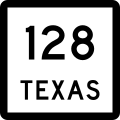
Texas State Highway 128

Last updated

Texas 128.svg

State Highway 128

Texas State Highway 128
SH 128, highlighted in red
Route information
Maintained by TxDOT
Length13.769 mi [1]  (22.159 km)
Existed1955–present
Major junctions
West endNew Mexico 128.svg NM 128 at New Mexico state line near Jal
East endTexas 115.svg SH 115
Location
Country United States
State Texas
Counties Andrews
Highway system
Texas 127.svg SH 127 Texas 129.svg SH 129

State Highway 128 (SH 128) is a state highway in Andrews County, Texas. [1]

Contents

Route description

SH 128 begins at the New Mexico state line east of Jal, New Mexico, as New Mexico Highway 128 crosses into Texas. The route immediately encounters its only intersection between its termini, at FM 1218, which runs just inside the state line. [2] The route travels eastward through unincorporated Andrews County before ending at SH 115 about 20 miles (32 km) southwest of Andrews. [3]

History

SH 128 was originally designated on May 21, 1927 along a route from Sinton northeast to the Victoria County line. On October 11, 1927, it was extended south to Robstown and numbered SH 128. [4] [5] On March 19, 1928, it was extended north to Victoria. [6] On June 24, 1931, it had been extended west to Alice, replacing a portion of SH 12A. [7] On September 19, 1933, it was extended north to Hallettsville. [8] On July 15, 1935, the section from Victoria to Hallettsville was cancelled. [9] On September 26, 1935, the section from Victoria to Hallettsville was restored as part of the lateral road program, and construction started on that section. [10] On November 24, 1936, the entire route became part of SH 44. SH 128 was then designated on the current SH 237 from La Grange northeast to US 290 near Carmine, replacing a portion of SH 72. [11] This was renumbered as SH 237 on December 22, 1936, presumably to avoid confusion with the just cancelled SH 128. [12]

The current route was originally designated on May 7, 1948 as Farm to Market Road 781 and ran from the state line to FM 703. [13] The highway was signed, but not officially designated, concurrently as SH 128 beginning on March 30, 1955, "for guidance of traveling public" to correspond with New Mexico State Highway 128 (which was renumbered from NM 256 to NM 128 that day; FM 703 was signed but not designated as part of SH 115 in October 1952). [1] The FM 781 designation was cancelled on August 29, 1990; the same day, FM 703 became part of SH 115. [13] [14]

Major intersections

The entire route is in Andrews County.

Locationmi [15] kmDestinationsNotes
0.00.0New Mexico 128.svg NM 128  Jal Western terminus and continuation
0.00.0Texas FM 1218.svg FM 1218
13.822.2Texas 115.svg SH 115  Kermit, Andrews Eastern terminus
1.000 mi = 1.609 km; 1.000 km = 0.621 mi

Related Research Articles

<span class="mw-page-title-main">Texas State Highway 3</span> State highway in Galveston and Harris counties in Texas, United States

State Highway 3 is a state highway in the U.S. state of Texas that runs from Interstate 45 in Houston near William P. Hobby Airport to State Highway 146, 9.9 miles (15.9 km) northwest of Galveston. For most of its length, SH 3 parallels I-45 and runs alongside the former Galveston, Houston and Henderson Railroad lines.

<span class="mw-page-title-main">Texas State Highway 37</span> State highway in Wood, Franklin, and Red River counties in Texas, United States

State Highway 37 is a state highway that runs from the Oklahoma state line near Albion to Mineola in the northeast corner of the state.

<span class="mw-page-title-main">Texas State Highway 43</span> State highway in Texas

State Highway 43 is a Texas state highway that runs from Henderson to Atlanta.

<span class="mw-page-title-main">Texas State Highway 44</span> State highway in Texas

State Highway 44 (SH 44) is a Texas state highway that runs from west of Encinal to Corpus Christi, Texas. This highway is also known as the Cesar Chavez Memorial Highway outside the city limits of Robstown, Banquete, Agua Dulce, Alice, and Corpus Christi in Nueces and Jim Hogg counties.

<span class="mw-page-title-main">Texas State Highway 51</span> State highway in Texas

State Highway 51 is a short state highway located entirely in Hansford County, Texas, just south of Spearman.

<span class="mw-page-title-main">Texas State Highway 95</span> State highway in Texas

State Highway 95 is a state highway which connects the cities of Yoakum and Temple in the U.S. state of Texas.

<span class="mw-page-title-main">Texas State Highway 57</span> State highway in Texas

State Highway 57 is a 1.474-mile (2.372 km) Texas state highway located in Tyler.

<span class="mw-page-title-main">Texas State Highway 89</span> State highway in Texas

State Highway 89 is a state highway in San Patricio County in the U.S. state of Texas. The route serves as a bypass of Sinton to the northeast, connecting to U.S. Route 181 (US 181) at both ends.

<span class="mw-page-title-main">Texas State Highway 111</span> State highway in Texas

State Highway 111 is a state highway that runs from Gonzales to Midfield in the southeastern region of the U.S. state of Texas.

<span class="mw-page-title-main">Texas State Highway 115</span> State highway in Texas

State Highway 115 is a state highway in the U.S. state of Texas that runs from Interstate 20 in Pyote to SH 349 at Patricia.

<span class="mw-page-title-main">Texas State Highway 81</span> State highway in Texas

State Highway 81 is a Texas state highway that runs from Hillsboro to Grandview. It was designated in 1991 to replace U.S. Highway 81, which was decommissioned south of Fort Worth.

<span class="mw-page-title-main">Texas State Highway 175</span> Highway in Texas

State Highway 175 (SH 175) is a state highway in the U.S. state of Texas that runs from Montague to Nocona in Montague County.

<span class="mw-page-title-main">Texas State Highway 132</span> State highway in Texas

State Highway 132 (SH 132) is a state highway in Texas, United States, running 12.71 miles (20.45 km) between Devine and Lytle. It follows a former alignment of U.S. Highway 81 (US 81), which was bypassed by the parallel Interstate 35 (I‑35). SH 132 was established in 1991, when US 81 was truncated to Fort Worth.

<span class="mw-page-title-main">Texas State Highway 137</span> State highway in Texas

State Highway 137 (SH 137) is a state highway in west Texas. It runs 192.238 miles (309.377 km) from SH 163 near Ozona to U.S. Highway 385 (US 385) near Brownfield. SH 137 was originally established in 1928, and it has been realigned several times since then.

<span class="mw-page-title-main">Texas State Highway 141</span> State highway in Texas

State Highway 141 is a Texas state highway in Jim Wells and Kleberg counties.

<span class="mw-page-title-main">Texas State Highway 173</span> State highway in Texas

State Highway 173 (SH 173) is a state highway that runs for 97.9 miles (157.6 km) from Jourdanton to Kerrville in south Texas, traversing through the Texas Hill Country.

<span class="mw-page-title-main">Texas State Highway 176</span> State highway in Texas

State Highway 176 (SH 176) is a Texas state highway running from the New Mexico state line east to Big Spring. It is most commonly known as the Andrews Highway.

<span class="mw-page-title-main">Texas State Highway 214</span> State highway in Texas

State Highway 214 (SH 214) is a Texas state highway that runs from Adrian to Seminole.

<span class="mw-page-title-main">Texas State Highway 234</span> Highway in Texas

State Highway 234 is a short state highway connecting Edroy and Odem in San Patricio County, Texas.

References

  1. 1 2 3 Transportation Planning and Programming Division (n.d.). "State Highway No. 128". Highway Designation Files. Texas Department of Transportation . Retrieved June 15, 2010.
  2. Transportation Planning and Programming Division (2018). Texas County Mapbook (PDF) (Map) (2018 ed.). 1:72,224. Texas Department of Transportation. p. 847. Retrieved December 23, 2022.
  3. Transportation Planning and Programming Division (2018). Texas County Mapbook (PDF) (Map) (2018 ed.). 1:72,224. Texas Department of Transportation. p. 848. Retrieved December 23, 2022.
  4. "Minutes" (PDF). publicdocs.txdot.gov. Texas Department of Transportation. October 10, 1927. Archived (PDF) from the original on January 22, 2018. Retrieved 5 May 2023.
  5. "Minutes" (PDF). publicdocs.txdot.gov. Texas Department of Transportation. May 23, 1927. Archived (PDF) from the original on January 22, 2018. Retrieved 5 May 2023.
  6. "Minutes" (PDF). publicdocs.txdot.gov. Texas Department of Transportation. March 19, 1928. Archived (PDF) from the original on January 22, 2018. Retrieved 5 May 2023.
  7. "Minutes" (PDF). publicdocs.txdot.gov. Texas Department of Transportation. June 22, 1931. Archived (PDF) from the original on January 29, 2018. Retrieved 5 May 2023.
  8. "Minutes" (PDF). publicdocs.txdot.gov. Texas Department of Transportation. September 18, 1933. Archived (PDF) from the original on February 5, 2018. Retrieved 5 May 2023.
  9. "Minutes" (PDF). publicdocs.txdot.gov. Texas Department of Transportation. July 15, 1935. Archived (PDF) from the original on October 20, 2017. Retrieved 5 May 2023.
  10. "Minutes" (PDF). publicdocs.txdot.gov. Texas Department of Transportation. September 16, 1935. Archived (PDF) from the original on February 6, 2018. Retrieved 5 May 2023.
  11. "Minutes" (PDF). publicdocs.txdot.gov. Texas Department of Transportation. November 23, 1936. Archived (PDF) from the original on October 19, 2017. Retrieved 5 May 2023.
  12. "Minutes" (PDF). publicdocs.txdot.gov. Texas Department of Transportation. December 21, 1936. Archived (PDF) from the original on October 19, 2017. Retrieved 5 May 2023.
  13. 1 2 Transportation Planning and Programming Division (n.d.). "Farm to Market Road No. 781". Highway Designation Files. Texas Department of Transportation . Retrieved November 21, 2010.
  14. Transportation Planning and Programming Division (n.d.). "State Highway No. 115". Highway Designation Files. Texas Department of Transportation . Retrieved June 15, 2010.
  15. Google (September 26, 2011). "Overview map of Texas State Highway 128 Distances Between Interchanges" (Map). Google Maps . Google. Retrieved September 26, 2011.