Thar Jath Airstrip

Last updated
Thar Jath Airstrip
Summary
Airport typePublic, Civilian
Ownern/a
ServesDuar, South Sudan
Location Duar, Flag of South Sudan.svg  South Sudan
Elevation  AMSL unknown ft / unknown m
Coordinates 08°46′55″N30°07′52″E / 8.78194°N 30.13111°E / 8.78194; 30.13111 (Thar Jath Airstrip)
Map
South Sudan adm location map.svg
Airplane silhouette.svg
Thar
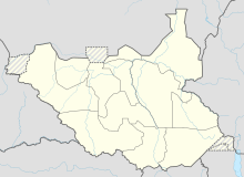
Location of Thar Jath Airstrip in South Sudan
Runways
Direction LengthSurface
ftm
14/326,561 (est.)2,000 (est.)Unpaved

Thar Jath Airstrip is an airport in South Sudan.

Location

Thar Jath Airstrip ( IATA : n/a, ICAO : n/a) is located in Guit County, Unity State, in the Greater Upper Nile Region of South Sudan, near the town of Duar.

Contents

This location lies approximately 464 kilometres (288 mi), by air, north of Juba International Airport, the largest airport in South Sudan. [1] The geographic coordinates of this airport are: 8° 46' 55.24"N, 30° 7' 52.42"E (Latitude: 8.782013; Longitude: 30.131228). The elevation of Thar Jath Airstrip is unknown. The airport has a single unpaved runway, the dimensions of which are not publicly known at this time.

Overview

Thar Jath Airstrip is a small civilian airport that serves the town of Duar and surrounding communities. It also serves the Thar Jath oil field. There are no known scheduled airlines serving this airport at this time, but the United Nations Humanitarian Air Service served the field from Rumbek Airport. [2]

See also

Related Research Articles

Akobo Airport is an airport serving the town of Akobo, in Jonglei State, South Sudan.

Aweil Airport is an airport serving the town of Aweil, in South Sudan.

Gogrial Airport is an airport in South Sudan.

Kajo Keji is an airstrip serving the town of Kajo Keji, in South Sudan.

<span class="mw-page-title-main">Kapoeta Airport</span> Airport in Kapoeta, South Sudan

Kapoeta Airport is an airport serving Kapoeta in South Sudan.

Pochalla Airport is an airport serving Pochalla in South Sudan.

Pibor Airport is an airport serving the town of Pibor, in South Sudan.

<span class="mw-page-title-main">Raga Airport</span> Airport in Raga, South Sudan

Raga Airport is an airport serving the town of Raga in South Sudan.

Renk Airport is an airport serving Renk in South Sudan.

Torit Airport is an airport serving the town of Torit, in South Sudan.

Tumbura Airport is an airport serving Tumbura in South Sudan.

Yambio Airport is an airport serving Yambio in South Sudan.

Yirol Airport is an airport in South Sudan. It has a single unpaved runway.

Yei Airport is an airport serving Yei in South Sudan.

<span class="mw-page-title-main">Wau Airport</span> Airport in Wau, South Sudan

Wau Airport is a civilian airport that serves the city of Wau and surrounding communities. Feeder Airlines has three return flights a week between Khartoum-Wau-Juba. Southern Star Airlines used to provide service on Wednesdays and Sundays to Juba; however, this service has been suspended in 2011 when the airline ceased flying.

Tonj Airport is an airport serving Tonj in South Sudan. It is located in Tonj County in Warrap State, in the town of Tonj, in the Bahr el Ghazal Region of South Sudan. The airport is just outside town to the west of the central business district.

Thar Jath is a community in Koch County, Unity State, South Sudan.

<span class="mw-page-title-main">Block 5A, South Sudan</span>

Block 5A is an oil concession in South Sudan. After oil field development began during the Second Sudanese Civil War, Block 5A was the scene of extensive fighting as rival militias struggled for control. Out of an original population of 240,000, an estimated 12,000 were killed or died of starvation and 160,000 were displaced by force. Production started in 2006. There is evidence that the environmentally sensitive marshlands beside the Nile are becoming polluted.

Boma Airstrip is an airport in South Sudan.

Mapel Airstrip is an airport in South Sudan.
References

  1. "Distance between Juba () (Airport) and Thar Jath Airstrip (Sudan)". distancecalculator.globefeed.com. Retrieved 2018-08-26.
  2. "UNHAS South Sudan Fixed Flight Schedule | Logistics Cluster". www.logcluster.org. Retrieved 2018-08-26.

8°46′55″N30°07′52″E / 8.782013°N 30.131228°E / 8.782013; 30.131228