Yei Airport

Last updated
Yei Airport
Summary
Airport type Public, Civilian
OwnerCivil Aviation Authority of South Sudan
ServesYei, South Sudan
Location Yei, Flag of South Sudan.svg  South Sudan
Elevation  AMSL 2,726 ft / 831 m
Coordinates 04°07′57″N30°43′17″E / 4.13250°N 30.72139°E / 4.13250; 30.72139 (Yei Airport)
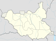
Map
South Sudan adm location map.svg
Airplane silhouette.svg
Yei Airport
Runways
Direction LengthSurface
ftm
4,9211,500Unpaved

Yei Airport is an airport serving Yei in South Sudan.

Contents

Location

Yei Airport ( IATA : n/a, ICAO : HSYE) is located in Yei River County in Central Equatoria, in the city of Yei, in the southern part of South Sudan, near the International borders with Uganda and the Democratic Republic of the Congo. The airport is located northeast of the central business district, on the road to Juba.

This location lies approximately 135 kilometres (84 mi), by air, southwest of Juba International Airport, the largest airport in South Sudan. [1] The geographic coordinates of this airport are: 4° 7' 57.00"N, 30° 43' 17.00"E (Latitude: 4.132500; Longitude: 30.721390). Yei Airport is situated 831 metres (2,726 ft) above sea level. [2] The airport has a single unpaved runway, the dimensions of which are not publicly known at this time.

Airlines and destinations

AirlinesDestinations
Eagle Air Arua, Entebbe [3]

See also

Related Research Articles

<span class="mw-page-title-main">Torit</span> City in South Sudan

Torit is a city of Eastern Equatoria State in South Sudan.

Kaya is a city in Central Equatoria, South Sudan.

<span class="mw-page-title-main">Arua</span> Place in Northern Region, Uganda

Arua is a city and commercial centre within the Arua District in the Northern Region of Uganda.

Yambio is a city in South Sudan.

<span class="mw-page-title-main">Lainya County</span> County in Central Equatoria, South Sudan

Lainya is a county in Central Equatoria State, South Sudan. Emmanuel Khamis Richard is the current commissioner of Lainya County.

Aweil Airport is an airport serving the town of Aweil, in South Sudan.

Gogrial Airport is an airport in South Sudan.

Kajo Keji is an airstrip serving the town of Kajo Keji, in South Sudan.

<span class="mw-page-title-main">Kapoeta Airport</span> Airport in Kapoeta, South Sudan

Kapoeta Airport is an airport serving Kapoeta in South Sudan.

Maridi Airport is an airport serving Maridi in Western Equatoria, South Sudan.

Nimule Airport is a small civilian and military airport serving the town of Nimule and surrounding communities, in South Sudan.

<span class="mw-page-title-main">Raga Airport</span> Airport in Raga, South Sudan

Raga Airport is an airport serving the town of Raga in South Sudan.

Torit Airport is an airport serving the town of Torit, in South Sudan.

Tumbura Airport is an airport serving Tumbura in South Sudan.

Yambio Airport is an airport serving Yambio in South Sudan.

<span class="mw-page-title-main">Torit County</span> County in Eastern Equatoria, South Sudan

Torit County is an administrative region in Eastern Equatoria of South Sudan, with headquarters in the town of Torit, which is also the state capital.

<span class="mw-page-title-main">Magwi</span> Town in Eastern Equatoria State, South Sudan

Magwi is a town in South Sudan. It is the capital, business center and home to the Acholi tribe of South Sudan.

Yei Agricultural and Mechanical University (YA&MU) is a university in South Sudan.

<span class="mw-page-title-main">Morobo County</span> County in Central Equatoria, South Sudan

Morobo is one of the six counties in Central Equatoria state, South Sudan. Morobo County borders Uganda and Congo. The county is mainly occupied by Kakwa speaking people, Keliko and Lugbara. The people in Morobo are local farmers working for food. Morobo is part of the green belt and also acts as a breadbasket for Yei and Juba.

<span class="mw-page-title-main">Yei River State</span> State of South Sudan from 2015 to 2020

Yei River State was a state in South Sudan that existed from 2 October 2015 to 22 February 2020.
References

  1. "Distance between Juba () (Airport) and Yambari (Al Wilayah al Istiwa'iyah) (Sudan)". distancecalculator.globefeed.com. Retrieved 2018-08-26.
  2. "Maps, Weather, Videos, and Airports for Yei, Sudan". www.fallingrain.com. Retrieved 2018-08-26.
  3. Eagle Air (1 August 2014). "Eagle Air Scheduled Flight Times Effective 1 August 2014". Entebbe: Eagle Air. Archived from the original on 14 October 2016. Retrieved 16 November 2016.

4°07′57″N30°43′17″E / 4.132500°N 30.721390°E / 4.132500; 30.721390