Kapoeta Airport

Last updated
Kapoeta Airport
Kapoeta, South Sudan - panoramio.jpg
Summary
Airport type Public, Civilian
OwnerCivil Aviation Authority of South Sudan
ServesKapoeta, South Sudan
Location Kapoeta, Flag of South Sudan.svg  South Sudan
Elevation  AMSL 2,221 ft / 677 m
Coordinates 04°46′48″N33°35′06″E / 4.78000°N 33.58500°E / 4.78000; 33.58500 (Kapoeta Airport)
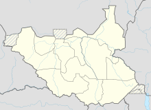
Map
South Sudan adm location map.svg
Airplane silhouette.svg
Kapoeta
Location of Kapoeta Airport in South Sudan
Runways
Direction LengthSurface
ftm
14/32 (approx.)3,4701,058Unpaved
Sources: [1]

Kapoeta Airport is an airport serving Kapoeta in South Sudan.

Contents

Location

Kapoeta Airport ( IATA : n/a, ICAO : HSKP) is located in Kapoeta South County in Namorunyang State, in the town of Kapoeta, near the International borders with Kenya and Uganda. The airport is located approximately 3 kilometres (1.9 mi), north of the central business district of Kapoeta.

This location lies approximately 221 kilometres (137 mi), by air, east of Juba International Airport, South Sudan's largest airport. [2] The geographic coordinates of this airport are: 4° 46' 48.00"N, 33° 35' 6.00"E (Latitude: 4.7800; Longitude: 33.5850). Kapoeta Airport is situated 677 metres (2,221 ft) above sea level. [3] The airport has a single unpaved runway that is 1058 m. in length.

Overview

Kapoeta Airport is a small civilian and military airport that serves the town of Kapoeta and surrounding communities.

See also

Related Research Articles

<span class="mw-page-title-main">Torit</span> City in South Sudan

Torit is a city of Eastern Equatoria State in South Sudan.

<span class="mw-page-title-main">Rumbek Airport</span> Airport in Rumbek, South Sudan

Rumbek Airport is an airport in South Sudan, near Rumbek, the capital of Lakes State. The airport is served by several national airlines and by air charter service providers.

Akobo Airport is an airport serving the town of Akobo, in Jonglei State, South Sudan.

Aweil Airport is an airport serving the town of Aweil, in South Sudan.

Bentiu Airport is an airport in South Sudan. It is located just north of Rubkona, a town that sits across the Bahr el Ghazal River from Bentiu. Via El Salaam Bridge, the airport is 4 kilometres (2.5 mi) by road from Bentiu.

Gogrial Airport is an airport in South Sudan.

Maridi Airport is an airport serving Maridi in Western Equatoria, South Sudan.

Nimule Airport is a small civilian and military airport serving the town of Nimule and surrounding communities, in South Sudan.

Pochalla Airport is an airport serving Pochalla in South Sudan.

Pibor Airport is an airport serving the town of Pibor, in South Sudan.

<span class="mw-page-title-main">Raga Airport</span> Airport in Raga, South Sudan

Raga Airport is an airport serving the town of Raga in South Sudan.

Renk Airport is an airport serving Renk in South Sudan.

Torit Airport is an airport serving the town of Torit, in South Sudan.

Tumbura Airport is an airport serving Tumbura in South Sudan.

Yambio Airport is an airport serving Yambio in South Sudan.

Yirol Airport is an airport in South Sudan. It has a single unpaved runway.

Yei Airport is an airport serving Yei in South Sudan.

<span class="mw-page-title-main">Wau Airport</span> Airport in Wau, South Sudan

Wau Airport is a civilian airport that serves the city of Wau and surrounding communities. Feeder Airlines has three return flights a week between Khartoum-Wau-Juba. Southern Star Airlines used to provide service on Wednesdays and Sundays to Juba; however, this service has been suspended in 2011 when the airline ceased flying.

<span class="mw-page-title-main">Kapoeta</span> Town in Eastern Equatoria State, South Sudan

Kapoeta is a town in South Sudan. It is located in Kapoeta South County, in Eastern Equatoria State, in southeastern South Sudan.

Raga is a town in South Sudan.

References

  1. from DAFIF (effective October 2006)
  2. "Distance between Kapoeta (Sharq al Istiwa'iyah) and Juba () (Airport) (Sudan)". distancecalculator.globefeed.com. Retrieved 2018-08-24.
  3. Kapoeta Elevation Is 2,220 Feet Above Sea Level Archived 2012-03-17 at the Wayback Machine

4°46′48″N33°35′06″E / 4.7800°N 33.5850°E / 4.7800; 33.5850