
Florence is a census-designated place (CDP) in Ravalli County, Montana. County Line Rd is on the northern edge of the city limits dividing it from Missoula County, Montana. The population was 821 at the 2020 census.

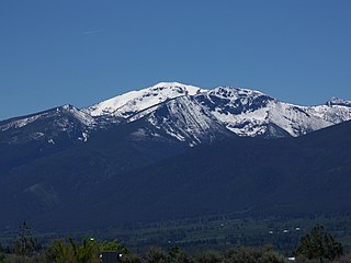
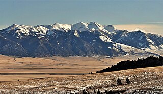
The Bitterroot Range is a mountain range and a subrange of the Rocky Mountains that runs along the border of Montana and Idaho in the northwestern United States. The range spans an area of 24,223 square miles (62,740 km2) and is named after the bitterroot, a small pink flower that is the state flower of Montana.

Torreys Peak is a mountain in the Front Range region of the Rocky Mountains in Colorado. It is one of 53 fourteeners in Colorado. Its nearest major city is Denver. Torreys Peak is located along the Continental Divide, as well as the division between Clear Creek County and Summit County. In the Arapaho language Torrey's Peak and the adjacent Gray's Peak are named, Heeniiyoowuu or "Ant Hills".

The Bitterroot River is a northward flowing 84-mile (135 km) river running through the Bitterroot Valley, from the confluence of its West and East forks near Conner in southern Ravalli County to its confluence with the Clark Fork River near Missoula in Missoula County, in western Montana. The Clark Fork River is a tributary to the Columbia River and ultimately, the Pacific Ocean. The Bitterroot River is a Blue Ribbon trout fishery with a healthy population of native westslope cutthroat trout and bull trout. It is the third most fly fished river in Montana behind the Madison and Big Horn Rivers.
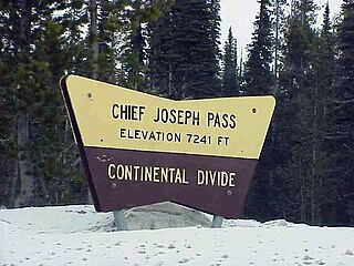
Chief Joseph Pass is a mountain pass on the continental divide of the Rocky Mountains in the northwestern United States joining Lemhi County, Idaho, and Beaverhead County, Montana. The pass is in the Bitterroot Mountains and is traversed by Montana Highway 43; it is named after Chief Joseph of the Wallowa band of the Nez Perce tribe, who traversed the pass in the summer of 1877 during the Nez Perce War, prior to the Battle of the Big Hole to the east.
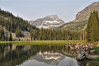
El Capitan is a mountain summit in the Bitterroot Range of Montana. The peak is located in the Selway-Bitterroot Wilderness on land managed by the Bitterroot National Forest. The summit lies 12 miles west of the town of Darby, Montana, and three miles east of the Idaho–Montana border. The highest point of the Central Bitterroot Range is line parent Trapper Peak, 9.3 miles south-southeast.

Old Baldy is a 9,156-foot (2,791-metre) double summit mountain located in Teton County of the U.S. state of Montana.
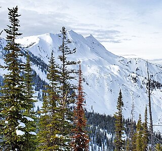
Saint Mary Peak is a 9,351-foot elevation (2,850 m) mountain summit located in Ravalli County, Montana.

Heavenly Twins is a 9,282-foot elevation (2,829 m) double summit mountain located in Ravalli County, Montana.

Sheep Mountain is a 9,688-foot elevation (2,953 m) mountain summit in Beaverhead County, Montana, United States.
Cedar Mountain is a 10,780-foot (3,286-metre) summit located in Madison County, Montana, United States.

Boat Mountain is a 9,071-foot (2,765-metre) mountain summit in Gallatin County, Montana, United States.
Nyack Mountain is a 7,750-foot-elevation (2,362-meter) mountain summit located in Flathead County, Montana, United States.
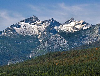
Como Peaks is a 9,624-foot-elevation (2,933-meter) mountain summit in Ravalli County, Montana, United States.

Saddle Peak is a 9,159-foot-elevation (2,792-meter) mountain summit in Gallatin County, Montana, United States.

Naya Nuki Peak is a 9,591-foot-elevation (2,923-meter) mountain summit in Gallatin County, Montana, United States.

Sheep Mountain is a 10,552-foot (3,216-metre) mountain summit in Park County, Montana, United States.
Big Horn Peak is a 9,935-foot (3,028-metre) mountain summit in Gallatin County, Montana, United States.

Steamboat Mountain is a 10,030-foot (3,057-metre) mountain summit in Gallatin County, Montana, United States.

Thunder Mountain is an 11,441-foot (3,487-metre) summit in Carbon County, Montana, United States.


