Hampshire is a ceremonial and non-metropolitan county in western South East England on the coast of the English Channel. Home to two cities on its south coast, Southampton and Portsmouth, Hampshire is the 9th-most populous county in England. The county town of Hampshire is Winchester. The county is bordered by Dorset to the south-west, Wiltshire to the north-west, Berkshire to the north, Surrey to the north-east, and West Sussex to the south east. The county is geographically diverse, with upland rising to 286 m (938 ft) and mostly south-flowing rivers. There are areas of downland and marsh, and two national parks: the New Forest and part of the South Downs, which together cover 45 per cent of Hampshire.

Springhill is a community located in central Cumberland County, Nova Scotia, Canada.
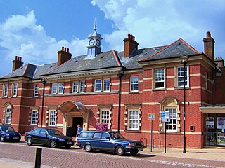
Fareham is a market town at the north-west tip of Portsmouth Harbour, between the cities of Portsmouth and Southampton in south east Hampshire, England. It gives its name to the Borough of Fareham. It was historically an important manufacturer of bricks, used to build the Royal Albert Hall, and grower of strawberries and other seasonal fruits. Current employers include Fareham Shopping Centre, small-scale manufacturers, HMS Collingwood and the Defence Science and Technology Laboratory.
Eastleigh is a town in Hampshire, England, between Southampton and Winchester. It is the largest town and the administrative seat of the Borough of Eastleigh, with a population of 24,011 at the 2011 census.

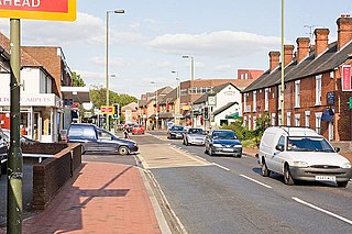
Brockenhurst is the largest village by population within the New Forest in Hampshire, England. The nearest city is Southampton some 13 miles (21 km) to the North East, while Bournemouth is also nearby, 15 miles (24 km) South West. Surrounding towns and villages include Beaulieu, Lymington, Lyndhurst, and Sway.
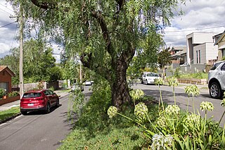
Kew (;) is a suburb of Melbourne, Victoria, Australia, 5 km east from Melbourne's Central Business District, located within the City of Boroondara local government area. Kew recorded a population of 24,499 at the 2021 census.

Kings Worthy is a village and civil parish in Hampshire, England, approximately two miles north-east of Winchester. Kings Worthy was a tithing of Barton Stacey when the Domesday Book was written.

St Anne's Catholic School is an 11-18 secondary school in Southampton, England, for girls. The school's sixth form is coeducational. The school is situated close to the city centre, and attracts pupils from all round the city and beyond. The school converted to academy status in August 2012. In January 2016, there were 1080 students enrolled, with 48 students at the end of Year 13. Until 2006, it was known as St Anne's Convent School.
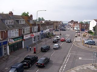
Chandler's Ford is a largely residential area and civil parish in the Borough of Eastleigh in Hampshire, England. It has a population of 21,436 in the 2011 UK Census.

Highcliffe-on-Sea is a seaside town in Dorset in England, administered since April 2019 as part of the unitary authority of Bournemouth, Christchurch and Poole. It forms part of the South East Dorset conurbation along the English Channel coast. The town lies on a picturesque stretch of Solent coastline with views of the Isle of Wight and its 'Needles' rocks. It is part of the historic county of Hampshire.

Northam is a suburb of Southampton in Hampshire. On the West bank of the River Itchen, it shares borders with St Mary's, Bitterne and Bevois Valley. Beside the border with St Mary's is the Chapel area, which has been home to some recent apartment building developments in Northam. The A3024 road runs through the suburb and crosses the Northam Bridge, which links Northam with Bitterne via Bitterne Manor. Although St Mary's Stadium takes its name from the neighbouring St Mary's, the stadium itself is in Northam, and home to Southampton F.C.
Woolston is a suburb of Southampton, Hampshire, located on the eastern bank of the River Itchen. It is bounded by the River Itchen, Sholing, Peartree Green, Itchen and Weston.
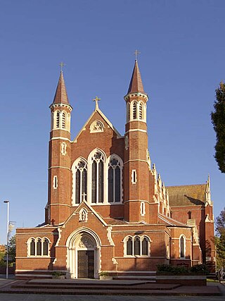
The Roman Catholic Diocese of Portsmouth is a Latin Church Roman Catholic diocese that covers the Channel Islands as well as parts of England. The episcopal see is St John's Cathedral in Portsmouth and is headed by the Bishop of Portsmouth. The diocese is part of the metropolitan Province of Southwark, which covers all of the far South of England as well as the Channel Islands.

Southampton is a port city in the ceremonial county of Hampshire in southern England. It is located approximately 70 mi (110 km) south-west of London and 15 mi (24 km) west of Portsmouth. The city forms part of the South Hampshire built-up area, which also covers Portsmouth and the towns of Havant, Waterlooville, Eastleigh, Fareham and Gosport.
Southampton is a city in Hampshire, England. The area has been settled since the Stone Age. Its history has been affected by its geographical location, on a major estuary on the English Channel coast with an unusual double high-tide, and by its proximity to Winchester and London; the ancient and modern capitals of England. Having been an important regional centre for centuries, Southampton was awarded city status by Queen Elizabeth II in 1964 .

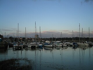
River Hamble Country Park is a 144.1-hectare (356-acre) Local Nature Reserve which runs along the west bank of the River Hamble between the villages of Botley and Bursledon in Hampshire. It is owned by Hampshire County Council and managed by Hampshire Countryside Service. It is part of Solent and Southampton Water Ramsar site and Special Protection Area, and of Solent Maritime Special Area of Conservation. Part of it is in Upper Hamble Estuary and Woods, which is a Site of Special Scientific Interest.

City College Southampton is a general further education college located in Southampton, Hampshire, England.
The following is a timeline of the history of the city of Southampton, Hampshire, England.

St James' Park, Southampton is a recreational area situated in the district of Shirley, Southampton opposite St James' Church, Southampton. It is adjacent to Winchester Road and surrounded by housing, some of it dating from the mid Victorian Period. It is supported by The Friends Of St James' Park (FOSJP) who run a cafe and organise community events.

