The Highlands is a historical region of Scotland. Culturally, the Highlands and the Lowlands diverged from the Late Middle Ages into the modern period, when Lowland Scots language replaced Scottish Gaelic throughout most of the Lowlands. The term is also used for the area north and west of the Highland Boundary Fault, although the exact boundaries are not clearly defined, particularly to the east. The Great Glen divides the Grampian Mountains to the southeast from the Northwest Highlands. The Scottish Gaelic name of A' Ghàidhealtachd literally means "the place of the Gaels" and traditionally, from a Gaelic-speaking point of view, includes both the Western Isles and the Highlands.

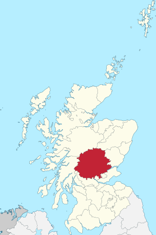
Perthshire, officially the County of Perth, is a historic county and registration county in central Scotland. Geographically it extends from Strathmore in the east, to the Pass of Drumochter in the north, Rannoch Moor and Ben Lui in the west, and Aberfoyle in the south; it borders the counties of Inverness-shire and Aberdeenshire to the north, Angus to the east, Fife, Kinross-shire, Clackmannanshire, Stirlingshire and Dunbartonshire to the south and Argyllshire to the west.

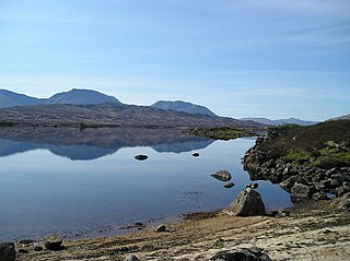
Rannoch Moor is an expanse of around 50 square miles (130 km2) of boggy moorland to the west of Loch Rannoch in Scotland, from where it extends into westerly Perth and Kinross, northerly Lochaber, and the area of Highland Scotland toward its south-west, northern Argyll and Bute. Rannoch Moor is designated a Site of Special Scientific Interest (SSSI) and a Special Area of Conservation. Much of the western part of the moor lies within the Ben Nevis and Glen Coe National Scenic Area, one of 40 such areas in Scotland.

Clan Robertson, is correctly known as Clan Donnachaidh ( Duncan ) (Scottish Gaelic: Clann Dhònnchaidh) is a Scottish clan. The principal surnames of the clan are Robertson, Reid and Duncan but there are also many other septs.

Loch Rannoch is a freshwater loch in Perth and Kinross, Scotland. It is over 15 kilometres (9.3 mi) long in a west–east direction with an average width of about 1.2 kilometres (0.75 mi), and is deepest at its eastern end, reaching a depth of 130 metres (440 ft). The River Tummel begins at its eastern end, where the small village of Kinloch Rannoch can be found, whilst the wild expanse of Rannoch Moor extends to the west of the loch. The area surrounding Loch Rannoch, along with Rannoch Moor itself, was formerly part of the native Caledonian Forest that stretched across much of Northern Scotland. Native forest is now largely absent from much of the area, due partly to logging, and partly to the climate becoming wetter, and Loch Rannoch is now largely surrounded by commercial forestry and open hillsides, although a small area remains at the Black Wood of Rannoch on the southern shore of the loch.
Rannoch is an area of the Scottish Highlands between the A9 road, to the east, and the A82, to the west. The area is crossed from south to north by the West Highland railway line.

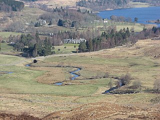
Rannoch School was a private boarding school, located on the south shore of Loch Rannoch in Perth and Kinross, Scotland on the Dall Estate, 6 miles (9.7 km) from Kinloch Rannoch. Dall House served as the main school building and a boarding house.

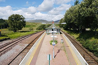
Rannoch railway station, on the West Highland Line, serves the area of Rannoch in Perth and Kinross, Scotland. In 2017, Simon Jenkins reported it to be one of the best 10 stations in Britain. It is situated between Corrour and Bridge of Orchy, 64 miles 36 chains (103.7 km) from Craigendoran Junction, near Helensburgh. ScotRail manage the station and operate most services, along with Caledonian Sleeper.

Kinloch Rannoch is a village in Perth and Kinross, Scotland, at the eastern end of Loch Rannoch, 18 miles (29 km) west of Pitlochry, on the banks of the River Tummel. The village is a tourist and outdoor pursuits centre. It has a small population and is fairly remote.

Beinn Achaladair is a Scottish mountain situated six kilometres north east of the hamlet of Bridge of Orchy. The mountain stands on the border of the Perth and Kinross and Argyll and Bute council areas.
Dugald Buchanan was a Scottish poet writing in Scots and Scottish Gaelic. He helped the Rev. James Stuart or Stewart of Killin to translate the New Testament into Scottish Gaelic. John Reid called him "the Cowper of the Highlands".

Rannoch Barracks was a military barracks constructed in 1746 at Bridge of Gaur, Perthshire, Scotland, at the western end of Loch Rannoch. The barracks were built in response to the Jacobite uprising of 1745.

Loch Bà is a shallow irregular shaped freshwater loch on Rannoch Moor, Argyll and Bute, in the Scottish West Highlands, within the Highland council area of Scotland. It is about 25 km east-south-east of Glen Coe, and 20 km north of Tyndrum.
James Small was a retired Army officer, a factor of forfeited estates in Perthshire and an improver of Kinloch Rannoch, Scotland.

The Raid on Rannoch took place in 1753 in the tumultuous aftermath of the Jacobite rising of 1745. Lieutenant Hector Munro, 8th laird of Novar who was a commissioned officer in the 34th (Cumberland) Regiment of Foot led the raid to capture the Jacobite rebel John Dubh Cameron who was later executed.

The Loch Rannoch and Glen Lyon National Scenic Area is a national scenic area (NSA) covering the area surrounding Loch Rannoch, Glen Lyon, and the Ben Lawers ranges of mountains in Scotland. It is one of 40 such areas in Scotland, which are defined so as to identify areas of exceptional scenery and to ensure its protection from inappropriate development by restricting certain forms of development. The Loch Rannoch and Glen Lyon NSA covers 48,625 ha, most of which lies in the council area of Perth and Kinross, with a small portion lying in Stirling.

Loch Eigheach is a large upland dammed freshwater loch in the Scottish Highlands. It is located in Rannoch Moor in the Council Area of Perth and Kinross. The undisturbed Loch Eigheach was much smaller.


