
Holmfirth is a town in the Metropolitan Borough of Kirklees, West Yorkshire, England, on the A635 and A6024 in the Holme Valley. Centred upon the confluence of the Holme and Ribble rivers, Holmfirth is 6 miles (9.7 km) south of Huddersfield and 13 miles (21 km) north-east of Glossop. It mostly consists of stone-built cottages nestled in the Pennine hills. The Peak District National Park around Holme Moss is 4 miles (6.4 km) south of the town.
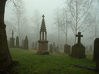
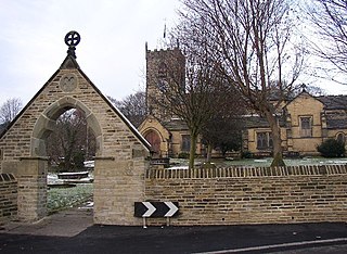
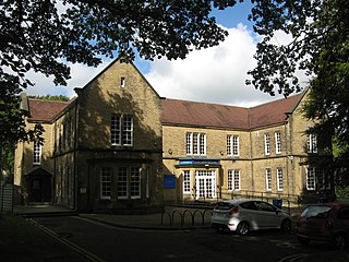
Kirkburton is a village, civil parish and ward in Kirklees in West Yorkshire, England. It is 5 miles (8 km) south-east of Huddersfield. Historically part of the West Riding of Yorkshire, the township comprises the villages of Kirkburton and Highburton and several hamlets, including Thunder Bridge, Thorncliffe, Storthes Hall, Burton Royd, Riley, Dogley, Common Side, Causeway Foot, Lane Head and Linfit. According to the 2011 census the civil parish had a population of 26,439, while the village itself had a population of 4,299.

Kirklees is a local government district of West Yorkshire, England, governed by Kirklees Council with the status of a metropolitan borough. The largest town and administrative centre of Kirklees is Huddersfield, and the district also includes Batley, Birstall, Cleckheaton, Denby Dale, Dewsbury, Heckmondwike, Holmfirth, Kirkburton, Marsden, Meltham, Mirfield and Slaithwaite. Kirklees had a population of 422,500 in 2011; it is also the third largest metropolitan district in England by area size, behind Doncaster and Leeds.

Huddersfield is a large market town in the Metropolitan Borough of Kirklees, West Yorkshire, England. Huddersfield was a prominent mill town in the industrial revolution. To the town's west are the Pennines, south is the River Holme's discharge into the similar-sized Colne. The town's historic county is the West Riding of Yorkshire.

Highburton is part of the township of Kirkburton, a village in the county of West Yorkshire, England. It is five miles southeast of Huddersfield. It occupies much of the high ground that can be found at the top of the steep inclines of Far Dene and Slant Gate and is a mixture of densely congregated housing estates and open pastoral farmland.
Birstall is a large village in the metropolitan borough of Kirklees, West Yorkshire, England. It is part of Birstall and Birkenshaw ward which had a population of 16,298 at the 2011 census. Historically in the West Riding of Yorkshire, and part of the Heavy Woollen District, the town is approximately 6 miles (10 km) south-west of Leeds and situated close to the M62 motorway. The village is situated between Leeds, Bradford, Huddersfield and Wakefield.
Deighton railway station serves the Deighton area of Huddersfield, West Yorkshire, England.

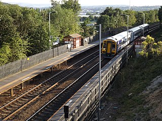
Stocksmoor is a hamlet, near Huddersfield, West Yorkshire, England. It is situated between the villages of Shepley and Brockholes. The total population of Thurstonland, Stocksmoor and Thunder Bridge together was 953 in the 2001 census.

Lepton is a village and former civil parish near Huddersfield, now in the parish of Kirkburton, in the Kirklees district, in the county of West Yorkshire, England. It is 4.25 miles (7 km) to the east of, and 120 metres (390 ft) above, the town centre directly north of Lepton Great Wood. In 1931 the parish had a population of 3323.
Kirkheaton is a village and former civil parish 3 miles (5 km) north-east of Huddersfield, now in the parish of Kirkburton, in the county of West Yorkshire, England, Historically, it is part of the West Riding of Yorkshire. It is in the Dalton ward of the Metropolitan Borough of Kirklees. In 1931 the parish had a population of 2,610.
Shepley is a village in the civil parish of Kirkburton, in Kirklees, West Yorkshire, England, and in the Diocese of Wakefield. It lies 8 miles (13 km) south south east of Huddersfield and 6 miles (9.7 km) north west of Penistone.

Flockton is a village in Kirklees, West Yorkshire, England, halfway between Huddersfield, 7 miles away and Wakefield, 8 miles away.
Storthes Hall is a part of the township of Kirkburton, West Yorkshire, England. A heavily wooded area, it comprises a single road, Storthes Hall Lane, which links Kirkburton with the nearby villages of Farnley Tyas and Thurstonland. The most significant properties in the area are Storthes Hall Mansion, Storthes Hall Hospital and, finally, Storthes Hall Park Student Village which has been built on the old hospital site.

Myers Wood is a wooded area in the village of Kirkburton, West Yorkshire, England. It forms part of a heavily forested area to the west of the village, occupying the rise in the valley leading up to Storthes Hall and beyond. It is directly west of the main Penistone Road, opposite Riley. Saville Wood is directly south, close to Thunder Bridge. Local residents consider the wood to be of poor quality due to the absence of woodland management.
Thorncliffe or Thorncliff is the name of the following places:

Nettleton Hill is a hamlet in the unparished area of Huddersfield, in the Kirklees district in the English county of West Yorkshire. It is situated near the town of Huddersfield, north of Scapegoat Hill and south of Pighill Wood. Longwood reservoir is to the east of the settlement. Nettleton Hill is part of the Golcar ward and of the HD7 postcode district.
Flockton Green is a hamlet in the civil parish of Kirkburton, in the Kirklees district, in the county of West Yorkshire, England. It is immediately east of Flockton village, on the junction of the road from Overton with the A637 road between Grange Moor and West Bretton and close to the border of Kirklees and Wakefield districts. Flockton Green has a pub called The George and Dragon.
Roydhouse is a hamlet in the Kirklees district, in the English county of West Yorkshire.
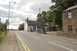
Thunder Bridge or Thunderbridge is a hamlet and bridge in the civil parish of Kirkburton, in the Kirklees district, in the county of West Yorkshire, England. It is near the A629 road and Stocksmoor railway station. Its post town is Huddersfield. It has a pub called the Woodman Inn. The bridge is a Grade II listed building which is a road bridge over Shepley Dike.

Kirkheaton railway station served the village of Kirkheaton, West Yorkshire, England until closure in 1930. It was located immediately north of the junction of Crossley Lane and School Lane, and was accessed from the latter. The line continued towards Kirkburton on a bridge across School Lane.


