Cotterstock is a village and civil parish in North Northamptonshire, England. The population of the civil parish at the 2011 census was 153.

Croughton is a village and civil parish in West Northamptonshire, England, about 3 miles (5 km) southwest of Brackley. The 2011 Census recorded the parish's population as 992.
Haselbech is a village and civil parish in West Northamptonshire in England. At the time of the 2001 census, the parish had a population of 87 people. The population remained less than 100 at the 2011 Census and was included in the civil parish of Kelmarsh.

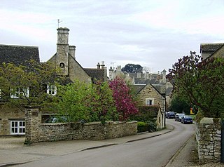
Sulgrave is a village and civil parish in West Northamptonshire, England, about 5 miles (8 km) north of Brackley. The village is just south of a stream that rises in the parish and flows east to join the River Tove, a tributary of the Great Ouse.
Newbottle is a civil parish and largely deserted village in West Northamptonshire, about 4 miles (6.4 km) west of the market town of Brackley. It is close to the Oxfordshire county boundary and about 4.5 miles (7.2 km) south-east of the town of Banbury.

Titchmarsh is a village and civil parish in North Northamptonshire, England. The 2001 census recorded a parish population of 543 people, increasing to 598 at the 2011 Census.

Catmore is a civil parish and village in West Berkshire about 5+1⁄2 miles (9 km) southeast of Wantage. Catmore is in the Berkshire Downs and the centre of the village is about 575 feet (175 m) above sea level.

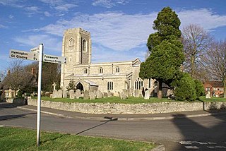
Caldecott is a village in the county of Rutland in the East Midlands of England. The civil parish population was 256 at the 2001 census increasing to 269 at the 2011 census. It is located about four miles (6.4 km) south of Uppingham and about 4 miles north of Corby in Northamptonshire. The A6003 runs through the village; traffic flow on the bridge over the Eye Brook is controlled by traffic lights.

Great Easton is a village and civil parish in the Harborough district of Leicestershire, England. The parish had a population of 558 according to the 2001 census, increasing to 671 at the 2011 census.
Benefield is a civil parish in North Northamptonshire, England, along the A427 road and about 6 miles (9.7 km) east of Corby and 3 miles (4.8 km) west of Oundle.

Whichford is a village and civil parish in Warwickshire, England, about 5 miles (8 km) southeast of Shipston-on-Stour. The parish adjoins the county boundary with Oxfordshire and the village is about 4+1⁄2 miles (7 km) north of the Oxfordshire town of Chipping Norton.

Hemington is a village and civil parish 5.5 miles (8.9 km) north west of Frome, in the Mendip district of Somerset, England. It is located just off the A366 between Trowbridge and Radstock. The parish includes the villages of Hardington, Faulkland and Foxcote.
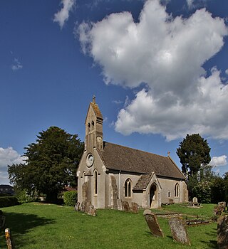
Hemington is a village and civil parish in North Northamptonshire, England. The parish population at the 2011 Census was 257.

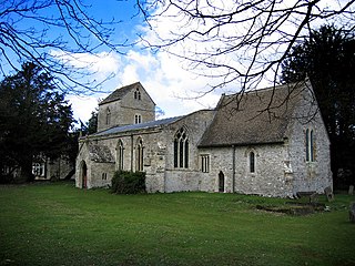
Duddington is a village and former civil parish, now in the parish of Duddington-with-Fineshade, in the North Northamptonshire district, in the ceremonial county of Northamptonshire, England. It is by the junction of the A47 and A43 roads, and is 9 kilometres (6 mi) southwest of the town of Stamford. The village is on the east bank of the River Welland which is the county boundary of Rutland. In 1961 the parish had a population of 184.

Furtho is a deserted medieval village and former civil parish, now in the parish of Potterspury, in the West Northamptonshire district, in the ceremonial county of Northamptonshire, England. In 1931 the parish had a population of 25.
Newton Purcell is a village in the civil parish of Newton Purcell with Shelswell, in the Cherwell district, in the county of Oxfordshire, England, 4+1⁄2 miles (7 km) southeast of Brackley in neighbouring Northamptonshire. The 2001 Census recorded a parish population of 103. The parish population from the 2011 Census is not available.
Easton on the Hill is a village and civil parish at the north eastern tip of North Northamptonshire, England. The village had a population at the 2011 census was 1,015. The village, sited on the A43 road, is compact in form, with the older part of the village located north of the High Street. The parish extends from the River Welland in the north to the western end of RAF Wittering. The village is also on the shortest boundary in England with it being in the northernmost part of Northamptonshire between Stamford and Collyweston.

Luddington-in-the-Brook or Luddington in the Brook is a village in North Northamptonshire, England. The name of its civil parish is Luddington. Owing to its small size, for census purposes the population of the parish is combined with the neighbouring parish of Hemington.
Lutton is a village and civil parish in North Northamptonshire, England. The 2011 Census recorded its parish population as 186.
Radstone is a hamlet and civil parish in West Northamptonshire, about 2 miles (3 km) north of Brackley. The 2001 Census recorded a parish population of 54. At the 2011 Census the population of the hamlet remained less than 100 and was included in the civil parish of Whitfield.


