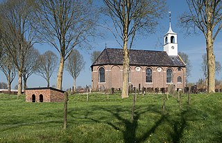
The village of Britsum is located in the municipality of Leeuwarden, in the Netherlands. Britsum was built on an artificial bank (terp) running along the eastern side of the former Middelzee. The church, built around 1300, is also located on this bank. It had a population of about 910 citizens in January 2017.
Ureterp is a village in the municipality of Opsterland in the east of Friesland, the Netherlands. After Gorredijk it is the second largest village of the municipality with a population of around 4,785 in January 2017.

Siegerswoude is a village in the municipality of Opsterland in eastern Friesland, the Netherlands. It had a population of around 810 in January 2017.
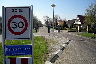
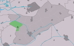
Delfstrahuizen is a small village in De Fryske Marren in the province of Friesland, the Netherlands. It had a population of around 380 including the surrounding area in 2017.

Terherne is a village in De Fryske Marren in the province of Friesland, the Netherlands. it had a population of around 780 in 2017.

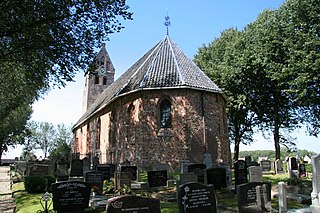
Idaerd is a village in Leeuwarden municipality in the province of Friesland, the Netherlands. It had a population of around 80 in January 2017.

Oudega is a small village in De Fryske Marren municipality in the province of Friesland, the Netherlands. It had a population of around 265 in 2017.
Sondel is a village in De Fryske Marren municipality in the province of Friesland, the Netherlands. It had a population of around 410 in 2017.
Jelsum is a village in Leeuwarden municipality in the province of Friesland, the Netherlands. It had a population of around 195 in January 2017. The stins Dekemastate is located in Jelsum.

Lekkum is a village in Leeuwarden municipality in the Friesland province of the Netherlands. It had a population of around 405 in January 2017.
Wirdum is a village in Leeuwarden municipality in the province of Friesland, the Netherlands. It had a population of around 1,060 in January 2017.

Frieschepalen is a village in the municipality of Opsterland in the east of Friesland, the Netherlands. It had a population of around 1,015 in January 2017.

Hemrik is a village in the municipality of Opsterland in the east of Friesland, the Netherlands. It had a population of around 770 in January 2017.

Langezwaag is a village in the municipality of Opsterland in the east of Friesland, the Netherlands. It had a population of around 1,365 in January 2017.

Lippenhuizen is a village in the municipality of Opsterland in the east of Friesland, the Netherlands. It had a population of around 1,330 in January 2017.

Olterterp is a village in the municipality of Opsterland in the east of Friesland, the Netherlands. It had a population of around 75 in January 2017.
Terwispel is a village in the municipality of Opsterland in the east of Friesland, the Netherlands. Its neighbouring villages are Tijnje (west), Nij Beets (north-west), Beetsterzwaag (north), Lippenhuizen (south-east), Gorredijk (South), Langezwaag (south-west) and Luxwoude. It had a population of around 1,020 in January 2017.

Nijehaske is a village in De Fryske Marren municipality, west of Heerenveen in the province of Friesland, the Netherlands. It had a population of around 55 in 2017. In 1934, most of Nijehaske was transferred to Heerenveen and has become a neighbourhood.

Terkaple is a village in De Fryske Marren municipality in the province of Friesland, the Netherlands. It had a population of around 220 in 2017.

Nijland is a village in Súdwest-Fryslân municipality in the province of Friesland, the Netherlands. It had a population of around 1,000 in January 2017.