
Area 51 is the common name of a highly classified United States Air Force (USAF) facility located within the Nevada Test and Training Range. A remote detachment administered by Edwards Air Force Base, the facility is officially called Homey Airport (XTA/KXTA) or Groom Lake. Details of the facility's operations are not made public, but the USAF says that it is an open training range, and it is commonly thought to support the development and testing of experimental aircraft and weapons systems. The USAF acquired the site in 1955, primarily for flight testing the Lockheed U-2 aircraft.
Bluetooth is a short-range wireless technology standard that is used for exchanging data between fixed and mobile devices over short distances using UHF radio waves in the ISM bands, from 2.402 GHz to 2.48 GHz, and building personal area networks (PANs). It was originally conceived as a wireless alternative to RS-232 data cables. It is mainly used as an alternative to wire connections, to exchange files between nearby portable devices and connect cell phones and music players with wireless headphones. In the most widely used mode, transmission power is limited to 2.5 milliwatts, giving it a very short range of up to 10 meters (30 feet).
The electromagnetic spectrum is the range of frequencies of electromagnetic radiation and their respective wavelengths and photon energies.

A mountain range or hill range is a series of mountains or hills ranged in a line and connected by high ground. A mountain system or mountain belt is a group of mountain ranges with similarity in form, structure, and alignment that have arisen from the same cause, usually an orogeny. Mountain ranges are formed by a variety of geological processes, but most of the significant ones on Earth are the result of plate tectonics. Mountain ranges are also found on many planetary mass objects in the Solar System and are likely a feature of most terrestrial planets.

The Rocky Mountains, also known as the Rockies, are a major mountain range and the largest mountain system in North America. The Rocky Mountains stretch 3,000 mi (4,800 km) in straight-line distance from the northernmost part of western Canada, to New Mexico in southwestern United States. Depending on differing definitions between Canada and the United States, its northern terminus is located either in northern British Columbia's Terminal Range south of the Liard River and east of the Trench, or in the northeastern foothills of the Brooks Range/British Mountains that face the Beaufort Sea coasts between the Canning River and the Firth River across the Alaska-Yukon border. Its southernmost point is near the Albuquerque area adjacent to the Rio Grande Basin and north of the Sandia–Manzano Mountain Range. Being the easternmost portion of the North American Cordillera, the Rockies are distinct from the tectonically younger Cascade Range and Sierra Nevada, which both lie farther to its west.
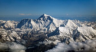
The Himalayas, or Himalaya ; Sanskrit: IPA: [ɦɪmɐːləjɐː], himá and ā-laya, are a mountain range in South and East Asia separating the plains of the Indian subcontinent from the Tibetan Plateau. The range has many of Earth's highest peaks, including the highest, Mount Everest, at the border between Nepal and China. The Himalayas include over fifty mountains exceeding 7,200 m (23,600 ft) in elevation, including ten of the fourteen 8,000-metre peaks. By contrast, the highest peak outside Asia is 6,961 m (22,838 ft) tall.
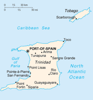
Trinidad is the larger and more populous of the two major islands of Trinidad and Tobago. The island lies 11 km (6.8 mi) off the northeastern coast of Venezuela and sits on the continental shelf of South America. It is often referred to as the southernmost island in the West Indies. With an area of 5,131 km2 (1,981 sq mi), it is also the fifth largest in the West Indies.
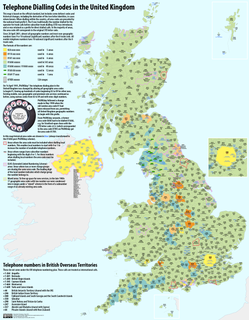
Telephone numbers in the United Kingdom are administered by the Office of Communications (Ofcom). For this purpose, Ofcom established a telephone numbering plan, known as the National Telephone Numbering Plan, which is the system for assigning telephone numbers to subscriber stations.

Rachel is a census-designated place (CDP) in Lincoln County, Nevada, United States. As of the 2010 census it had a population of 54. As the closest settlement to the Nellis Air Force Range and Area 51, Rachel enjoys a modest celebrity status, particularly among aviation enthusiasts and UFO hunters.

Basketball is a sport generally played by five players per team. Historically, these players have been assigned to positions defined by the role they play on the court, from a strategic point of view. Broadly speaking, the three main positions are guard, forward, and center, with the standard team featuring two guards, two forwards, and a center. Over time, as more specialized roles developed, each of the guards and forwards came to be differentiated, and today each of the five positions are known by unique names, each of which has also been assigned a number: point guard (PG) or 1, the shooting guard (SG) or 2, the small forward (SF) or 3, the power forward (PF) or 4, and the center (C) or 5.

The Death Valley '49ers were a group of pioneers from the Eastern United States that endured a long and difficult journey during the late 1840s California Gold Rush to prospect in the Sutter's Fort area of the Central Valley and Sierra Nevada in California. Their route from Utah went through the Great Basin Desert in Nevada, and Death Valley and the Mojave Desert in Southern California, in attempting to reach the Gold Country.

The Nevada Test and Training Range (NTTR) is one of two military training areas at the Nellis Air Force Base Complex in Nevada and used by the United States Air Force Warfare Center at Nellis Air Force Base. The NTTR land area includes a "simulated Integrated Air Defense System", several individual ranges with 1200 targets, and 4 remote communication sites. The current NTTR area and the range's former areas have been used for aerial gunnery and bombing, for nuclear tests, as a proving ground and flight test area, for aircraft control and warning, and for Blue Flag, Green Flag, and Red Flag exercises.

Tikaboo Peak is the unofficial name for a mountain in Lincoln County, Nevada, United States 26 miles (42 km) to the east of Area 51. It is the closest publicly accessible vantage point with a view of the area.
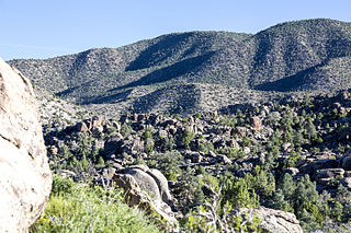
The Mount Irish Range is a mountain range in Lincoln County, Nevada. The range is bounded by the Coal Valley to the north, the Pahranagat Valley to the east, the Tikaboo Valley to the southwest and the Wild Horse Valley to the northwest. Surrounding ranges include the Seaman Range and Hiko Range to the east, the Pahranagat Range and East Pahranagat Range to the south and south east, the Groom Range to the southwest, the Timpahute Range to the west and the Golden Gate Range across Murphy Gap to the northwest.

The Land Rover Range Rover is a 4x4 motor car produced by Land Rover, a marque and sub-brand of Jaguar Land Rover. The Range Rover line was launched in 1970 by British Leyland and is now in its fourth generation.

Indian Springs Valley is one of the Central Nevada Desert Basins in the Clark County portion of the Nevada Test and Training Range and includes Creech Air Force Base and the communities of Cactus Springs and Indian Springs, Nevada. The south side of the valley is along the "Las Vegas Valley Shear Zone", and to the east is the Pintwater Range, to the southeast is the Las Vegas Valley, to the south are foothills near the Spring Mountains, to the southwest is Mercury Valley, and to the west is the Spotted Range. The valley's drainage basin receives ~500 acre-feet (620,000 m3) of annual precipitation and is a southern portion of the Sand Springs-Tikaboo Watershed where it meets the Ivanpah-Pahrump Watershed. The Wheeler Survey in 1869 passed through the Indian Springs Valley.
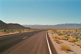
Tikaboo Valley is a valley in Lincoln County, Nevada, United States. Its geographical coordinates are 37.1563494 and -115.4016881. It has an elevation of 3,793 feet or 1,156 meters.


