Timberlake, North Carolina

Last updated
Timberlake
USA North Carolina location map.svg
Red pog.svg
Timberlake
Location within the state of North Carolina
Coordinates: 36°17′11″N78°57′03″W / 36.28639°N 78.95083°W / 36.28639; -78.95083 Coordinates: 36°17′11″N78°57′03″W / 36.28639°N 78.95083°W / 36.28639; -78.95083
Country United States
State North Carolina
County Person
Time zone UTC-5 (Eastern (EST))
  Summer (DST) UTC-4 (EDT)
ZIP codes
27583

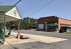
Timberlake [1] is an unincorporated community in south-central Person County, North Carolina. The population was 6,921 at the 2010 census. It lies between Roxboro and Durham along the US Highway 501 corridor through Person County. The economy of this community is dominated by tobacco agriculture and manufacturing.

Contents

Culture

Even though Timberlake has a fairly large population for an unincorporated municipality, it does not have a large number of businesses. The majority of residents work and do business in the nearby municipalities of Roxboro, NC, Durham, NC, and Hillsborough, NC.

Demographics

According to the 2010 U.S. Census, there were 6,921 people in 2,684 households. The racial composition of the town was 82.9% White, 13.7% Black or African American, 0.5% Native American, 0.3% Asian, 0.1% Vietnamese, 1.1% some other race, and 1.5% of two or more races. 2.2% of the population were Hispanic or Latino of any race. [2] Out of the population it only has a 5.5% unemployment rate. [3]

Notable people

Points of interest

Education

Related Research Articles

Person County, North Carolina U.S. county in North Carolina, US

Person County is a county located in the U.S. state of North Carolina. The population was 39,464 at the 2010 census. The county seat is Roxboro.

Orange County, North Carolina U.S. county in North Carolina

Orange County is a county located in the U.S. state of North Carolina. As of the 2010 census, the population was 133,801. Its county seat is Hillsborough.

Durham County, North Carolina U.S. county in North Carolina

Durham County is a county located in the U.S. state of North Carolina. As of the 2010 census, the population was 267,587, making it the sixth-most populous county in North Carolina. Its county seat is Durham.

Yanceyville, North Carolina Town in North Carolina, United States

Yanceyville is a town in and the county seat of Caswell County, North Carolina, United States. The population was 2,039 at the 2010 census. The town is part of the Greensboro-High Point Metropolitan Statistical Area.

Spring Lake, North Carolina Town in North Carolina, United States

Spring Lake is a town in Cumberland County, North Carolina, United States. The 2010 census recorded the population at 11,964 people, with an estimated population in 2019 of 12,005.

Roxboro, North Carolina City in North Carolina, United States

Roxboro is a city and the county seat of Person County in the U.S. state of North Carolina. The population was 8,362 at the 2010 census. The city is 30 miles (48 km) north of Durham and is a part of the four-county Durham–Chapel Hill Metropolitan Statistical Area, which has a population of 504,357 as of the 2010 Census. The Durham–Chapel Hill MSA is a part of the larger Raleigh–Durham–Cary Combined Statistical Area, which has a population of 1,749,525 as of the 2010 Census.

Apex, North Carolina Town in North Carolina, United States

Apex is a town in Wake County, North Carolina, United States. Apex encompasses the community of Friendship at its southern border. In 1994, the downtown area was designated a historic district, and the Apex train depot, built in 1867, is designated a Wake County landmark. The depot location marks the highest point on the old Chatham Railroad, hence the town's name. The town motto is "The Peak of Good Living".

Fuquay-Varina, North Carolina Place in North Carolina, United States

Fuquay-Varina is a town in southern Wake County, North Carolina, United States, lying south of Holly Springs and southwest of Garner, and north of the Harnett County town of Angier and west of the unincorporated community of Willow Springs. The population was 17,937 at the 2010 census, and estimated at 30,324 as of July 2019. The hyphenated name attests to the town's history as two separate towns. Fuquay Springs and Varina merged in 1963 to create the modern town. Economically, the town initially grew due to tobacco trade and agriculture, but has seen recent population growth and real estate development due to its proximity to Research Triangle Park.

Wendell, North Carolina Town in North Carolina, United States

Wendell is a town in Wake County, North Carolina United States. It is a satellite town of Raleigh, the state capital. The population was 5,845 at the 2010 census.

Cary, North Carolina Place in North Carolina, United States

Cary is the largest town and seventh-largest municipality in North Carolina. Cary is predominantly in Wake County and is the county's second-largest municipality, as well as the third-largest municipality in The Triangle after Raleigh and Durham.

Durham, North Carolina City in North Carolina, United States

Durham, also known as the "Bull City", is a city in and the county seat of Durham County in the U.S. state of North Carolina. Small portions of the city limits extend into Orange County and Wake County. With a population of 283,506 in the 2020 Census, Durham is the 4th-most populous city in North Carolina, and the 75th-most populous city in the United States. The city is located in the east-central part of the Piedmont region along the Eno River. Durham is the core of the four-county Durham-Chapel Hill Metropolitan Area, which has a population of 644,367 as of U.S. Census 2019 Population Estimates. The Office of Management and Budget also includes Durham as a part of the Raleigh-Durham-Cary Combined Statistical Area, commonly known as the Research Triangle, which has a population of 2,079,687 as of U.S. Census 2019 Population Estimates.

Morrisville, North Carolina Town in North Carolina, United States

Morrisville is a town located primarily in Wake County, North Carolina. The population was 18,576 at the 2010 census. The U.S. Census Bureau estimates the town's population to be 28,846 as of July 1, 2019. Morrisville is part of the Research Triangle metropolitan region. The regional name originated after the 1959 creation of the Research Triangle Park, located midway between the cities of Raleigh and Durham. The Research Triangle region encompasses the U.S. Census Bureau's Combined Statistical Area (CSA) of Raleigh-Durham-Cary. The estimated population of the Raleigh-Durham-Cary CSA was 1,565,223 as of July 1, 2006, with the Raleigh-Cary Metropolitan Statistical Area (MSA) portion estimated at 994,551 residents. The headquarters of multinational Lenovo are located in the municipal limits.

Zebulon, North Carolina Place in North Carolina, United States

Zebulon is the easternmost town in Wake County, North Carolina, United States. The population was 4,433 at the 2010 census. Zebulon is part of the Research Triangle metropolitan region. Five County Stadium, home to the Carolina Mudcats minor league baseball team, is located in the town.

Research Triangle Geographic region of North Carolina, U.S.

The Research Triangle, or simply The Triangle, are both common nicknames for a metropolitan area in the Piedmont region of North Carolina in the United States, anchored by three major research universities: North Carolina State University, Duke University, and University of North Carolina at Chapel Hill, located in the cities of Raleigh and Durham and the town of Chapel Hill, respectively. The nine-county region, officially named the Raleigh–Durham–Cary combined statistical area (CSA), comprises the Raleigh–Cary and Durham–Chapel Hill Metropolitan Statistical Areas and the Henderson Micropolitan Statistical Area.

U.S. Route 501 is a spur of U.S. Route 1. It runs 355 miles (571 km) from Buena Vista, Virginia at U.S. Route 60 to Myrtle Beach, South Carolina at U.S. Route 17 Business. It passes through the states of Virginia, North Carolina and South Carolina. From Durham to Laurinburg, a 108-mile (174 km) section of US 501 overlaps U.S. Route 15. Sections of US 15-501 also share routings with U.S. Route 1 in sections near Sanford, North Carolina and Aberdeen, North Carolina.

Rougemont, North Carolina Census-designated place in North Carolina, United States

Rougemont is an unincorporated community and census-designated place (CDP) in Durham and Person counties, North Carolina, United States. The population of the CDP was 978 at the 2010 census. An act to incorporate Rougemont as a town was introduced to the North Carolina General Assembly in 2011.

Leasburg, North Carolina

Leasburg is a former town and the former county seat of Caswell County, North Carolina. The community has a partial presence in Person County. The population was 1,662 at the 2010 census. It was named in honor of longtime resident William Lea and is located along US 158 and NC 119 near Hyco Lake. Leasburg is also the name of a Caswell County township.

Rocky Mount metropolitan area MSA in North Carolina, United States

The Rocky Mount Metropolitan Statistical Area, as defined by the United States Census Bureau, is an area consisting of two counties – Edgecombe and Nash – in eastern North Carolina, anchored by the city of Rocky Mount. As of the 2010 census, the MSA had a population of 152,392. It is commonly referred to as the Twin Counties.

North Carolina Highway 157 (NC 157) is a 29.3-mile-long (47.2 km) primary state highway in the U.S. state of North Carolina. The highway runs in a north–south direction from Interstate 85 (I-85), U.S. Route 15 (US 15), US 70, and US 501 in Durham, to US 158, US 501, and NC 57 in Roxboro. The highway serves the cities of Durham and Roxboro, along with the communities of Caldwell and Hurdle Mills. NC 157 is named Guess Road between its southern terminus and Hurdle Mills, and Hurdle Mills Road between Hurdle Mills and the Roxboro city limits. NC 157 does not directly parallel US 501, however, the two highways generally follow a similar alignment between Durham and Roxboro. NC 157 serves the counties of Durham, Orange, and Person.

Rocky Mount-Wilson-Roanoke Rapids combined statistical area CSA in North Carolina, United States

The Rocky Mount-Wilson-Roanoke Rapids Combined Statistical Area, as defined by the United States Census Bureau, is an area consisting of five counties in northeastern North Carolina. As of the 2010 census, the CSA had a population of 310,416, with an estimated population of 297,726 in 2018. The statistical area includes the Rocky Mount Metropolitan Statistical Area, Wilson Micropolitan Statistical Area, and Roanoke Rapids Micropolitan Statistical Area, and the counties of Nash, Wilson, Edgecombe, Halifax, Northampton.

References

  1. Powell, William S (1968). The North Carolina Gazetteer: A Dictionary of Tar Heel Places. Chapel Hill: University of North Carolina Press. p. 493. ISBN   0-8078-1247-1.
  2. "Profile of General Population and Housing Characteristics: 2010 Demographic Profile Data (DP-1): Timberlake town, North Carolina". United States Census Bureau . Retrieved January 3, 2012.
  3. "Best Places to Live in Timberlake (zip 27583), North Carolina". Bestplaces.net. Retrieved 23 January 2018.