North Carolina is a state in the Southeastern region of the United States. It is bordered by Virginia to the north, the Atlantic Ocean to the east, South Carolina to the south, Georgia to the southwest, and Tennessee to the west. The state is the 28th-largest and 9th-most populous of the United States. Along with South Carolina, it makes up the Carolinas region of the East Coast. At the 2020 census, the state had a population of 10,439,388. Raleigh is the state's capital and Charlotte is its most populous city. The Charlotte metropolitan area, with an estimated population of 2,805,115 in 2023, is the most populous metropolitan area in North Carolina, the 22nd-most populous in the United States, and the largest banking center in the nation after New York City. The Research Triangle, with an estimated population of 2,368,947 in 2023, is the second-most populous combined metropolitan area in the state, 31st-most populous in the United States, and is home to the largest research park in the United States, Research Triangle Park.

Raleigh is the capital city of the U.S. state of North Carolina and the seat of Wake County. It is the second-most populous city in North Carolina, after Charlotte. Raleigh is the tenth-most populous city in the Southeast, the 41st-most populous city in the U.S., and the largest city of the Research Triangle metro area. Raleigh is known as the "City of Oaks" for its many oak trees, which line the streets in the heart of the city. The city covers a land area of 148.54 square miles (384.7 km2). The U.S. Census Bureau counted the city's population as 467,665 at the 2020 census. It is one of the fastest-growing cities in the United States. It is ranked as a sufficiency-level world city by the Globalization and World Cities Research Network. The city of Raleigh is named after Sir Walter Raleigh, who established the now-lost Roanoke Colony in present-day Dare County.

Hoke County is a county in the U.S. state of North Carolina. As of the 2020 census, its population was 52,082. Its county seat is Raeford.

Cumberland County is a county located in the U.S. state of North Carolina. As of the 2020 census, the population was 334,728, making it the fifth-most populous county in North Carolina. Its county seat is Fayetteville. Cumberland County is part of the Fayetteville, NC Metropolitan Statistical Area.

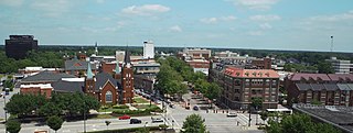
Fayetteville is a city in and the county seat of Cumberland County, North Carolina, United States. It is best known as the home of Fort Liberty, a major U.S. Army installation northwest of the city.

U.S. Route 401 (US 401) is a north–south United States highway, a spur of U.S. Route 1, that travels along the Fall Line from Sumter, South Carolina to Interstate 85 near Wise, North Carolina.

Interstate 295 (I-295), also known as the Fayetteville Outer Loop, is a partially completed Interstate-grade planned 34-mile-long (55 km) bypass around the western side of Fayetteville, North Carolina, United States. As of August 2020, it stretches for 22 miles (35 km) from US Highway 401 (US 401) in western Fayetteville to I-95 and US 13 near Eastover. The final section between US 401 and I-95 near Parkton is being constructed in segments and is expected to be completed around 2026. A two-mile-long (3.2 km) segment from Parkton Road northeast of Parkton to Black Bridge Road south of Hope Mills is signed as North Carolina Highway 295 (NC 295). NC 295 was also used as temporary designations for the highway before I-295 was signed.
The All American Freeway is a highway in the U.S. state of North Carolina connecting I-295 and the western suburbs of Fayetteville to Fort Liberty. The majority of its length is a controlled-access freeway, while the northernmost 1.28 miles (2.06 km) of the road is a limited-access divided highway. Inside Fort Liberty it is named the All American Parkway. The road parallels NC 24/NC 87 for much of its length outside of Fort Liberty.

Interstate 95 (I-95) is a part of the Interstate Highway System that runs along the East Coast of the United States from Miami, Florida, to the Canada–United States border at Houlton, Maine. In the state of North Carolina, the route runs for 181.36 miles (291.87 km) from the South Carolina border near Rowland to the Virginia border near Pleasant Hill. The highway serves the cities of Lumberton, Fayetteville, Wilson, Rocky Mount, and Roanoke Rapids. The route goes through a mostly rural area of the state, avoiding most of the major metro areas of North Carolina. It forms the informal border between the Piedmont and Atlantic Plain regions of the state.

North Carolina Highway 87 (NC 87) is a primary state highway in the U.S. state of North Carolina. NC 87 begins in the Atlantic coastal town of Southport and crosses into Virginia at the Virginia state line five miles (8 km) north of Eden in Rockingham County. At 240 miles (390 km) in length, NC 87 is the second longest state highway in the U.S. state of North Carolina with only North Carolina Highway 24 being longer. Labeled as a north–south route, NC 87 travels along a relatively straight southeast–northwest path, connecting Cape Fear region with the Piedmont. It is also the main north-south route connecting the cities of Fayetteville, Sanford, Burlington and Reidsville.

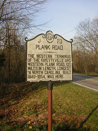
The Fayetteville and Western Plank Road was a 129 mi (208 km) plank road from Fayetteville, NC to the Moravian settlement at Bethania, NC. The road was constructed from 1851-1852 using funds raised by boosters and accompanying funds provided by the state of North Carolina.
Overhills is an unincorporated community located in the Johnsonville Township of Harnett County, North Carolina, United States, near the Cumberland County town of Spring Lake. It is a part of the Dunn Micropolitan Area, which is also a part of the greater Raleigh–Durham–Cary Combined Statistical Area (CSA) as defined by the United States Census Bureau.

North Carolina Highway 210 is a 192-mile-long (309 km) primary state highway in the U.S. state of North Carolina that connects settlements in the Atlantic Coastal Plain region. Due to its meandering route NC 210 changes directional orientation twice, changing from east-west to north-south at Old Stage Road east of Angier, then changing from north-south to west-east at the Bladen–Pender county line. The route traverses through central Fayetteville and the Fort Liberty Army installation and crosses both Topsail Island access bridges over the Atlantic Intracoastal Waterway. Owing primarily to its meandering route, NC 210 is the sixth longest state highway in North Carolina.
The following is a timeline of the history of Charlotte, North Carolina, United States.
The following is a timeline of the history of the city of Raleigh, North Carolina, USA.
The following is a timeline of the history of the city of Greensboro, North Carolina, USA.
The following is a timeline of the history of the city of Winston-Salem, North Carolina, USA.
The following is a timeline of the history of the city of Durham, North Carolina, USA.
The following is a timeline of the history of the city of Asheville, North Carolina, USA.
The following is a timeline of the history of the city of Wilmington, North Carolina, United States.


