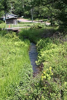
Paint Spring Run is a tributary of Harveys Creek in Luzerne County, Pennsylvania, in the United States. It is approximately 3.0 miles (4.8 km) long and flows through Lake Township. The watershed of the stream has an area of 2.35 square miles (6.1 km2). It has one named tributary. Wild trout inhabit Paint Spring Run. Wisconsinan Till, Wisconsinan Bouldery Till, Wisconsinan Ice-Contact Stratified Drift, alluvium, peat bogs, wetlands, and bedrock consisting of sandstone and shale all occur in the surficial geology in the stream's vicinity.

Davis Hollow is a tributary of Fishing Creek in Columbia County, Pennsylvania, in the United States. It is approximately 1.4 miles (2.3 km) long and flows through Benton Township. The watershed of the stream has an area of 0.80 square miles (2.1 km2). The surficial geology in its vicinity mainly consists of alluvium, alluvial terrace, Wisconsinan Till, Wisconsinan Lag, Illinoian Flow-Till, and Illinoian Lag.
Dymond Creek is a tributary of the Susquehanna River in Luzerne County, Pennsylvania, in the United States. It is approximately 3.3 miles (5.3 km) long and flows through Franklin Township and Exeter Township. The watershed of the creek has an area of 2.24 square miles (5.8 km2). The creek is not designated as impaired and its drainage basin is a Coldwater Fishery and a Migratory Fishery. The surficial geology in its vicinity consists of Wisconsinan Till, Wisconsinan Outwash, Wisconsinan Ice-Contact Stratified Drift, alluvium, alluvial fan, and bedrock.
Thurston Hollow is a tributary of Moneypenny Creek in Wyoming County, Pennsylvania, in the United States. It is approximately 1.4 miles (2.3 km) long and flows through Eaton Township. The stream's watershed has an area of 1.62 square miles (4.2 km2). Thurston Hollow is not designated as an impaired waterbody. The surficial geology in its vicinity consists of Wisconsinan Till, alluvium, and bedrock. It has one unnamed tributary.

Benson Hollow is a tributary of Bowman Creek in Wyoming County, Pennsylvania, in the United States. It is approximately 0.9 miles (1.4 km) long and flows through Eaton Township. The watershed of the stream has an area of 1.82 square miles (4.7 km2). Benson Hollow is a first-order stream and is not designated as an impaired waterbody. The surficial geology in its vicinity consists of Wisconsinan Outwash, alluvium, Wisconsinan Till, bedrock, and a lake. The stream's watershed is designated as a High-Quality Coldwater Fishery and a Migratory Fishery.
Sugar Run is a tributary of Marsh Creek in Wyoming County, Pennsylvania, in the United States. It is approximately 1.3 miles (2.1 km) long and flows through Monroe Township, Northmoreland Township, and Eaton Township. The watershed of the creek has an area of 1.36 square miles (3.5 km2). The creek is not designated as an impaired body and it contains wild trout. The surficial geology in its vicinity consists of Wisconsinan Till, alluvium, Wisconsinan Ice-Contact Stratified Drift, and wetlands.

Newton Run is a tributary of Roaring Run in Wyoming County, Pennsylvania, in the United States. It is approximately 2.7 miles (4.3 km) long and flows through Eaton Township and Monroe Township. The watershed of the stream has an area of 2.55 square miles (6.6 km2). The stream is not designated as an impaired waterbody. The surficial geology in its vicinity consists of alluvium, alluvial fan, Wisconsinan Till, and bedrcok.
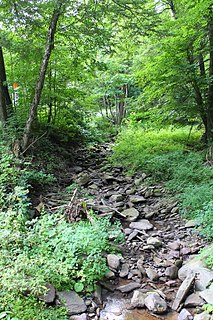
South Branch Roaring Run is a tributary of Roaring Run in Wyoming County, Pennsylvania, in the United States. It is approximately 2.0 miles (3.2 km) long and flows through Noxen Township and Forkston Township. The watershed of the stream has an area of 3.31 square miles (8.6 km2). The surficial geology in its vicinity consists of bedrock, Wisconsinan Till, Wisconsinan Bouldery Till, Wisconsinan Ice-Contact Stratified Drift, and alluvium. South Branch Roaring Run is classified as Class A Wild Trout Waters.
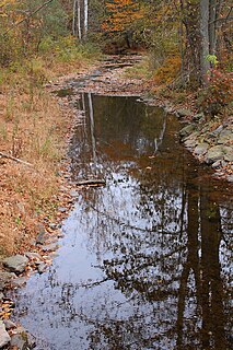
Beaver Run is a tributary of Bowman Creek in Luzerne County and Wyoming County, in Pennsylvania, in the United States. It is approximately 7.7 miles (12.4 km) long and flows through Lake Township in Luzerne County and Noxen Township in Wyoming County. The watershed of the stream has an area of 10.6 square miles (27 km2). It is not designated as an impaired waterbody. The surficial geology in its vicinity includes alluvial fan, alluvial terrace, alluvium, Wisconsinan Till, Wisconsinan Ice-Contact Stratified Drift, fill, wetlands, and bedrock.

Hettesheimer Run is a tributary of Bowman Creek in Wyoming County, Pennsylvania, in the United States. It is approximately 1.6 miles (2.6 km) long and flows through Noxen Township. The watershed of the stream has an area of 1.94 square miles (5.0 km2). It is not designated as an impaired waterbody. The stream was historically used as an industrial water supply. Its watershed is designated as a High-Quality Coldwater Fishery and a Migratory Fishery and the stream is Class A Wild Trout Waters.

York Run is a tributary of Bowman Creek in Wyoming County, Pennsylvania, in the United States. It is approximately 2.3 miles (3.7 km) long and flows through Noxen Township. The watershed of the creek has an area of 1.42 square miles (3.7 km2). The surficial geology in its vicinity consists of alluvium, Wisconsinan Till, alluvial fan, and Wisconsinan Ice-Contact Stratified Drift. The watershed of the stream is designated as a High-Quality Coldwater Fishery and a Migratory Fishery and the stream is Class A Wild Trout Waters.

Stone Run is a tributary of Bowman Creek in Wyoming County, Pennsylvania, in the United States. It is approximately 2.2 miles (3.5 km) long and flows through Noxen Township. The watershed of the stream has an area of 2.43 square miles (6.3 km2). The stream is not designated as an impaired waterbody. The surficial geology in its vicinity consists of alluvium, Wisconsinan Ice-Contact Stratified Drift, Wisconsinan Till, and Wisconsinan Bouldery Till. The stream is classified as Class A Wild Trout Waters and its watershed is designated as a High-Quality Coldwater Fishery and a Migratory Fishery.
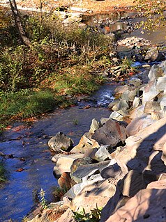
Sorber Run is a tributary of Bowman Creek in Luzerne County and Wyoming County, in Pennsylvania, in the United States. It is approximately 3.1 miles (5.0 km) long and flows through Lake Township in Luzerne County and Noxen Township in Wyoming County. The watershed of the stream has an area of 2.08 square miles (5.4 km2). The surficial geology in the stream's vicinity consists of alluvium and Wisconsinan Till. The watershed is designated as Exceptional Value waters and a Migratory Fishery. The stream is one of two Wilderness Trout Streams in Wyoming County.

Baker Run is a tributary of Bowman Creek in Wyoming County, Pennsylvania, in the United States. It is approximately 1.1 miles (1.8 km) long and flows through Noxen Township. The watershed of the stream has an area of 2.28 square miles (5.9 km2). The stream is not designated as an impaired waterbody. The surficial geology in its vicinity consists of alluvium, alluvial terrace, and Wisconsinan Till. Its watershed is designated as a High-Quality Coldwater Fishery and a Migratory Fishery.
Broad Hollow Run is a tributary of Bowman Creek in Wyoming County, Pennsylvania, in the United States. It is approximately 1.0 mile (1.6 km) long and flows through Noxen Township. The watershed of the stream has an area of 1.04 square miles (2.7 km2). The surficial geology in the vicinity of the stream consists of alluvium, alluvial fan, and Wisconsinan Till. Its watershed is designated as a High-Quality Coldwater Fishery and a Migratory Fishery.
Sugar Run is a tributary of Bowman Creek in Luzerne County and Wyoming County, in Pennsylvania, in the United States. It is approximately 1.8 miles (2.9 km) long and flows through Lake Township in Luzerne County and Noxen Township in Wyoming County. The watershed of the stream has an area of 1.02 square miles (2.6 km2). The surficial geology in its vicinity consists of alluvium, alluvial fan, Wisconsinan Till, and bedrock. The stream's watershed is designated as a High-Quality Coldwater Fishery and a Migratory Fishery.
Rock Creek is a tributary of Tunkhannock Creek in Susquehanna County, Pennsylvania, in the United States. It is approximately 3.8 miles (6.1 km) long and flows through Herrick Township, Ararat Township, and Gibson Township. The watershed of the creek has an area of 3.76 square miles (9.7 km2). The creek has no named tributaries and is not designated as an impaired waterbody. It is classified as Class A Wild Trout Waters.
Little Creek is a tributary of East Branch Tunkhannock Creek in Susquehanna County, Pennsylvania, in the United States. It is approximately 3.0 miles (4.8 km) long and flows through Herrick Township and Clifford Township. The watershed of the creek has an area of 4.56 square miles (11.8 km2). The creek has one unofficially named tributary, which is known as Tinker Hollow. Little Creek is designated as Class A Wild Trout Waters. The surficial geology in its vicinity mainly consists of Wisconsinan Till and alluvium.
Tinker Creek is a tributary of East Branch Tunkhannock Creek in Susquehanna County, Pennsylvania, in the United States. It is approximately 4.3 miles (6.9 km) long and flows through Clifford Township. The watershed of the creek has an area of 5.02 square miles (13.0 km2). The creek is not designated as an impaired waterbody and has no named tributaries. It is classified as Class A Wild Trout Waters.
Butler Creek is a tributary of Nine Partners Creek in Susquehanna County, Pennsylvania, in the United States. It is approximately 12 miles (19 km) long and flows through Jackson Township, Gibson Township, and Harford Township. The watershed of the creek has an area of 20.6 square miles (53 km2). The creek has one named tributary, which is known as Little Butler Creek, and is not designated as an impaired waterbody. The creek's valley is a "beaded valley", at least in its upper reaches, and has thick deposits of till in its valley.


