Lubbock Preston Smith International Airport is five miles north of Lubbock, in Lubbock County, Texas, United States. Originally Lubbock International Airport, it was renamed in 2004 for former Texas governor Preston E. Smith, an alumnus of Texas Tech University.

Peter O. Knight Airport is an airport on Davis Islands, five minutes from downtown Tampa, Florida. Built as a Works Progress Administration project, it was Tampa's main airport from 1935 to 1945, and is still used by general aviation operators today because of its proximity to the central city. The airport was named for prominent attorney and businessman Peter O. Knight, namesake of Holland & Knight.
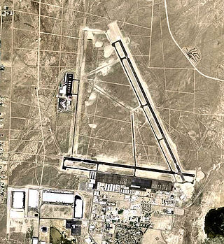
Reno Stead Airport is a large public and military general aviation airport located in the North Valleys area, 10 nautical miles (19 km) northwest of the central business district of Reno, in Washoe County, Nevada, United States. A former military installation until 1966, when it was known as Stead Air Force Base, the airport's sole remaining military presence consists of an Army Aviation Support Facility and the 189th General Support Aviation Battalion of the Nevada Army National Guard, flying CH-47 Chinook helicopters. The airport is owned by the Reno Tahoe Airport Authority. The National Plan of Integrated Airport Systems for 2011–2015 categorized it as a general aviation reliever airport.

Easterwood Airport is a regional airport in College Station, Texas, with Texas A&M University, Bryan-College Station, and Brazos County, Texas as its communities. Reached from Farm to Market Road 60, it is 3 miles (4.8 km) southwest of the center of College Station, and 0.25 miles (0.40 km) from Texas A&M University. There is no public transportation from Easterwood Airport to the surrounding cities; however, in the fall of 2019, a new university bus route was established to connect Easterwood Airport with the Engineering Quad and the Texas A&M Hotel and Conference Center. The airport bus route is available only to those with a University ID or Brazos Transit District ID. Despite owning and managing the airport, there are no aviation courses at the university.

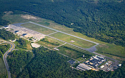
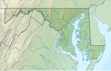
On February 17, 1974, United States Army Private Robert Kenneth Preston (1953–2009) took off in a stolen Bell UH-1B Iroquois "Huey" helicopter from Tipton Field, Maryland, and landed it on the South Lawn of the White House in a significant breach of security. Preston had enlisted in the Army to become a helicopter pilot. However, he did not graduate from the helicopter training course and lost his opportunity to attain the rank of warrant officer pilot. His enlistment bound him to serve four years in the Army, and he was sent to Fort Meade as a helicopter mechanic. Preston believed that this situation was unfair and later said that he stole the helicopter to show his skill as a pilot.

Sierra Vista Municipal Airport, a joint-use civil-military airport which shares facilities with Libby Army Airfield, is located on Fort Huachuca in Sierra Vista, a city and U.S. Army installation in Cochise County, Arizona, United States. The airport has three runways and one helipad. It is mostly used for military aviation for the surrounding military base.
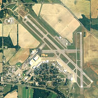
Dothan Regional Airport is a public airport in Dale County, Alabama, United States, seven miles northwest of Dothan, a city mostly in Houston County.

Palm Beach County Park Airport is a county-owned, public-use airport in Palm Beach County, Florida, United States. It is located six nautical miles south of the central business district of West Palm Beach, Florida. This airport is included in the National Plan of Integrated Airport Systems for 2011–2015, which categorized it as a reliever airport. It is also commonly referred to as the Lantana Airport.
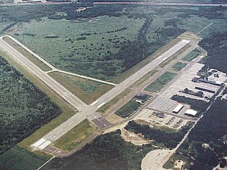
Norwood Memorial Airport is a public airport 2 mi east of Norwood, in Norfolk County, Massachusetts, United States. It is home to the offices of prominent local business people and several maintenance facilities.

Marana Regional Airport, also known as Marana Northwest Regional Airport or Avra Valley Airport, is a non-towered, general aviation airport about 15 miles northwest of Tucson, Arizona in Marana a town in Pima County, Arizona, United States. In 1999, the airport was purchased from Pima County by the town of Marana.

Majors Airport is a city-owned airport 4 nautical miles (7.4 km) southeast of the central business district of Greenville, in Hunt County, Texas.

Clarksville–Montgomery County Regional Airport, or simply Outlaw Field, is seven miles northwest of Clarksville, in Montgomery County, Tennessee, United States. It is owned by the city of Clarksville and Montgomery County and is near Fort Campbell.
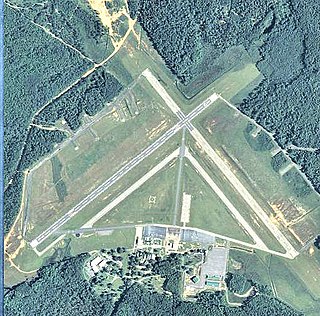
MidCoast Regional Airport at Wright Army Airfield is a joint public and military use airport at Fort Stewart, a United States Army post located near the city of Hinesville in Liberty County, Georgia, United States. The airport's physical address is 1116 E. Lowe Circle, Fort Stewart, GA 31314 and its mailing address is P.O. Box 10, Hinesville, GA 31310.
Cecil Airport is a public airport and commercial spaceport located in Jacksonville, Florida, United States. It is owned by the Jacksonville Aviation Authority and services military aircraft, corporate aircraft, general aviation, and air cargo. The Florida Army National Guard's primary Army Aviation Support Facility and the U.S. Coast Guard's Helicopter Interdiction Tactical Squadron (HITRON) are also located here, the former operating CH-47 Chinook, UH-60 Blackhawk, UH-72 Lakota and C-12 Huron aircraft, and the latter operating the MH-65C Dolphin helicopter.

Stinson Municipal Airport is seven miles south of downtown San Antonio in Bexar County, Texas. The National Plan of Integrated Airport Systems for 2011–2015 categorized it as a reliever airport.

Kissimmee Gateway Airport, formerly known as Kissimmee Municipal Airport, is a public airport in Kissimmee, a city in Osceola County, Florida, United States. The airport is located 16 nautical miles (30 km) southwest of the central business district of Orlando. It is owned and operated by the City of Kissimmee.

Immokalee Regional Airport is a public use airport located one nautical mile (2 km) northeast of the central business district of Immokalee, in Collier County, Florida, United States. The airport is owned by the Collier County Airport Authority. Formerly known as Immokalee Airport, it is included in the National Plan of Integrated Airport Systems for 2011–2015, which categorized it as a general aviation facility.

Fort Sumner Municipal Airport is a village owned, public use airport located two nautical miles (4 km) northeast of the central business district of Fort Sumner, a village in De Baca County, New Mexico, United States. It is included in the National Plan of Integrated Airport Systems for 2011–2015, which categorized it as a general aviation airport.

Thompson–Robbins Airport is 6 miles (9.7 km) northwest of the center of Helena–West Helena, in unincorporated Phillips County, Arkansas, United States. It is owned by the city of Helena–West Helena.

The United States capital, Washington, D.C., has been the site of several events in the nation's history of aviation, beginning from the time of the American Civil War, often for the purpose of promoting the adoption of new aeronautical technologies by the government. It has also been home to several aircraft manufacturers and aviation organizations, and many aerospace contractors have maintained a presence there as well.
