Tirosen County (Zhuluo County) (Chinese:諸羅縣; pinyin:Zhūluó Xiàn; Pe̍h-ōe-jī:Chu-lô-koān) was a political division in Taiwan from 1684 to 1787, during Qing Dynasty rule of the island. Initially encompassing the underdeveloped northern two-thirds of Taiwan, the county shrank in size as the population and economy of the north and central western plains grew and new counties were created. In 1787 the county underwent further restructuring and was renamed Kagee (modern-day Chiayi County).
Traditional Chinese characters are Chinese characters in any character set that does not contain newly created characters or character substitutions performed after 1946. They are most commonly the characters in the standardized character sets of Taiwan, of Hong Kong and Macau, and in the Kangxi Dictionary. The modern shapes of traditional Chinese characters first appeared with the emergence of the clerical script during the Han Dynasty, and have been more or less stable since the 5th century.
Hanyu Pinyin, often abbreviated to pinyin, is the official romanization system for Standard Chinese in mainland China and to some extent in Taiwan. It is often used to teach Standard Mandarin Chinese, which is normally written using Chinese characters. The system includes four diacritics denoting tones. Pinyin without tone marks is used to spell Chinese names and words in languages written with the Latin alphabet, and also in certain computer input methods to enter Chinese characters.
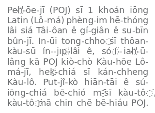
Pe̍h-ōe-jī is an orthography used to write variants of Southern Min Chinese, particularly Taiwanese Hokkien and Amoy Hokkien. Developed by Western missionaries working among the Chinese diaspora in Southeast Asia in the 19th century and refined by missionaries working in Xiamen and Tainan, it uses a modified Latin alphabet and some diacritics to represent the spoken language. After initial success in Fujian, POJ became most widespread in Taiwan and, in the mid-20th century, there were over 100,000 people literate in POJ. A large amount of printed material, religious and secular, has been produced in the script, including Taiwan's first newspaper, the Taiwan Church News.
The city now known as Chiayi originally took its name from the aboriginal tribe who lived there: the Tirosen. The former Chinese placename was Tsu-lo-san[1] (Chinese:諸羅山; pinyin:Zhūluóshān; Pe̍h-ōe-jī:Chu-lô-san), a representation of the original Formosan-language name. This town (in reality a village of perhaps one or two thousand people) gave its name to the surrounding area, dropping the -shan to leave Zhuluo as the name for the county as a whole.[2] In some English-language texts the spellings Chu-lo[3] or Choolo[4] are used.
Chiayi, officially known as Chiayi City, is a provincial city located in the plains of southwestern Taiwan. Formerly called Kagee during the late Qing dynasty and Kagi during the Japanese era, its historical name is Tirosen.
Chinese is a group of related, but in many cases not mutually intelligible, language varieties, forming the Sinitic branch of the Sino-Tibetan language family. Chinese is spoken by the Han majority and many minority ethnic groups in China. About 1.2 billion people speak some form of Chinese as their first language.
1684–1723
When the Qing wrested the island from the control of the Kingdom of Tungning in 1683, Taiwan was made a prefecture under the administration of Fujian Province. This new Taiwan Prefecture included three hien or districts;[4]Zhuluo County covered the central western plains and the north.
The Kingdom of Tungning or Kingdom of Formosa was a government that ruled part of southwestern Formosa (Taiwan) between 1661 and 1683. It was founded by Koxinga as part of the loyalist movement to restore the Ming dynasty in China after it was overthrown by the Manchu-led Qing dynasty. Koxinga hoped to recapture the Chinese mainland from the Qing, using the island as a base of operations. Until its incorporation into the Qing Dynasty in 1683, the Kingdom was ruled by Koxinga's heirs, the House of Koxinga.
Taiwan Prefecture was a prefecture of Taiwan under Qing rule. The prefecture was established by the Qing dynasty government in 1684, after the island "became an integral part of the Chinese Empire" in 1683. The Taiwan Prefecture Gazetteer documented it as part of Fujian Province. The Taiwan Prefecture Gazetteer was completed by Gao Gonggan in 1695, the 34th year of the reign of the Kangxi Emperor.
The county started as a catch-all for the areas not incorporated in one of the other, smaller, more developed counties. Zhuluo County was initially made up of four Villages (里; Lǐ; Lí) and 34 Communities (社; Shè; Siā - the name normally given to aboriginal settlements). The villages were all near the border with Taiwan County, with the communities making up the rest of Zhuluo County. At this point in time the county covered 18,499km2, more than half the total area of Taiwan,[5] with the county seat in the Jialixing area of Kaihua Village (modern-day Jiali District, Tainan).[3]
Jiali District is a district located in Tainan, Taiwan, about 15 km north of the former Dutch base of Fort Zeelandia.
Tainan, officially Tainan City, is a special municipality of Taiwan, facing the Formosan Strait or Taiwan Strait in the west and south. Tainan is the oldest city on the island of Taiwan and also commonly known as the "Capital City" for its over 200 years of history as the capital of Taiwan under Koxinga and later Qing dynasty rule. Tainan's complex history of comebacks, redefinitions and renewals inspired its popular nickname "the Phoenix City".
In 1697 the Qing Imperial official Yu Yonghe visited the area and wrote that "Zhuluo and Fengshan have no residents, only savages"[6] i.e. there were no Han Chinese settlements in the county.[3] In 1694 there was only one registered market in Zhuluo as opposed to 17 in the far smaller Taiwan County, a situation which reflected the disparity in the Han Chinese populations in both counties.[7]
Yu Yonghe was a traveler from China whose adventures are recorded in Small Sea Travel Diaries (裨海紀遊). The book contributes significantly to the research on the historical development of Taiwan (Formosa) in the seventeenth century.
In the first two decades of the eighteenth century Han settlers began to encroach more extensively into Zhuluo, with significant Chinese populations cultivating in the areas around modern-day Douliu and Changhua City. Settlers who attempted to move further north were however violently resisted by aboriginal tribes.[3] In 1704 the administrative seat of the county was relocated to Zhuluoshan, today known as Chiayi City.[3]
Douliu is a county-administered city and the county seat of Yunlin County, Taiwan. It is also the political and economic center of the county. Douliu City is served by National Highway No. 3.
1723–1787
By 1723, following the Zhu Yigui rebellion, the number of Han Chinese settlements in central and northern Taiwan had increased dramatically. To facilitate better administration Zhuluo was split into three.[8] The northernmost section, corresponding to modern-day Taipei, New Taipei, Keelung, Taoyuan City, Hsinchu City, Hsinchu County, and Miaoli County, was called Tamsui Subprefecture (淡水廳). Changhua Hsien (彰化縣) was also created, encompassing the area of modern Changhua County, Taichung, half of Yunlin County and three townships of Nantou County. The remaining area, some 3,844km2 from the Huwei River (虎尾溪) to the borders with Taiwan County and the ungoverned aboriginal areas, remained under the name of Zhuluo County.[5]
In 1787, the Lin Shuangwen rebellion against Qing rule began, and rebels gained control of almost the entire island. Imperial troops regained control of the city and vicinity in 1788.[9] In 1787, the county was renamed Kagi (Chinese:嘉義; pinyin:Jiāyì; literally: "commended righteousness") to reflect the fidelity of the city during the incident.[10]
↑ Campbell, William (1903). "Explanatory Notes". Formosa under the Dutch: described from contemporary records, with explanatory notes and a bibliography of the island. London: Kegan Paul. p.549. OCLC644323041.
↑ Davidson (1903), p.73: "After the terrible insurrection of 1722, it was found that the district of Choolo was too large to be conveniently administered by a single magistrate, and the northern portion was detached to become a new prefecture, named Changwha, while the north part of the island was formed into a ting or division, Tamsui, and was placed under the authority of a marine magistrate."
Hsu, Hsueh-chi, ed. (2006). 臺灣歷史辭典[Dictionary of Taiwan History] (in Chinese) (4th ed.). Taipei: Yuan-Liou. ISBN9570174307.
Keliher, Macabe (2004). Small Sea Travel Diaries: Yu Yonghe's Records of Taiwan. Southern Materials Center. ISBN9576386292.
Shepherd, John (1993). Statecraft and Political Economy on the Taiwan Frontier, 1600–1800. Stanford University Press. ISBN9780804720663.
This page is based on this Wikipedia article Text is available under the CC BY-SA 4.0 license; additional terms may apply. Images, videos and audio are available under their respective licenses.