Tizza | |
|---|---|
| Country | |
| Region | Upper West Region |
| District | Jirapa District |
| Time zone | GMT |
| • Summer (DST) | GMT |
Tizza is a small town in the Jirapa District of the Upper West Region of Ghana. The People of this town speak Dagaare [1] [2]
Tizza | |
|---|---|
| Country | |
| Region | Upper West Region |
| District | Jirapa District |
| Time zone | GMT |
| • Summer (DST) | GMT |
Tizza is a small town in the Jirapa District of the Upper West Region of Ghana. The People of this town speak Dagaare [1] [2]

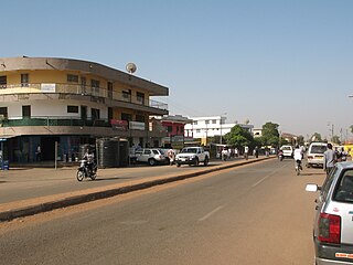
Bolgatanga, colloquially known as Bolga, is a town and the capital of the Bolgatanga Municipal and the Upper East Region of Ghana, adjacent to the border with Burkina Faso. Bolgatanga is 161 km (100 mi) to the north of Tamale. The town lies in the Red Volta Valley, with the White Volta and the cliffs of the Gambaga escarpment to the south of the town forming the southern boundary of the Upper East Region. As of 2012, the town has a population of about 66,685 people. Some ethnic groups who lived in large qualities in Bolgatanga are Northerners, Akan, Ewe, and Ga-Adangbe. The current mayor of the town is Rex Asanga.
The Districts of Ghana are second-level administrative subdivisions of Ghana, below the level of region. There are currently 261 local metropolitan, municipal and district assemblies.
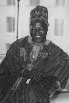
Hilla Limann, was a Ghanaian diplomat and politician who served the President of Ghana from 24 September 1979 to 31 December 1981. He served as a diplomat in Lomé, Togo and Geneva, Switzerland.
Wa is a town and the capital of the Wa Municipal District and the Upper West Region of Ghana. It has a population of 200,672 people according to the 2021 census.

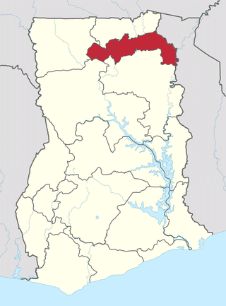
The Upper West Region of Ghana is located in the north-western corner of Ghana and is bordered by Upper East Region to the east, Northern Region to the south, and Burkina Faso to the west and north. The Upper West regional capital and largest settlement is Wa. The Upper West was created by the then Head of State, Jerry Rawlings in 1983 under the Provisional National Defence Council (PNDC) military regime. The area was carved out of the former Upper Region, which is now the Upper East Region. For about thirty-five years, it remained the youngest region of Ghana until 2018 when six more regions were created by the Nana Addo Dankwa Akufo-Addo government; hence increasing the total number of administrative regions in the country to sixteen.
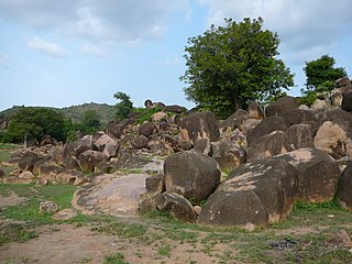
Paga is a town in Upper East Region of Ghana, lying north of Bolgatanga. Paga is the capital of Kassena Nankana West District, a district in the Upper East Region in the northern part of Ghana. The town is located on the border of Burkina Faso and is 166 km south of Ouagadougou via the N5 highway, the main road linking Ghana and Burkina Faso. The majority of the people of Paga are of the Kassena tribe.
The Upper East Region is located in northern part of Ghana and it is the third smallest of the 16 administrative regions in Ghana. It occupies a total land surface of 8,842 square kilometers or 2.7% of the total land area of Ghana. The regional capital is Bolgatanga, which is sometimes referred to as Bolga. Other major towns in the region include Navrongo, Paga, Sandema, Bawku, and Zebilla, Tempane, Pusiga, Garu, Pwalugu, Widana

Bawku is a town and is the capital of the Bawku Municipal District, district in the Upper East region of north Ghana, adjacent to the border with Burkina Faso. It is located approximately between latitudes 11o 111 and 100 401 North and longitude 0o 181w and 0o 61 E in the north-eastern corner of the region. The municipality has a total land area of about 257 km2. The Municipality was established by Legislative Instrument (L.I) 2103. The municipality has a total land area of about 257 km2. Bawku has a 2021 settlement population of 119,458 people. Hon. Ayariga Mahama is the Member of Parliament for Bawku Central Constituency.
Tumu is a small town and is the capital of Sissala East district, a district in the Upper West Region of north Ghana, adjacent to the border with Burkina Faso. The Municipality has the population of 80,619 with 39,868 males and 40,751 females according to 2021 population and housing census. The town consists mainly of the Sissala by tribe. Tumu is connected by road to the town of Navrongo.

Ghana is a multilingual country in which about eighty languages are spoken. Of these, English, which was inherited from the colonial era, is the official language and lingua franca. Of the languages indigenous to Ghana, Akan is the most widely spoken in the south. Dagbani, Dagare, Sisaala, Waale, and Gonja are among the most widely spoken in the northern part of the country.
Wa Municipal District is one of the eleven districts in Upper West Region, Ghana. Originally created as an ordinary district assembly in 1988 when it was known as Wa District, until two parts of the district were later split off by a decree of president John Agyekum Kufuor in July 2004 to create Wa East District and Wa West District respectively; thus the remaining part was later elevated to municipal district assembly status on the same year to become Wa Municipal District. The municipality is located in the southern part of Upper West Region and has Wa as its capital town, which also serves as the regional capital of the Upper West Region.
Sisaala (Sissala) is a Gur language cluster spoken in northern Ghana near the town of Tumu and in the neighbouring republic of Burkina Faso. Western Sisaala is intermediate between Sisaali and Tumulung Sisaala.

Roads in Ghana form a network of varied quality and capacity. Responsibility for the road network differs between trunk and non-trunk routes. Trunk roads, which are the most important roads, are administered by the Ghana Highway Authority, which was established in 1974 to develop the trunk road network. Ghana's 13,367 km of trunk roads accounts for 33% of the total road network of 40,186 km. The Department of Feeder Roads is responsible for the construction and maintenance of feeder roads in Ghana, while responsibility for urban roads lies with the Department of Urban Roads. In the 18th and 19th centuries, the Ashanti Empire constructed a complex network of roads to link Kumasi with their territories in modern Ghana. For John Thornton, these roads improved transportation across the region by the 19th century.

Upper Denkyira West is one of the constituencies represented in the Parliament of Ghana. It elects one member of parliament (MP) by the first past the post system of election. The Upper Denkyira West constituency is located in the Upper Denkyira district of the Central Region of Ghana.

Jirapa is the capital town of the Jirapa Municipal in the Upper West Region of Ghana.

Lambussie Karni District is one of the eleven districts in Upper West Region, Ghana. Originally it was formerly part of the then-larger Jirapa/Lambussie District in 1988; until the northern part of the district was later split off to create Lambussie-Karni District on 29 February 2008; thus the remaining part has been renamed as Jirapa District. The district assembly is located in the northwest part of Upper West Region and has Lambussie as its capital town.
The Adele people are an ethnic group and tribe of the Ghanaian-Togo border area indigenous to the Jasikan, Nkwanta South and Nkwanta North Districts of the Volta Region centered around the towns of Dadiasi and Dutukpene in Ghana and the Sotouboua Prefecture of the Centrale Region centered around the towns of Assouma Kedeme and Tiefouma in Togo. The Adele people are agricultural, primarily farming yams, cassava, plantain, beans, and rice.
The North East Region is one of the sixteen regions of Ghana. It is located in the north of the country and was created in December 2018 after a referendum was voted upon to break it off of the Northern region. The region's capital is Nalerigu.

Nadowli Kaleo is one of the constituencies represented in the Parliament of Ghana. It elects one Member of Parliament (MP) by the first past the post system of election. Nadowli Kaleo is located in the Nadowli-Kaleo District of the Upper West Region of Ghana.