
Stateline is a census-designated place (CDP) on the southeastern shore of Lake Tahoe in Douglas County, Nevada, United States. It lies next to the California state line and City of South Lake Tahoe. The population was 842 at the 2010 census. The population swells considerably during the busy winter and summer seasons, due to the high number of hotel rooms and rental accommodations available.

Silver Springs is a census-designated place (CDP) in Lyon County, Nevada, United States at the intersection of US 50 and US 95A. The population was 5,296 at the 2010 census. Lahontan Reservoir, Lahontan State Recreation Area and historic Fort Churchill State Historic Park are all located nearby. The area is served by the Silver Springs Airport.

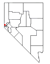
Smith Valley is a census-designated place (CDP) in Lyon County, Nevada, United States. The population was 1,603 at the 2010 census.
Incline Village is a census-designated place (CDP) on the north shore of Lake Tahoe in Washoe County, Nevada, United States. The population was 8,777 at the 2010 census. It is part of the Reno−Sparks Metropolitan Statistical Area. Until the 2010 census, the CDP Crystal Bay, Nevada was counted jointly with Incline Village.
Lemmon Valley is a census-designated place (CDP) in Washoe County, Nevada, United States. The population was 5,040 at the 2010 census. It is a northern suburb of the city of Reno and is part of the Reno–Sparks Metropolitan Statistical Area. Prior to 2010 it was listed by the U.S. Census Bureau as part of the Lemmon Valley–Golden Valley CDP.

Coleville is an unincorporated community and census-designated place (CDP) in Mono County, California, United States. It is located at an elevation of 5,141 feet (1,567 m) in the Antelope Valley on the West Walker River. The population was 419 at the 2020 census, down from 495 at the 2010 census.

Crystal Bay is a census-designated place (CDP) on the north shore of Lake Tahoe in Washoe County, Nevada, United States. The population was 305 at the 2010 census. It is part of the Reno−Sparks Metropolitan Statistical Area. Prior to 2010, it was listed by the U.S. Census Bureau within the Incline Village–Crystal Bay CDP.

Walker Lake is an unincorporated town and census-designated place in Mineral County, Nevada, United States. As of the 2010 census, the population of Walker Lake was 275.

Glenbrook is a census-designated place (CDP) on the east shore of Lake Tahoe in Douglas County, Nevada, United States. The population was 215 at the 2010 census. Beach and Bay are for residents and renters living in Glenbrook's gated community. There is no public access to the beach or bay.

Kingvale is a census-designated place (CDP) in Placer County and Nevada County, California, United States. The CDP straddles the border of the two counties, with Nevada County to the north and Placer County to the south. It is located near Soda Springs, 5.5 mi (8.9 km) west of Donner Pass. Kingvale was listed on an official map as of 1955. The population was 143 at the 2010 census.

Mono City is an unincorporated community and census-designated place (CDP) in Mono County, California, United States. It lies north of Mono Lake at the base of the Sierra Nevada at the junction of U.S. Route 395 and California State Route 167, at an elevation of 6,768 feet (2,063 m). The ZIP Code is 93541; mail to Mono City should be addressed Lee Vining. The population was 224 at the 2020 census, up from 172 at the 2010 census.
Topaz is an unincorporated community and census-designated place (CDP) in Mono County, California, United States. It is located 3 miles (5 km) north of Coleville, at an elevation of 5,033 feet (1,534 m). Topaz's ZIP Code is 96133. The population was 150 at the 2020 census.

Walker is an unincorporated community and census-designated place (CDP) in Mono County, California, United States. It is located 3 miles (5 km) south of Coleville, at an elevation of 5,403 feet (1,647 m). The ZIP Code is 96107, and mail to Walker should be addressed Coleville.
Lakeridge is a census-designated place (CDP) in Douglas County, Nevada, United States. The population was 371 at the 2010 census.
Logan Creek is a census-designated place (CDP) on the east shore of Lake Tahoe in Douglas County, Nevada, United States. The population was 26 at the 2010 census.

Round Hill Village is a census-designated place (CDP) in northwestern Douglas County, Nevada, United States. The population was 759 at the 2010 census. Prior to 2010, the community was part of the Zephyr Cove–Round Hill Village CDP.
Skyland is a census-designated place (CDP) in Douglas County, Nevada, United States. The population was 376 at the 2010 census.
Topaz Ranch Estates is a census-designated place (CDP) in Douglas County, Nevada, United States. The population was 1,501 at the 2010 census.
Bennett Springs is a census-designated place in Lincoln County, Nevada, United States. As of the 2010 census it had a population of 132.
Rock House is a census-designated place (CDP) in Gila County, Arizona, United States. The population was 50 at the 2010 census.

