
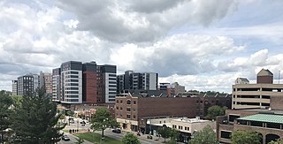
Springfield is the capital city of the U.S. state of Illinois and the seat of Sangamon County. The city's population was 114,394 at the 2020 census, which makes it the state's seventh-most populous city, the second-most populous outside of the Chicago metropolitan area, and the most populous in Central Illinois. Approximately 208,000 residents live in the Springfield metropolitan area, which consists of all of Sangamon and Menard counties. Springfield lies in a plain near the Sangamon River north of Lake Springfield. The city is on historic Route 66.

U.S. Route 66 or U.S. Highway 66 was one of the original highways in the United States Numbered Highway System. It was established on November 11, 1926, with road signs erected the following year. The highway, which became one of the most famous roads in the United States, ran from Chicago, Illinois, through Missouri, Kansas, Oklahoma, Texas, New Mexico, and Arizona before terminating in Santa Monica in Los Angeles County, California, covering a total of 2,448 miles (3,940 km).

Sangamon County is a county located near the center of the U.S. state of Illinois. According to the 2020 census, it had a population of 196,343. Its county seat and largest city is Springfield, the state capital.

University Park is a village in Will County with a small portion in Cook County in the U.S. state of Illinois. It is a south suburb of Chicago. The village is one of the region's few planned communities; it was developed in the 1960s as Wood Hill, then Park Forest South, and finally University Park. Governors State University was established in the village in 1969. The village population was 7,145 at the 2020 census.

Romeoville is a village in Will County, Illinois, United States. The village is located 26 mi (42 km) southwest of Chicago on the Gateway Wetlands, directly west of the Des Plaines River. Per the 2020 census, the population was 39,863. It is located in the southwest suburban area of Chicago near Interstate 55 and Interstate 355.

Middletown is the largest city in Orange County, New York, United States. It lies in New York's Hudson Valley region, near the Wallkill River and the foothills of the Shawangunk Mountains. Middletown is situated between Port Jervis and Newburgh, New York. At the 2020 United States census, the city's population was 30,345, reflecting an increase of 2,259 from the 28,086 counted in the 2010 census. The ZIP Code is 10940. Middletown falls within the Kiryas Joel–Poughkeepsie–Newburgh Metropolitan Statistical Area, which belongs to the larger New York–Newark–Bridgeport, NY–NJ–CT–PA Combined Statistical Area.

Springfield is a census-designated place (CDP) in Fairfax County, Virginia, United States. The Springfield CDP is recognized by the U.S. Census Bureau with a population of 31,339 as of the 2020 census. Previously, per the 2010 census, the population was 30,484. Homes and businesses in bordering CDPs including North Springfield, West Springfield, and Newington are usually given a Springfield mailing address. The population of the collective areas with Springfield addresses is estimated to exceed 100,000. The CDP is a part of Northern Virginia, the most populous region of the Washington Metropolitan Area.
East Lansing is a city in the U.S. state of Michigan. Most of the city lies within Ingham County with a smaller portion extending north into Clinton County. At the 2020 census the population was 47,741. Located directly east of the state capital of Lansing, East Lansing is well known as the home of Michigan State University. The city is part of the Lansing–East Lansing metropolitan area.

The University of Illinois Springfield (UIS) is a public university in Springfield, Illinois, United States. The university was established by the Illinois General Assembly in 1969 as Sangamon State University with a focus on post-graduate education. It became the third member of the University of Illinois system on July 1, 1995. The university serves 4,198 students as of fall 2022 with 56 bachelor's degrees, 39 minors, 44 master's degrees, one doctoral degree, 37 graduate certificates, and coursework that leads to six ISBE endorsements.

Forgottonia, also spelled Forgotonia, is the name given to a 16-county region in Western Illinois in the late 1960s and early 1970s. This geographic region forms the distinctive western bulge of Illinois that is roughly equivalent to "The Tract", the Illinois portion of the Military Tract of 1812, along and west of the Fourth Principal Meridian. Since this wedge-shaped region lies between the Illinois and Mississippi rivers, it has historically been isolated from the eastern portion of Central Illinois.
U.S. Route 66 was a United States Numbered Highway in Illinois that connected St. Louis, Missouri, and Chicago, Illinois. The historic Route 66, the Mother Road or Main Street of America, took long distance automobile travelers from Chicago to Southern California. The highway had previously been Illinois Route 4 and the road has now been largely replaced with Interstate 55 (I-55). Parts of the road still carry traffic and six separate portions of the roadbed have been listed on the National Register of Historic Places.

Lake Springfield is a 3,965-acre (16.05 km2) reservoir in the southeast of the capital city of Springfield, Illinois. It is 560 ft (170 m) above sea level. The lake was formed by building Spaulding Dam across Sugar Creek, a tributary of the Sangamon River. It is the largest municipally-owned body of water in Illinois. The lake and the lands adjoining it are all owned by City Water, Light & Power, the municipal utility for the city of Springfield, which operates the Dallman Power Plant at the lake's north end. Multiple city parks border its more than 50 miles (80 km) of shoreline.

New York State Route 173 (NY 173) is a state highway located in the Syracuse area of central New York in the United States. It takes a slightly bow-shaped route from NY 31 in the town of Van Buren to NY 5 in Chittenango, gently curving to the south of Downtown Syracuse in the center of its 30.59-mile (49.23 km) routing. Even so, NY 173 briefly enters the Syracuse city limits near where it intersects U.S. Route 11 (US 11). NY 173 passes through several suburbs of Syracuse, including Camillus, where it first meets NY 5, and Manlius, where it has a short overlap with NY 92.
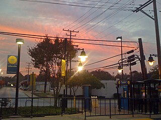
Lutherville is a census-designated place (CDP) in Baltimore County, Maryland, United States. As of the 2010 census it had a population of 6,504. Prior to 2010 the area was part of the Lutherville-Timonium CDP. Within its borders lies the Lutherville Historic District.

Elsmere is a hamlet of the town of the Bethlehem in Albany County, New York, United States. The hamlet is a suburb of the neighboring city of Albany. From the northeast to the southwest, it is bisected by New York Route 443, which is also the hamlet's main street and a major commuter route into Albany. Delaware Avenue is also home to most of the office and retail locations in Elsmere, including the largest such location: Delaware Plaza.
Columbus, the state capital and Ohio's largest city, has numerous neighborhoods within its city limits. Neighborhood names and boundaries are not officially defined. They may vary or change from time to time due to demographic and economic variables.

Central Illinois is a region of the U.S. state of Illinois that consists of the entire central third of the state, divided from north to south. Also known as the Heart of Illinois, it is characterized by small towns and mid-sized cities. Agriculture, particularly corn and soybeans, as well as educational institutions and manufacturing centers, figure prominently.
Buffalo Hart is an unincorporated community in northern Sangamon County in the U.S. state of Illinois. It is the population center of its own township, Buffalo Hart Township.
Clayville is a former roadside hamlet, inhabited from 1824 into the 1850s, located in Cartwright Township near Pleasant Plains, Illinois, United States. The settlement was never large but was firmly centered on a once-thriving tavern on the main road between the state capital of Springfield and the Illinois River port of Beardstown. The Broadwell Tavern continues to stand on its original foundation today as a reminder of the once-active frontier settlement.

Smith's Ferry is a neighborhood in Holyoke, Massachusetts, United States, located to the north of the city center, approximately 1.5 miles (2.4 km) from downtown. The neighborhood prominently features the Mount Tom State Reservation, as well as the Mountain Park Amphitheater, the Dinosaur Footprints Reservation, and several other recreational and historic venues. Smith's Ferry is the second largest geographic division in Holyoke after Rock Valley, comprising roughly 3,800 acres (1,500 ha) of mixed residential, commercial, and recreational zoning.


