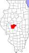
Riddle Hill, Illinois

Last updated
Riddle Hill, Illinois
USA Illinois location map.svg
Red pog.svg
Riddle Hill, Illinois
Usa edcp location map.svg
Red pog.svg
Riddle Hill, Illinois
Coordinates: 39°47′12″N89°45′52″W / 39.78667°N 89.76444°W / 39.78667; -89.76444 Coordinates: 39°47′12″N89°45′52″W / 39.78667°N 89.76444°W / 39.78667; -89.76444
Country United States
State Illinois
County Sangamon
Elevation
610 ft (190 m)
Time zone UTC-6 (Central (CST))
  Summer (DST) UTC-5 (CDT)
Area code(s) 217
GNIS feature ID416627 [1]

Riddle Hill is a rural unincorporated community located in Curran and Woodside townships, Sangamon County, Illinois. It is a crossroads located adjacent to where Old Jacksonville Road crosses Little Spring Creek, 6.5 miles west of Springfield. [2]

History

Old Jacksonville Road is one of the oldest roads in central Illinois; it is a traditional route between Jacksonville and the state capital, Springfield. Starting as early as the 1830s, travelers used the place where this road forded the creek as a campground, and the community grew from there.

On the night of September 28–29, 1838, participants in the 850-member Potawatomi Trail of Death encamped here on their forced march from Indiana to a portion of the unorganized western territory of the United States that would later be organized as Kansas Territory. A roadside historical marker has been erected on or near the site of their campground. The camping place is identified as 'McCoy's Mill', apparently recalling the name of a gristmill on Little Spring Creek at the ford. [3]

On July 4, 1861, the 21st Illinois Volunteer Infantry Regiment, en route to service in the American Civil War, camped here for its first night in the field since mustering into federal service in Springfield. The new regiment's fledgling colonel, Ulysses S. Grant, issued his first written orders here. A historical marker in the yard of the New Salem Methodist Church commemorates the site of a now-vanished tree that marked the campsite. [4]

Related Research Articles

Pilot Mountain (North Carolina) mountain in United States of America

Pilot Mountain, a metamorphic quartzite monadnock rising to a peak 2,421 feet (738 m) above sea level, is one of the most distinctive natural features in the U.S. state of North Carolina. It is a remnant of the ancient chain of Sauratown Mountains. The Saura Indians, the region's earliest known inhabitants, called the mountain "Jomeokee", meaning "great guide".

Chilkoot Trail

The Chilkoot Trail is a 33-mile (53 km) trail through the Coast Mountains that leads from Dyea, Alaska, in the United States, to Bennett, British Columbia, in Canada.

Denver, North Carolina Unincorporated community & census-designated place in North Carolina, United States

Denver, formerly known as Dry Pond, is a census-designated place and unincorporated community located in Lincoln County, North Carolina, United States. It is situated on North Carolina State Highway 16 on the west shore of Lake Norman on the Catawba River. It is about 25 miles north of downtown Charlotte and just south of the Catawba County boundary.

Mount Pisgah, Iowa human settlement in Iowa, United States of America

Mount Pisgah was a semi-permanent settlement or way station from 1846 to 1852 along the Mormon Trail between Garden Grove and Council Bluffs, in the U.S. state of Iowa. It is located near the small community of Thayer in Jones Township, Union County. This site is now part of the Mormon Pioneer National Historic Trail. It is the birthplace of Helaman Pratt. The address of the memorial is 1704 Mount Pisgah Road in Thayer.

Indian Creek massacre

The Indian Creek Massacre occurred on May 21, 1832 with the attack by a party of Native Americans on a group of United States settlers in LaSalle County, Illinois following a dispute about a settler-constructed dam that prevented fish from reaching a nearby Potawatomi village. The incident coincided with the Black Hawk War, but it was not a direct action of the Sauk leader Black Hawk and conflict with the United States. The removal of the dam was asked, was rejected by the settlers and between 40 and 80 Potawatomis and three Sauks attacked and killed fifteen settlers, including women and children. Two young women kidnapped by the Indians were ransomed and released unharmed about two weeks later.

Niangua River river in the United States of America

The Niangua River is a 125-mile-long (201 km) tributary of the Osage River in the Ozarks region of southern and central Missouri in the United States. Via the Osage and Missouri rivers it is part of the watershed of the Mississippi River.

Forest Preserve District of Cook County public land management agency

The Forest Preserve District of Cook County is a governmental commission in Cook County, Illinois, that owns and manages a network of open spaces, containing forest, prairie, wetland, streams, and lakes, that are mostly set aside as natural areas. Cook County contains Chicago, and is the center of the most densely populated urban metropolitan area in the Midwest. The Forest Preserves encompass approximately 68,000 acres (275 km²) of open space within the urban surroundings of Chicago. It contains facilities for recreation, as well as a zoo and a botanic garden.

Salmon River (Clackamas County, Oregon) river in Oregons Cascade Range

The Salmon River is a 33.5-mile (53.9 km) river in the Cascade Range in the U.S. state of Oregon that drains part of southwestern Mount Hood. The entire length of the river is a protected National Wild and Scenic River. Several portions are in protected wilderness. It is affluent to the Sandy River, a tributary of the Columbia River.

Kankakee River State Park

Kankakee River State Park is an Illinois state park on 4,000 acres (1,619 ha) primarily in Kankakee and Will Counties, Illinois, United States. Originally, 35 acres (14 ha) of land was donated by Ethel Sturges Dummer for the creation of the state park in 1938. Another 1,715 acres (694 ha) was donated by Commonwealth Edison in 1956, which again donated more land in 1989. The islands of Smith, Hoffman, Langham, and Willow are all located inside the park on the Kankakee River.

Red Hills State Park

Red Hills State Park is an Illinois state park on 967 acres (391 ha) in Lawrence County, Illinois, United States. The park sits at an elevation of 515 feet (157 m). Red Hills State Park is open for year-round recreation including boating, fishing, hunting, hiking and various winter sports. The park includes a restaurant which is open year-round and has banquet facilities.

Potawatomi Trail of Death forced removal by militia in 1838 of members of the Potawatomi nation from Indiana

The Potawatomi Trail of Death was the forced removal by militia in 1838 of some 859 members of the Potawatomi nation from Indiana to reservation lands in what is now eastern Kansas. The march began at Twin Lakes, Indiana on September 4, 1838, and ended on November 4, 1838, along the western bank of the Osage River, near present-day Osawatomie, Kansas. During the journey of approximately 660 miles (1,060 km) over 61 days, more than 40 persons died, most of them children. It marked the single largest Indian removal in Indiana history.

Emigrant Trail in Wyoming

The path followed by the Oregon Trail, California Trail and Mormon Trail spans 400 miles (640 km) through the U.S. state of Wyoming. The trail entered from Nebraska on the eastern border of the state near the present day town of Torrington and exited on the western border near the towns of Cokeville and Afton. An estimated 350,000 to 400,000 settlers traveled on the trail through Wyoming between 1841 and 1868. All three trails follow the same path through most of the state. The Mormon Trail splits at Fort Bridger and enters Utah, while the Oregon and California Trails continue to Idaho.

Course of the Rogue River (Oregon) river in the United States of America

The Rogue River in the U.S. state of Oregon begins at Boundary Springs on the border between Klamath and Douglas counties near the northern edge of Crater Lake National Park. The Rogue River flows generally west for 215 miles (346 km) from the Cascade Range through the Rogue River – Siskiyou National Forest and the Klamath Mountains to the Pacific Ocean at Gold Beach. Communities along its course include Union Creek, Prospect, Trail, Shady Cove, Gold Hill, and Rogue River, all in Jackson County; Grants Pass, and Galice in Josephine County, and Agness, Wedderburn and Gold Beach in Curry County. Significant tributaries include the South Fork Rogue River, Elk Creek, Bear Creek, the Applegate River, and the Illinois River. Arising at 5,320 feet (1,622 m) above sea level, the river loses more than 1 mile (1.6 km) in elevation by the time it reaches the Pacific.

Trappers Trail Historical trail or road

The Trapper's Trail or Trappers' Trail is a north-south path along the eastern base of the Rocky Mountains that links the Great Platte River Road at Fort Laramie and the Santa Fe Trail at Bent's Old Fort. Along this path there were a number of trading posts, also called trading forts.

Illinois in the American Civil War

The U.S. state of Illinois during the American Civil War was a major source of troops for the Union Army, and of military supplies, food, and clothing. Situated near major rivers and railroads, Illinois became a major jumping off place early in the war for Ulysses S. Grant's efforts to seize control of the Mississippi and Tennessee rivers. Statewide, public support for the Union was high despite Copperhead sentiment.

Tassinong, Indiana Community in Indiana, United States

Tassinong is an unincorporated rural community in Porter County, Indiana, south of the city of Valparaiso. The community includes an historic marker claiming it to be a French mission and trading post in 1673, which would make it the oldest European settlement in Indiana as well as in neighboring Illinois.

Sisters State Park state park in Deschutes County, Oregon, United States.

Sisters State Park is a state park located at the southeast side of the town of Sisters in Deschutes County, Oregon, United States. The park property is bisected by U.S. Route 20 and Oregon Route 126, creating three separate parcels. The park covers 28 acres (11 ha) of undeveloped forest land along Whychus Creek. It is adjacent to two developed city parks that were once part of the state park. Sisters State Park is administered by the Oregon Parks and Recreation Department.

This is a compendium of information on springs in Travis County, Texas, especially those with prehistoric or historic links to Texas Native Americans. Information is based primarily on Gunnar Brune’s report to the Texas Water Development Board, “Major and Historical Springs of Texas”, and his book, Springs of Texas. Additional sources are cited with associated springs.

Mount Adams Recreation Area

The Mount Adams Recreation Area is a 21,000-acre (8,500 ha) recreation area in the U.S. state of Washington managed by the Yakama Nation Tribal Forestry Program. The area encompasses an ecologically complex and geologically active landscape. The region features the most rugged side of Mount Adams, including canyons and the Great Gap section of the Mount Adams circumnavigation route, a three-mile trail-less section over two great canyons and many difficult glacial creeks. At 12,276 feet (3,742 m), Mount Adams is one of the major Cascade mountains. The recreation area is on the east side of the mountain and is part of the Yakama Indian Reservation and includes the popular Bird Creek Meadows area.

Fall Creek (Middle Fork Willamette River) river in Oregon, United States of America

Fall Creek is a 34-mile (55 km) tributary of the Middle Fork Willamette River in Lane County in the U.S. state of Oregon. Beginning in the Cascade Range, the creek flows generally west through the Willamette National Forest to enter the Middle Fork upstream of Jasper, southeast of Springfield and Eugene.

References

  1. "Riddle Hill". Geographic Names Information System . United States Geological Survey.
  2. Illinois Atlas and Gazetteer. Freeport, Maine: DeLorme Mapping. 1991. ISBN   978-0-89933-213-0.
  3. "Historic Marker Ahead: Potawatomi Trail of Death". New Berlin Area Historical Society. Retrieved 2011-06-02.
  4. "Ulysses S. Grant Marker in Springfield, Illinois". Springfield Chapter, Daughters of the American Revolution . Retrieved 2011-06-02.