Cimic, Illinois | |
|---|---|
 Cimic, Illinois  Cimic, Illinois | |
| Coordinates: 39°35′24″N89°39′21″W / 39.59000°N 89.65583°W | |
| Country | United States |
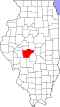
| State | Illinois |
| County | Sangamon |
| Elevation | 610 ft (190 m) |
| Time zone | UTC-6 (Central (CST)) |
| • Summer (DST) | UTC-5 (CDT) |
| Area code | 217 |
| GNIS feature ID | 422552 [1] |
Cimic is an unincorporated community in Divernon Township, Sangamon County, Illinois, United States. Cimic is located on Illinois Route 104 west of its junction with Interstate 55; parts of the community have been annexed by Divernon. [2]