Torysh

Last updated
Ball shaped rock formations Konkretsii v Zapadnom Kazakhstane. Concretions. Western Kazakhstan.JPG
Ball shaped rock formations

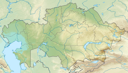
Torysh is a valley close to the village of Shetpe and the mountain Sherkala in Mangystau, Kazakhstan. Also known as "The Valley of Balls", [1] the area features many spherical rock formations which have formed naturally across the landscape in the sedimentary rock, through a concretion process. [2] It is near the eastern shores of the Caspian Sea and the medieval trading settlement of Kyzylkala. [3]

Contents

Rocks

There has been little research into the formation of the ball-shaped rocks in Torysh. However, there is a prevailing theory that they are the product of various geological processes: [4]

  1. Sediment deposition occurs from the Caspian, which used to extend this far, although only to a shallow depth.
  2. Various organic and inorganic hard, small items (such as shells, grains of sand and minerals) act as nucleation point, beginning the sedimentation process.
  3. Minerals (usually calcites, silicates and iron oxides) precipitate and combine onto the nuclei, known as concretion. The resultant rocks are formed of onion-like layers.
  4. The rocks undergo cementation, a process wherein minerals adhere to the deposits to bind them together, forming a much harder, more erosion-resistant rock.
  5. Lithification acts on the rocks, making them harder and less porous, while they are compacted, consolidating the visible sedimentary layers.
  6. Finally, erosion of the surrounding rock leaves the concretions behind, as uplift from the tectonic plates push the boulders towards the surface.

This process occurs over tens of millions of years. The complicated mix of processes means that the boulders vary in appearance, with some exhibiting cracks and weathering marks, while others being completely smooth. Rocks also vary in colour. [4] They also vary in size, from marble-sized to car-sized, [5] although most are roughly 3-4 metres in diameter. [6]

This type of rocks is not rare around the world, although Torysh is home to some of the largest examples. [2] Some of the boulders are embedded within softer sedimentary rocks in the ground of the valley. These rocks may contain unique fossils as a result - many Jurassic fossils of plants have been found at and near the site. [7] The boulders date from the Jurassic Cretaceous period, around 120-180 million years ago.

The area has a high salt deposits in the ground, as it is situated near the Caspian and the rocks were formed therefrom. Salt-tolerant shrubs and grasses grow, which can survive the arid and salty conditions.

Folklore

According to local legend, the Mangystau Region in modern-day western Kazakhstan was invaded by hoardes of enemies. Residents prayed for help, and the skies sent a downpour of rain, thunder and lightning. All the enemies were instantly turned to stone, leaving thousands of strange rock formations across the region, and in Torysh. [8]

Related Research Articles

<span class="mw-page-title-main">Sedimentary rock</span> Rock formed by the deposition and cementation of particles

Sedimentary rocks are types of rock that are formed by the accumulation or deposition of mineral or organic particles at Earth's surface, followed by cementation. Sedimentation is the collective name for processes that cause these particles to settle in place. The particles that form a sedimentary rock are called sediment, and may be composed of geological detritus (minerals) or biological detritus. The geological detritus originated from weathering and erosion of existing rocks, or from the solidification of molten lava blobs erupted by volcanoes. The geological detritus is transported to the place of deposition by water, wind, ice or mass movement, which are called agents of denudation. Biological detritus was formed by bodies and parts of dead aquatic organisms, as well as their fecal mass, suspended in water and slowly piling up on the floor of water bodies. Sedimentation may also occur as dissolved minerals precipitate from water solution.

<span class="mw-page-title-main">Sediment</span> Particulate solid matter that is deposited on the surface of land

Sediment is a naturally occurring material that is broken down by processes of weathering and erosion, and is subsequently transported by the action of wind, water, or ice or by the force of gravity acting on the particles. For example, sand and silt can be carried in suspension in river water and on reaching the sea bed deposited by sedimentation; if buried, they may eventually become sandstone and siltstone through lithification.

<span class="mw-page-title-main">Boulder</span> Natural rock fragment larger than 10 inches

In geology, a boulder is a rock fragment with size greater than 25.6 cm (10.1 in) in diameter. Smaller pieces are called cobbles and pebbles. While a boulder may be small enough to move or roll manually, others are extremely massive. In common usage, a boulder is too large for a person to move. Smaller boulders are usually just called rocks or stones.

<span class="mw-page-title-main">Gravel</span> Mix of crumbled stones: grain size range between 2 – 63 mm according to ISO 14688

Gravel is a loose aggregation of rock fragments. Gravel occurs naturally on Earth as a result of sedimentary and erosive geological processes; it is also produced in large quantities commercially as crushed stone.

Sedimentology encompasses the study of modern sediments such as sand, silt, and clay, and the processes that result in their formation, transport, deposition and diagenesis. Sedimentologists apply their understanding of modern processes to interpret geologic history through observations of sedimentary rocks and sedimentary structures.

<span class="mw-page-title-main">Rock (geology)</span> Naturally occurring mineral aggregate

In geology, rock is any naturally occurring solid mass or aggregate of minerals or mineraloid matter. It is categorized by the minerals included, its chemical composition, and the way in which it is formed. Rocks form the Earth's outer solid layer, the crust, and most of its interior, except for the liquid outer core and pockets of magma in the asthenosphere. The study of rocks involves multiple subdisciplines of geology, including petrology and mineralogy. It may be limited to rocks found on Earth, or it may include planetary geology that studies the rocks of other celestial objects.

The Llano Uplift is a geologically ancient, low geologic dome that is about 90 miles (140 km) in diameter and located mostly in Llano, Mason, San Saba, Gillespie, and Blanco counties, Texas. It consists of an island-like exposure of Precambrian igneous and metamorphic rocks surrounded by outcrops of Paleozoic and Cretaceous sedimentary strata. At their widest, the exposed Precambrian rocks extend about 65 miles (105 km) westward from the valley of the Colorado River and beneath a broad, gentle topographic basin drained by the Llano River. The subdued topographic basin is underlain by Precambrian rocks and bordered by a discontinuous rim of flat-topped hills. These hills are the dissected edge of the Edwards Plateau, which consist of overlying Cretaceous sedimentary strata. Within this basin and along its margin are down-faulted blocks and erosional remnants of Paleozoic strata which form prominent hills.

<span class="mw-page-title-main">Spheroidal weathering</span> Form of chemical weathering that affects jointed bedrock

Spheroidal weathering is a form of chemical weathering that affects jointed bedrock and results in the formation of concentric or spherical layers of highly decayed rock within weathered bedrock that is known as saprolite. When saprolite is exposed by physical erosion, these concentric layers peel (spall) off as concentric shells much like the layers of a peeled onion. Within saprolite, spheroidal weathering often creates rounded boulders, known as corestones or woolsack, of relatively unweathered rock. Spheroidal weathering is also called onion skin weathering,concentric weathering,spherical weathering, or woolsack weathering.

<span class="mw-page-title-main">Concretion</span> Compact mass formed by precipitation of mineral cement between particles

A concretion is a hard, compact mass formed by the precipitation of mineral cement within the spaces between particles, and is found in sedimentary rock or soil. Concretions are often ovoid or spherical in shape, although irregular shapes also occur. The word 'concretion' is derived from the Latin concretio "(act of) compacting, condensing, congealing, uniting", itself from con meaning "together" and crescere meaning "to grow".

<span class="mw-page-title-main">Unconformity</span> Rock surface indicating a gap in the geological record

An unconformity is a buried erosional or non-depositional surface separating two rock masses or strata of different ages, indicating that sediment deposition was not continuous. In general, the older layer was exposed to erosion for an interval of time before deposition of the younger layer, but the term is used to describe any break in the sedimentary geologic record. The significance of angular unconformity was shown by James Hutton, who found examples of Hutton's Unconformity at Jedburgh in 1787 and at Siccar Point in Berwickshire in 1788, both in Scotland.

<span class="mw-page-title-main">Moeraki Boulders</span> Large spherical boulders on Otago coast, New Zealand

The Moeraki Boulders are unusually large spherical boulders lying along a stretch of Koekohe Beach on the wave-cut Otago coast of New Zealand between Moeraki and Hampden. They occur scattered either as isolated or clusters of boulders within a stretch of beach where they have been protected in a scientific reserve. These boulders are grey-coloured septarian concretions, which have been exhumed from the mudstone and bedrock enclosing them and concentrated on the beach by coastal erosion. Especially in recent years, the boulders have been a popular tourist attraction.

<span class="mw-page-title-main">Mudrock</span> Type of sedimentary rock

Mudrocks are a class of fine-grained siliciclastic sedimentary rocks. The varying types of mudrocks include siltstone, claystone, mudstone and shale. Most of the particles of which the stone is composed are less than 116 mm and are too small to study readily in the field. At first sight, the rock types appear quite similar; however, there are important differences in composition and nomenclature.

<span class="mw-page-title-main">Navajo Sandstone</span> Geologic formation in the southwestern United States

The Navajo Sandstone is a geological formation in the Glen Canyon Group that is spread across the U.S. states of southern Nevada, northern Arizona, northwest Colorado, and Utah as part of the Colorado Plateau province of the United States.

<span class="mw-page-title-main">Clastic rock</span> Sedimentary rocks made of mineral or rock fragments

Clastic rocks are composed of fragments, or clasts, of pre-existing minerals and rock. A clast is a fragment of geological detritus, chunks, and smaller grains of rock broken off other rocks by physical weathering. Geologists use the term clastic to refer to sedimentary rocks and particles in sediment transport, whether in suspension or as bed load, and in sediment deposits.

New Jersey is a very geologically and geographically diverse region in the United States' Middle Atlantic region, offering variety from the Appalachian Mountains and the Highlands in the state's northwest, to the Atlantic Coastal Plain region that encompasses both the Pine Barrens and the Jersey Shore. The state's geological features have impacted the course of settlement, development, commerce and industry over the past four centuries.

<span class="mw-page-title-main">Red Rock Coulee</span> Nature preserve in Canada

Red Rock Coulee is a Provincial Natural Area in southeastern Alberta, Canada, 54 kilometres (30 mi) south-southwest of the city of Medicine Hat and 26 kilometres (20 mi) south of the hamlet of Seven Persons on Alberta Highway 887. The main feature of this natural landscape is the large spherical reddish boulders (concretions), some of which measure 2.5 metres (8.2 ft) in diameter. They are scattered across the badlands and coulees, and can be seen along the hiking trails, as well as from the viewpoint on Highway 887.

This glossary of geology is a list of definitions of terms and concepts relevant to geology, its sub-disciplines, and related fields. For other terms related to the Earth sciences, see Glossary of geography terms.

<span class="mw-page-title-main">Geology of Germany</span>

The geology of Germany is heavily influenced by several phases of orogeny in the Paleozoic and the Cenozoic, by sedimentation in shelf seas and epicontinental seas and on plains in the Permian and Mesozoic as well as by the Quaternary glaciations.

The geology of Montana includes thick sequences of Paleozoic, Mesozoic and Cenozoic sedimentary rocks overlying ancient Archean and Proterozoic crystalline basement rock. Eastern Montana has considerable oil and gas resources, while the uplifted Rocky Mountains in the west, which resulted from the Laramide orogeny and other tectonic events have locations with metal ore.

<span class="mw-page-title-main">Armored mud ball</span> Sedimentary structure

An armored mud ball is a small sedimentary structure, formed in flowing water, which consists of a fragment of clay or mud that has been rolled by currents into a spherical shape, and which then becomes coated in a layer of sand, gravel or pebbles that serves to protect (armor) it against further breakdown. Armored mud balls can vary in size from less than a centimeters up to 50 centimeters in diameter. Typically, they are between 5 and 10 centimeters in diameter. Mud balls are known to form in many parts of the world, and armored mud balls can form in river, lake or marine environments.

References

  1. "BBC iPlayer - CBeebies - Go Jetters, Series 2, The Valley of Balls, Kazakhstan". bbc.co.uk.
  2. 1 2 "Mysterious Valley of Balls, Kazakhstan". charismaticplanet.com. 27 June 2016. Retrieved 2018-01-27.
  3. "Valley of Balls". Atlas Obscura. Retrieved 2024-07-21.
  4. 1 2 MAT, Mahmut (2024-07-09). "The Valley of Balls or Torysh | Geology, Formation". Geology Science. Retrieved 2024-07-21.
  5. "A Valley in Kazakhstan Home to Countless Massive Stone Spheres". archaeologynewsnetwork.com. 2022-04-20. Retrieved 2024-07-21.
  6. "The Valley of Balls, Kazakhstan". www.amusingplanet.com. Retrieved 2024-07-21.
  7. "Torysh, Tupkaragan District, Mangystau Region, Kazakhstan". Mindat.org . 2024-07-21. Retrieved 2024-07-21.
  8. "The field of spherical concretions Torysh in Mangistau · Kazakhstan travel and tourism blog" . Retrieved 2024-07-21.

44°21′41″N51°33′40″E / 44.3614°N 51.5611°E / 44.3614; 51.5611