
The City of Canning is a local government area in the southeastern suburbs of the Western Australian capital city of Perth, about 10 kilometres (6 mi) southeast of Perth's central business district. The City covers an area of 64.8 square kilometres (25.0 sq mi) and had a population of approximately 90,000 as at the 2016 Census.

The City of Cockburn is a local government area in the southern suburbs of the Western Australian capital city of Perth about 8 kilometres (5 mi) south of Fremantle and about 24 kilometres (15 mi) south of Perth's central business district. The City covers an area of 167.5 square kilometres (64.7 sq mi) and had a population of over 104,000 as at the 2016 Census.

The Town of East Fremantle is a local government area in the southern suburbs of the Western Australian capital city of Perth, located immediately northeast of the port city of Fremantle and about 17 kilometres (11 mi) southwest of Perth's central business district. The Town covers an area of 3.1 square kilometres (1.2 sq mi), maintains 46 km of roads and had a population of over 7,000 as at the 2016 Census.
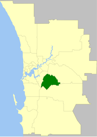
The City of Gosnells is a local government area in the southeastern suburbs of the Western Australian capital city of Perth, located northwest of Armadale and about 20 kilometres (12 mi) southeast of Perth's central business district. The City covers an area of 128 square kilometres (49.42 sq mi), a portion of which is state forest rising into the Darling Scarp to the east, and had a population of approximately 118,000 at the 2016 Census. The largest activity centre in the City is the Central Maddington shopping centre. District centres exist in the Gosnells town centre, Thornlie and Canning Vale.

The City of Melville is a local government area in the southern suburbs of the Western Australian capital city of Perth, east of the port city of Fremantle and about 12 kilometres (7.5 mi) south of Perth's central business district. The City covers an area of 52.73 square kilometres (20.36 sq mi) and had a population of about 98,000 as at the 2016 Census.

The City of Kwinana is a local government area of Western Australia. It covers an area of approximately 118 square kilometres in metropolitan Perth, and lies about 38 km south of Perth central business district, via the Kwinana Freeway. Kwinana maintains 287 km of roads and had a population of almost 39,000 as at the 2016 Census.

The Town of Mosman Park is a local government area of Western Australia. It covers an area of approximately 4.3 km² in western metropolitan Perth, the capital of Western Australia and lies about 14 km southwest of the Perth CBD and 5 km from Fremantle.
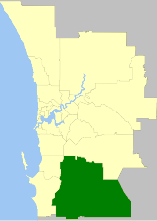
The Shire of Serpentine-Jarrahdale is a local government area in the outer southeastern metropolitan area of Perth, the capital of Western Australia, and has an area of 905 square kilometres (349 sq mi) and a population of almost 27,000 as at the 2016 Census. The Shire's seat of government is the town of Mundijong.

The Town of Victoria Park is a local government area of Western Australia. It covers an area of 17.62 km² in metropolitan Perth, the capital of Western Australia. It had a population of approximately 35,000 as at the 2016 Census.

The Shire of Augusta Margaret River is a local government area in the south-west corner of the South West region of Western Australia, approximately 270 kilometres (168 mi) south of Perth. The shire covers an area of 2,243 square kilometres (866 sq mi) and had a population of over 14,000 at the 2016 Census, about half of whom live in the towns of Margaret River and Augusta.

North Fremantle is a suburb of Perth, Western Australia, located within the City of Fremantle, a local government area of the state. Its postcode is 6159.

The Shire of Upper Gascoyne is a local government area in the Gascoyne region of Western Australia, inland from Carnarvon and about 1,000 kilometres (620 mi) north of the state capital, Perth. The Shire has an area of 57,939 square kilometres (22,370 sq mi), much of which is uninhabited land or sparsely vegetated sheep station country, and its seat of government is the small town of Gascoyne Junction. It has a population of 170, 56% of whom identify as Aboriginal.
The Shire of Dowerin is a local government area in the Wheatbelt region of Western Australia, about 160 kilometres (100 mi) northeast of Perth, the state capital. The Shire covers an area of 1,847 square kilometres (713 sq mi) and its seat of government is the town of Dowerin.

The City of Mandurah is a local government area of Western Australia, covering both Mandurah proper and an additional area reaching down as far south as Lake Clifton. The city has a total area of approximately 174 square kilometres (67 sq mi).

The Shire of Waroona is a local government area in the Peel region of Western Australia between Mandurah and Harvey and about 110 kilometres (68 mi) south of Perth, the state capital. The Shire covers an area of about 835 km² (322 mi²) and its seat of government is the town of Waroona.

The Town of Claremont is a local government area in the inner western suburbs of the Western Australian capital city of Perth, located about halfway between the port city of Fremantle and Perth's central business district. The Town covers an area of 4.9 square kilometres (1.9 sq mi), maintains 48 km of roads and 87 km of footpaths, and has a population of approximately 10,000 as at the 2016 Census.

The Town of Cottesloe is a local government area in the western suburbs of Perth, the capital of Western Australia. It covers the suburb of the same name as well as a tiny portion of the suburb of Claremont. Cottesloe is located 11 kilometres (7 mi) west of Perth's central business district, covers an area of 3.9 square kilometres (1.5 sq mi), maintains 45.7 km of roads and had a population of approximately 7,500 as at the 2016 Census. Cottesloe is served by Swanbourne, Victoria Street, Grant Street and Cottesloe train stations, all operated through the Fremantle Railway Line. Various bus routes operate along Stirling Highway, enabling transport through the suburb's western and eastern precincts with Perth and Fremantle. All services are operated by the Public Transport Authority. The Town of Cottesloe's inclusion of walk and cycle paths enable it to be a walkable precinct.

The City of Subiaco is a local government area in Western Australia. It covers an area of approximately 7 km² in inner western metropolitan Perth and lies about 3 km west of the Perth CBD. The City includes the historically working-class suburb of Subiaco centred around Rokeby Road. Since the 1990s the area has been extensively redeveloped and gentrified.

The Shire of Peppermint Grove is a local government area in Perth, Western Australia, 12 kilometres (7.5 mi) southwest of the Perth central business district. At 1.1 km2 (0.42 sq mi), it is the smallest local government area in Australia; it contains only the eponymous suburb, Peppermint Grove. The council comprises seven elected councillors, with no ward divisions.

The City of Fremantle is a local government area in the south of Perth, Western Australia. The City covers an area of 19.0 square kilometres (7.3 sq mi), and lies about 19 kilometres (12 mi) southwest of the Perth central business district.
