Trade River

Last updated
Trade River
Atanwa
Location
Country United States
State Wisconsin
Cities Atlas, WI, Trade Lake, WI, Trade River, WI
Physical characteristics
Source 
 - locationTunnel Channel Woods near Straight Lake State Park, Polk County, WI
Mouth St. Croix River
 - location
near Wolf Creek, WI, Polk County, Pine County, WI
Length50.8 mi (81.8 km)

The Trade River is a 50.8-mile-long (81.8 km) tributary of the St. Croix River in northwestern Wisconsin in the United States. [1] In its history, it has been known by the names "Atanwa" or "Ottoway" River, both of which are Anglicized versions of an Ojibwe language word meaning "trade" (see Ottawa). Beneath the mouth of the Trade River, the St. Croix River was once known as the Grave-marker River.

Tributary stream or river that flows into a main stem river or lake

A tributary or affluent is a stream or river that flows into a larger stream or main stem river or a lake. A tributary does not flow directly into a sea or ocean. Tributaries and the main stem river drain the surrounding drainage basin of its surface water and groundwater, leading the water out into an ocean.

Wisconsin A north-central state of the United States of America

Wisconsin is a U.S. state located in the north-central United States, in the Midwest and Great Lakes regions. It is bordered by Minnesota to the west, Iowa to the southwest, Illinois to the south, Lake Michigan to the east, Michigan to the northeast, and Lake Superior to the north. Wisconsin is the 23rd largest state by total area and the 20th most populous. The state capital is Madison, and its largest city is Milwaukee, which is located on the western shore of Lake Michigan. The state is divided into 72 counties.

United States federal republic in North America

The United States of America (USA), commonly known as the United States or America, is a country composed of 50 states, a federal district, five major self-governing territories, and various possessions. At 3.8 million square miles, the United States is the world's third or fourth largest country by total area and is slightly smaller than the entire continent of Europe's 3.9 million square miles. With a population of over 327 million people, the U.S. is the third most populous country. The capital is Washington, D.C., and the largest city by population is New York City. Forty-eight states and the capital's federal district are contiguous in North America between Canada and Mexico. The State of Alaska is in the northwest corner of North America, bordered by Canada to the east and across the Bering Strait from Russia to the west. The State of Hawaii is an archipelago in the mid-Pacific Ocean. The U.S. territories are scattered about the Pacific Ocean and the Caribbean Sea, stretching across nine official time zones. The extremely diverse geography, climate, and wildlife of the United States make it one of the world's 17 megadiverse countries.

Contents

The Trade River begins in the Straight Lake Tunnel Channel Woods in northern Polk County, Wisconsin, [2] and flows northward before bending westward to meet the South Fork a few miles south of Frederic. The South Fork of the Trade River begins in wetlands north of Luck and flows northward, roughly parallel to State Highway 35, until it meets the main branch. The Trade River then winds its way westward through farmland and a series of lakes in northern Polk and southern Burnett counties. West of State Highway 87, it is joined by the North Fork Trade River, which flows south-southwest from Isaac Lake via Canute Creek Flowage. Shortly thereafter, the river enters Governor Knowles State Forest and flows through pine barrens in the town of Sterling before joining the St. Croix River.
Straight Lake State Park state park of Wisconsin, United States

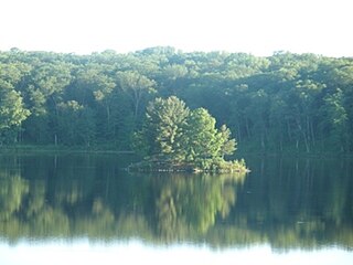
Straight Lake State Park is a 2,780-acre (1,130 ha) Wisconsin state park north of the village of Luck, Wisconsin. Straight Lake State Park was established in 2002, making it Wisconsin's newest state park. The park is traversed by the Ice Age National Scenic Trail, which runs along the northern shore of Straight Lake before following the course of the Straight River through the Straight River Tunnel Channel. The Clam Falls Trail, an abandoned road that served as an important thoroughfare during the logging era, also traverses the park roughly parallel to the Ice Age Trail.
Polk County, Wisconsin County in the United States

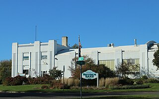
Polk County is a county in the U.S. state of Wisconsin. As of the 2010 census, the population was 44,205. Its county seat is Balsam Lake. The county was created in 1853.

Frederic, Wisconsin Village in Wisconsin, United States

Frederic is a village in Polk County, Wisconsin, United States. The population was 1,137 at the 2010 census.

Cities and towns

See also

Related Research Articles

St. Croix County, Wisconsin County in the United States

St. Croix County is a county in the U.S. state of Wisconsin. As of the 2010 census, the population was 84,345. Its county seat is Hudson. The county was created in 1840 and organized in 1849.

Burnett County, Wisconsin County in the United States

Burnett County is a county located in the U.S. state of Wisconsin. As of the 2010 census, the population was 15,457. Its county seat is Siren, with the majority of county governmental services located at the Burnett County Government Center. The county was created in 1856 and organized in 1865.

Goodhue County, Minnesota County in the United States

Goodhue County is a county in the U.S. state of Minnesota. As of the 2010 census, the population was 46,183. Its county seat is Red Wing. Nearly all of Prairie Island Indian Community is within the county.

St. Croix River (Wisconsin–Minnesota) river in Wisconsin and Minnesota, United States

The St. Croix River is a tributary of the Mississippi River, approximately 169 miles (272 km) long, in the U.S. states of Wisconsin and Minnesota. The lower 125 miles (201 km) of the river form the border between Wisconsin and Minnesota. The river is a National Scenic Riverway under the protection of the National Park Service. A hydroelectric plant at St. Croix Falls supplies power to the Minneapolis–St. Paul metropolitan area.

U.S. Highway 8 (US 8) is a United States Numbered Highway that runs primarily east–west for 280 miles (451 km), mostly within the state of Wisconsin. It connects Interstate 35 (I-35) in Forest Lake, Minnesota, to US 2 at Norway in the Upper Peninsula of Michigan near the border with Wisconsin. Except for the short freeway segment near Forest Lake, and sections near the St. Croix River bridge and Rhinelander, Wisconsin, it is mostly undivided surface road. As a state highway in the three states, US 8 is maintained by the Minnesota, Wisconsin and Michigan departments of transportation.

The Wood River is a 47.7-mile-long (76.8 km) tributary of the St. Croix River in western Burnett County, Wisconsin, United States. It follows a meandering course in a generally westward direction. Its banks are mostly low and marshy, though there are high sandbanks in places. Although it flows through a few communities, for most of its course it flows through relatively natural settings.

Zumbro River river in the United States of America

The Zumbro River is a tributary of the Mississippi River in the Driftless Area of southeastern Minnesota in the United States. It is 64.6 miles (104.0 km) long from the confluence of its principal tributaries and drains a watershed of 1,428 square miles (3,700 km2). The river's name in English is a change from its French name Rivière des Embarras due to its mouth located near Pine Island in the Mississippi River; the Dakota name for this river is Wapka Wazi Oju, having reference to the grove of great white pines at Pine Island.

The Totagatic River is an 80.0-mile-long (128.7 km) tributary of the Namekagon River in northwestern Wisconsin in the United States. Via the Namekagon and St. Croix rivers, it is part of the watershed of the Mississippi River. According to the Geographic Names Information System, the river's name has also been historically spelled Togatatic and Totogatic. Its name is derived from the Ojibwe language Dootoogaatigo-ziibi meaning "River of Boggy Riverway", due to its course through wetlands.

Apple River (Wisconsin)

The Apple River is a 77.5-mile-long (124.7 km) tributary of the St. Croix River in northwestern Wisconsin in the United States. Via the St. Croix, it is part of the watershed of the Mississippi River.

Black River (Wisconsin) tributary of the Mississippi River near La Crosse, Wisconsin

The Black River is a river in west-central Wisconsin and tributary of the Mississippi River. The river is approximately 190 miles (310 km) long. During the 19th century, pine logs were rafted down the Black, heading for sawmills at La Crosse and points beyond.

State Trunk Highway 35 is a Wisconsin state highway running north–south across western Wisconsin. It is 412.15 miles in length, and is the longest state highway in Wisconsin. Portions of WIS 35 are part of the Great River Road.

State Trunk Highway 64 is a Wisconsin state highway running east–west across central Wisconsin. It is 275.65 miles (443.62 km) in length. The western end of Highway 64 is located at the Minnesota state line on the St. Croix Crossing bridge in Oak Park Heights, Minnesota. The eastern end is located at U.S. Highway 41 in downtown Marinette on the corner of Marinette Avenue and Hall Avenue. In between, Highway 64 runs through eight counties in the northern part of Wisconsin.

State Trunk Highway 65 is a state highway in the U.S. state of Wisconsin. It runs north–south in west central Wisconsin from St. Croix Falls to Ellsworth.

State Trunk Highway 110 is a state highway in the U.S. state of Wisconsin. It runs north–south in central Wisconsin from Fremont to Marion. Its southern terminus is at U.S. Highway 10 and WIS-96 southeast of Fremont. Its northern terminus is at U.S. Highway 45 in Marion.

State Trunk Highway 113 is a state highway in the U.S. state of Wisconsin. It runs in north–south in south central Wisconsin from Madison to Baraboo, The highway uses the Merrimac Ferry, the last ferry in the Wisconsin state highway system, to cross the Wisconsin River at Merrimac. Over the length of the road, it runs through Dane, Columbia, and Sauk counties.

Willow River (St. Croix River tributary)

The Willow River is a 61.1-mile-long (98.3 km) river in St. Croix County, Wisconsin, United States, and a tributary of the St. Croix River. Its source is in southern Polk County east of the village of Clear Lake. The river at one time flowed unobstructed into the lower St. Croix River between Hudson and North Hudson. However a dam was built to block off its mouth, a narrow channel was cut above the dam to the St. Croix River, the channel was dammed, and a mill was built to exploit the head of water that the two dams created. Subsequently, the Willow River Power Company built a hydroelectric facility to utilize the same head of water, but the head was substantially decreased when the United States built the Red Wing Dam 30 miles (48 km) downstream on the Mississippi River.

New York State Route 58 highway in New York

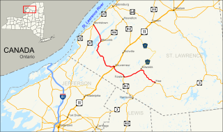
New York State Route 58 (NY 58) is a north–south state highway located in St. Lawrence County, New York, in the United States. The highway runs in a northwest to southeast direction as it traverses the county. The southern terminus of the route is at a junction with NY 3 in the hamlet of Fine within the town of the same name. Its northern terminus is at an intersection with NY 37 near the St. Lawrence River in the village of Morristown. Part of NY 58 passes through the Adirondack Mountains.

Colorado State Highway 149 highway in Colorado

State Highway 149 (SH 149) is a 117.522-mile-long (189.133 km) state highway in southwestern Colorado, United States. SH 149's southern terminus is at U.S. Highway 160 (US 160) in South Fork, and the northern terminus is at US 50 west of Gunnison.

The Clam River is a 63.4-mile-long (102.0 km) tributary of the St. Croix River in northwestern Wisconsin in the United States. In its history, it has been known by the names Kayeskikan, Kiesca-seba, and "Shell River".

Straight River (Wisconsin)

The Straight River is a 15.5-mile-long (24.9 km) tributary of the Apple River located entirely within Polk County, Wisconsin in the United States. The Straight River rises in wetlands west of Straight Lake in Straight Lake State Park. After exiting Straight Lake, the river flows generally southeastward toward Big Round Lake in the town of Georgetown. From Big Round, the Straight flows through Little and Big Blake lakes, before meeting Fox Creek, the outlet of Bone Lake. Below the confluence, Fox Creek flows southward for 5.2 miles (8.4 km), roughly parallel to County Road I/H, before meeting the Apple River a few miles west of White Ash Lake within the town of Apple River.

References

  1. U.S. Geological Survey Geographic Names Information System: Trade River
  2. "Wisconsin DNR: Tunnel Channel Woods".

Coordinates: 45°34′04″N92°46′07″W / 45.56778°N 92.76861°W / 45.56778; -92.76861

Geographic coordinate system Coordinate system

A geographic coordinate system is a coordinate system that enables every location on Earth to be specified by a set of numbers, letters or symbols. The coordinates are often chosen such that one of the numbers represents a vertical position and two or three of the numbers represent a horizontal position; alternatively, a geographic position may be expressed in a combined three-dimensional Cartesian vector. A common choice of coordinates is latitude, longitude and elevation. To specify a location on a plane requires a map projection.