
The Franconian Saale is a 140 km long river in Bavaria, Germany. It is a right-bank tributary of the Main, in Lower Franconia. It should not be confused with the larger Saxon Saale, which is a tributary of the Elbe River.

Schweyen is a commune in the Moselle department of the Grand Est administrative region in north-eastern France.

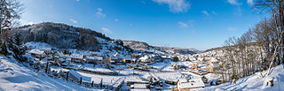
Franconian Switzerland is an upland in Upper Franconia, Bavaria, Germany and a popular tourist retreat. Located between the River Pegnitz in the east and the south, the River Regnitz in the west and the River Main in the north, its relief, which reaches 600 metres in height, forms the northern part of the Franconian Jura (Frankenjura). Like several other mountainous landscapes in the German-speaking lands, e.g. Holstein Switzerland, Märkische Schweiz, or Pommersche Schweiz, Franconian Switzerland was given its name by Romantic artists and poets in the 19th century who compared the landscape to Switzerland. Franconian Switzerland is famous for its high density of traditional breweries.

Meisenthal is a commune in the Moselle department of the Grand Est administrative region in north-eastern France.

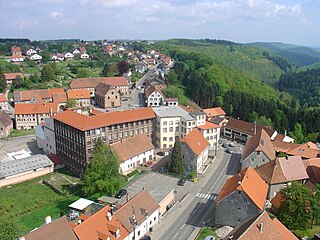
Ebermannstadt is a town in the district of Forchheim, in Bavaria, Germany. It is situated 10 km northeast of Forchheim and 25 km southeast of Bamberg.

Franconia is a region for quality wine in Germany situated in the north west of Bavaria in the district of Franconia, and is the only wine region in the federal state of Bavaria. In 2014, vines were grown on 6,176 hectares of land in the region.

Saint-Louis-lès-Bitche is a commune in the Moselle department of the Grand Est administrative region in north-eastern France.

Rohrbach-lès-Bitche is a commune in the Moselle department of the Grand Est administrative region in north-eastern France.

Nousseviller-lès-Bitche is a commune in the Moselle department of the Grand Est administrative region in north-eastern France.

Roppeviller is a commune in the Moselle department of the Grand Est administrative region in north-eastern France.

Schneckenbusch is a commune in the Moselle department in Grand Est in north-eastern France. The word Schneckenbusch is German for "snails bush".

Éguelshardt is a commune in the Moselle department of the Grand Est administrative region in north-eastern France.
Goetzenbruck or Gœtzenbruck is a commune in the Moselle department of the Grand Est administrative region in north-eastern France.

Kuntzig is a commune in the Moselle department in Grand Est in north-eastern France. In 1988 it ceded part of its territory to the new commune of Stuckange.

Ormersviller is a commune in the Moselle department of the Grand Est administrative region in north-eastern France.
Soucht is a commune in the Moselle department of the Grand Est administrative region in north-eastern France.
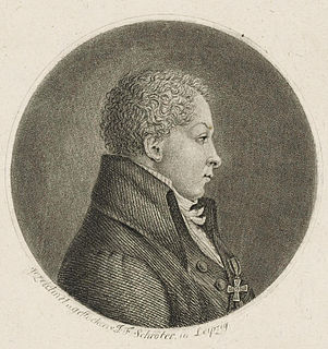
[[File:|thumb|Johann Christian Rosenmüller]]
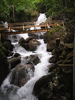
The Myra Falls are located in a ravine in the municipality of Muggendorf in the Austrian federal state of Lower Austria. The ravine has been cut by the Myrabach, a small tributary of the Piesting. The Myra, as the stream is also known, rises at the foot of the Unterberg from the Myralucke, a spring steeped in legend, that is fed by an underground lake. Although the Myra is only a few kilometres long, it used to power a large number of mills and sawmills in the Myra valley.

Wiesent is a river located in Bavaria, Germany. It is a right tributary of the river Regnitz. It is the main river of the Franconian Switzerland region, rising near the village Steinfeld. It flows through the towns Hollfeld, Muggendorf and Ebermannstadt, and joins the Regnitz in Forchheim.

The Franconian flag is a symbol of Franconia, a region in North Bavaria and parts of Thuringia, Hesse and Baden-Württemberg in Germany.


