Humboldt County is a county in the U.S. state of Nevada. As of the 2020 Census, the population was 17,285. It is a largely rural county that is sparsely populated with the only major city being Winnemucca which has a population of 8,431. Humboldt County comprises the Winnemucca, NV Micropolitan Statistical Area and serves as an important crossroads in the national transportation network. Interstate 80 travels through the southeastern corner of the county, meeting US 95 in Winnemucca that serves as a primary freight corridor between Northern Nevada and Boise, Idaho and the Interstate 84 freight corridor that links much of the Pacific Northwest. The original transcontinental railway, constructed by the Central Pacific Railroad, reached Humboldt County on Sept. 16, 1868. The Western Pacific Railroad would reach Humboldt County by November 1909, providing two mainline rail links to California and the Eastern United States. Both railroads have since been acquired by the Union Pacific Railroad, who continues to serve the region today.

Winnemucca is the only incorporated city in, and is the county seat of, Humboldt County, Nevada, United States. As of the 2020 census, the city had a total population of 8,431, up 14.0 percent from the 2010 census figure of 7,396. Interstate 80 passes through the city, where it meets U.S. Route 95.

Lovelock is the county seat of Pershing County, Nevada, United States, in which it is the only incorporated city. It is the namesake of a nearby medium-security men's prison and a Cold War-era gunnery range. Formerly a stop for settlers on their way to California and later a train depot, the town's economy remains based on farming, mining and increasingly on tourism.

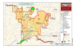
The Black Rock Desert is a semi-arid region of lava beds and playa, or alkali flats, situated in the Black Rock Desert–High Rock Canyon Emigrant Trails National Conservation Area, a silt playa 100 miles (160 km) north of Reno, Nevada that encompasses more than 300,000 acres (120,000 ha) of land and contains more than 120 miles (200 km) of historic trails. It is in the northern Nevada section of the Great Basin with a lakebed that is a dry remnant of Pleistocene Lake Lahontan.

The Humboldt River is an extensive river drainage system located in north-central Nevada. It extends in a general east-to-west direction from its headwaters in the Jarbidge, Independence, and Ruby Mountains in Elko County, to its terminus in the Humboldt Sink, approximately 225 direct miles away in northwest Churchill County. Most estimates put the Humboldt River at 300 to 330 miles long however, due to the extensive meandering nature of the river, its length may be more closely estimated at 380 miles (610 km). It is located within the Great Basin Watershed and is the third longest river in the watershed behind the Bear River at 355 miles (571 km) and the Sevier River at 325 miles (523 km). The Humboldt River Basin is the largest sub-basin of the Great Basin encompassing an area of 16,840 square miles (43,600 km2). It is the only major river system wholly contained within the state of Nevada.

The California Trail was an emigrant trail of about 1,600 mi (2,600 km) across the western half of the North American continent from Missouri River towns to what is now the state of California. After it was established, the first half of the California Trail followed the same corridor of networked river valley trails as the Oregon Trail and the Mormon Trail, namely the valleys of the Platte, North Platte, and Sweetwater rivers to Wyoming. The trail has several splits and cutoffs for alternative routes around major landforms and to different destinations, with a combined length of over 5,000 mi (8,000 km).

The Smoke Creek Desert is an arid region of northwestern Nevada, that lies about 60 miles (97 km) to the north of Pyramid Lake, west of the Fox Range and east of the Smoke Creek Mountains. The southern end of the desert lies on the Pyramid Lake Indian Reservation, and a rail line lies at the eastern edge. The Smoke Creek Desert is southwest of the Black Rock Desert's South Playa and is between the Granite Range and the Fox Range.

Interstate 80 (I-80) traverses the northern portion of the US state of Nevada. The freeway serves the Reno metropolitan area and passes through the towns of Fernley, Lovelock, Winnemucca, Battle Mountain, Carlin, Elko, Wells, and West Wendover on its way through the state.

State Route 447 is a state highway in the U.S. state of Nevada. The highway is almost entirely within Washoe County but does for a brief time enter Pershing County, Nevada. The highway connects the town of Gerlach to the remainder of the state via Wadsworth. Though passing through extremely remote and desolate areas of Nevada, the highway has recently gained fame as the primary route to access the Black Rock Desert, the site of the annual Burning Man festival. The state maintained portion ends at Gerlach; however the highway continues as Washoe County Route 447 from Gerlach north to the California state line near Cedarville.

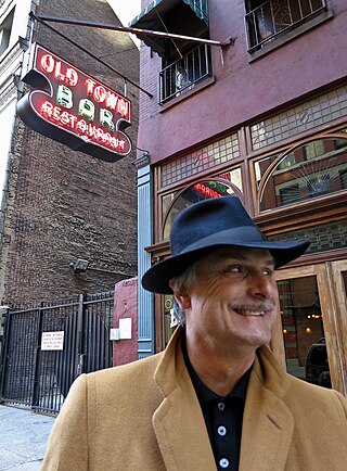
John Law is an American artist, culture-jammer, and a primary member of the Cacophony Society and a member of the Suicide Club. He is also a co-founder of Burning Man which evolved out of the spirit of the Cacophony Society when a precursor solstice party was banned from San Francisco's Baker Beach and merged with another Cacophony event on the Black Rock desert in Nevada. Originally from Michigan, Law has lived in San Francisco, California since 1976.

The Black Rock Desert–High Rock Canyon Emigrant Trails National Conservation Area is the federal land in northwestern Nevada, under the Bureau of Land Management-BLM management and protection, and the ten Wilderness Areas within it.

The Little High Rock Canyon Wilderness is a US Wilderness Area in Nevada under the Bureau of Land Management. It is located south of the High Rock Canyon Wilderness and west of the High Rock Lake Wilderness.

The Lahontan Valley is a basin in Churchill County, Nevada, United States. The valley is a landform of the central portion of the prehistoric Lake Lahontan's lakebed of 20,000-9,000 years ago. The valley and the adjacent Carson Sink represent a small portion of the lake bed. Humboldt Lake is to the valley's northeast. Pyramid Lake is west. Walker Lake is to the south. The valley is part of the larger Great Basin Desert, however during the California Gold Rush the valley was often called the Forty Mile Desert.

The Nobles Emigrant Trail, also known as the Fort Kearney, South Pass and Honey Lake Wagon Road, is a trail in California that was used by emigrant parties from the east as a shortened route to northern California. It was pioneered in 1851 by William Nobles, who discovered an easy shortcut between the Applegate Trail in Nevada and the Lassen Trail in California. The trail was extensively used until the 1870s, when it was superseded by railroads.

Idah Meacham Strobridge was an American writer and bookbinder. Known primarily for a trio of works about the Great Basin which mix folktales, fiction, sketches, and nature writing: In Miners' Mirage-Land (1904), The Loom of the Desert (1907) and The Land of Purple Shadows (1909).

Jungo is a ghost town located on Humboldt County Route 55, between Winnemucca, Nevada and Sulphur, Nevada. At one time, Jungo boasted a hotel, store, filling station and blacksmith's shop, though no buildings remain.
Desert Siteworks was an event held on the Black Rock Desert for three years (1992-1994). Participants built art and participated in self-directed performances.

Old Razorback Mountain is a 5,650-foot elevation (1,722 m) summit located in Pershing County, Nevada, United States.


