A transboundary protected area (TBPA) is an ecological protected area that spans boundaries of more than one country or sub-national entity. Such areas are also known as transfrontier conservation areas (TFCAs) or peace parks.
Magnolia guatemalensis is a tree found in the highlands and mountains of Chiapas, Guatemala, El Salvador, and Honduras. It is considered an indicator species of the cloud forest.
Concepción Las Minas is a municipality in southern Chiquimula department of Guatemala in Central America. It has a population of 11,693 (2018) and cover an area of 222 km2.

The Central American pine–oak forests is a tropical and subtropical coniferous forests ecoregion in the mountains of northern Central America and Chiapas state in southern Mexico.
Under UNESCO’s Man and the Biosphere Programme, there are 125 biosphere reserves recognized as part of the World Network of Biosphere Reserves in Latin America and the Caribbean. These are distributed across 21 countries in the region.
Montecristo Trifinio National Park is a national park in Honduras. It was established on 1 January 1987 and covers an area of 54 square kilometres.

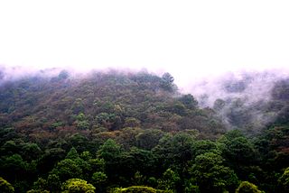
Montecristo National Park is a large national park centered on the Montecristo cloud forest in Mesoamerica. Montecristo National Park is located in the north-western tip of El Salvador, a country in Central America known for its wildlife diversity.

The Central American montane forests are an ecoregion of the tropical and subtropical moist broadleaf forests biome, as defined by the World Wildlife Fund, located in mountains of Central America.

The Volcán Tacaná Biosphere Reserve is a UNESCO Biosphere Reserve at the Tacaná Volcano in Chiapas, Mexico, on the border with Guatemala. The volcano is part of the Central America Volcanic Arc. The 6,378 hectares (24.63 sq mi) reserve contains fragile ecosystems very rich in wild flora and fauna species of cultural, scientific, economic and biological relevance. Its rich biodiversity and high endemism are found particularly in the high mountain ecosystem and landscapes and in the volcanic edifice which presents geophysical features of great scientific and aesthetic value. Average annual rainfall can amount to 2,000–5,000 millimetres (79–197 in), as in the case of Soconusco.
La Michilía Biosphere Reserve is a protected area in northwestern Mexico. It is located in the Sierra Madre Occidental range in southern Durango state.
Ocampo Flora and Fauna Protection Area is a protected area in northern Mexico. It covers an area of 3442.38 km2 in the state of Coahuila.
The Cuenca Alimentadora del Distrito Nacional de Riego 026 Bajo Río San Juan is a protected area in northeastern Mexico. It extends over part of the northern Sierra Madre Occidental, near the cities of Monterrey and Saltillo.

La Primavera Biosphere Reserve, also known as La Primavera Flora and Fauna Protection Area, is a protected natural area in western Mexico. It is located in the state of Jalisco, immediately west of the city of Guadalajara.
The Trifinio Biosphere Reserve is a protected area in Guatemala, located where the borders of Guatemala, El Salvador, and Honduras meet. The reserve was created in 1987, and has an area of 221.79 km2. It protects the Guatemalan portion of the Montecristo massif and its cloud forests, and is the Guatemalan portion of the Trifinio Fraternidad Transboundary Biosphere Reserve, which spans the three countries' borders.
The Sierra de Huautla is a mountain range and biosphere reserve in central Mexico. Located in southern Morelos, the Sierra de Huautla is a southern extension of the Trans-Mexican Volcanic Belt range into the Balsas Basin. The dry forests of Sierra are home to a diverse community of animals and plants, and the reserve's outstanding biodiversity is recognized by UNESCO.

Barranca de Metztitlán is a biosphere reserve in Hidalgo state of Mexico. It is protected for its dramatic scenery of steep cliffs and deep winding canyons, and its distinctive flora and fauna.

Nahá–Metzabok Biosphere Reserve is a biosphere reserve in southeastern Mexico. It is located in the state of Chiapas, on the northeastern flank of the Chiapas Highlands. The reserve protects montane rain forests, pine and oak forests, and natural lakes.

La Sepultura is a biosphere reserve in southern Mexico. It protects a portion of the Sierra Madre de Chiapas range in the state of Chiapas.

El Triunfo Biosphere Reserve is a biosphere reserve in southern Mexico. It is in the Sierra Madre de Chiapas in southern Chiapas.
Tawahka Asagni Biosphere Reserve is a protected area in Honduras. The reserve was established in 1999, and covers an area of 2509.42 km2.


