Trinity Green Almshouses

Last updated

Almshouses at Trinity Green. Trinity Green and Alms Houses E1 - geograph.org.uk - 1192789.jpg
Almshouses at Trinity Green.

Trinity Green Almshouses (formerly Trinity Hospital) are a series of Grade I listed almshouses on Mile End Road in Whitechapel [1] in London. They were originally built in 1695 to provide housing for retired sailors, and are possibly the 2nd oldest almshouses in Central London, The Charterhouse, founded by Thomas Sutton in 1611 being the oldest. . [2] The buildings were damaged during the Second World War, and were restored in the 1950s by London County Council.

Contents

History

The Trinity Green Almshouses were built in 1695 by the Corporation of Trinity House to provide housing for "28 decay’d Masters & Commanders of Ships or ye Widows of such"; [3] the land was given to the corporation by Captain Henry Mudd of Ratcliffe. The almshouses are believed to have been designed by Sir William Ogbourne, [4] [5] [lower-alpha 1] and the houses were organised into two rows, with a central green and chapel. [4] [8] [9] The chapel is in the parish of St Dunstan's, Stepney. [10]

In 1735, Trinity Green had 28 people, at a cost of 12 shillings per resident per month. [11] In 1895–96, Trinity Green was threatened with closure, after Sir Frederic Leighton proposed that the almshouses be destroyed. The closure was prevented due to a public campaign [4] [7] [12] led by Charles Robert Ashbee, who set up a Committee for the Survey of the Memorials of Greater London. [13] The almshouses were the first buildings to be put on his preservation register, which eventually became the listed building system. [14]

In 1927, a bronze bust memorial for William Booth was installed at Trinity Green; in the 19th century, Booth had preached in the Vine Tavern in front of the almshouses, which had led to the founding of The Salvation Army. [15] [14] In the Second World War, the Trinity Green almshouses were damaged, with those almshouses north of the chapel being destroyed. [4] [16] In 1950, Trinity Green became a Grade I listed building; the listing included the almshouses, chapel, gates, railings and walls. [17] In 1954, London County Council bought and restored the non-destroyed houses, including the restoration of the chapel with 18th-century panelling from Bradmore House in Hammersmith. [16] [4] When Mile End Road was built, Trinity Green's location was altered from rural peace and quiet into traffic. [6]

Trinity Green was included on a Mile End mural created in 2011. [18] In 2016, local residents complained at proposals for Sainsbury's to build a 28-storey tower block less than 80 yards (73 m) from the Trinity Green almshouses; they argued that the tower block would cast a shadow over the almshouses. [19] [20]

Notes

  1. Some sources say that the architect was Sir Christopher Wren. [6] [7]

Related Research Articles

<span class="mw-page-title-main">Bethnal Green</span> Human settlement in England

Bethnal Green is an area in the East End of London, England, 3 miles (4.8 km) northeast of Charing Cross. The area emerged from the small settlement which developed around the Green, much of which survives today as Bethnal Green Gardens, beside Cambridge Heath Road. By the 16th century the term applied to a wider rural area, the Hamlet of Bethnal Green, which subsequently became a Parish, then a Metropolitan Borough before merging with neighbouring areas to become the north-western part of the new London Borough of Tower Hamlets.

<span class="mw-page-title-main">Stepney</span> Human settlement in England

Stepney is a district in the East End of London in the London Borough of Tower Hamlets. The district is no longer officially defined, and is usually used to refer to a relatively small area. However, for much of its history the place name applied to a much larger manor and parish. Stepney Green is a remnant of a larger area of Common Land formerly known as Mile End Green.

<span class="mw-page-title-main">Whitechapel</span> Human settlement in England

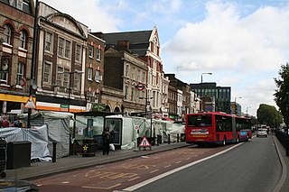
Whitechapel is a district in East London and the future administrative centre of the London Borough of Tower Hamlets. It is a part of the East End of London, 3.4 miles (5.5 km) east of Charing Cross. Part of the historic county of Middlesex, the area formed a civil and ecclesiastical parish after splitting from the ancient parish of Stepney in the 14th century. It became part of the County of London in 1889 and Greater London in 1965. The district is primarily built around Whitechapel High Street and Whitechapel Road, which extend from the City of London boundary to just east of Whitechapel station.

<span class="mw-page-title-main">London Borough of Tower Hamlets</span> Borough in London, England

The London Borough of Tower Hamlets is a borough of London, England. Situated on the north bank of the River Thames and immediately east of the City of London, the borough spans much of the traditional East End of London and includes much of the regenerated London Docklands area. The 2019 mid-year population for the borough is estimated at 324,745.

<span class="mw-page-title-main">Whitechapel Bell Foundry</span> Defunct bell foundry in London, England

The Whitechapel Bell Foundry was a business in the London Borough of Tower Hamlets. At the time of the closure of its Whitechapel premises, it was the oldest manufacturing company in Great Britain. The bell foundry primarily made church bells and their fittings and accessories, although it also provided single tolling bells, carillon bells and handbells. The foundry was notable for being the original manufacturer of the Liberty Bell, a famous symbol of American independence, and for re-casting Big Ben, which rings from the north clock tower at the Houses of Parliament in London.

<span class="mw-page-title-main">Spitalfields</span> Area of London

Spitalfields is a district in the East End of London and within the London Borough of Tower Hamlets. The area is formed around Commercial Street and includes the locale around Brick Lane, Christ Church, Toynbee Hall and Commercial Tavern. It has several markets, including Spitalfields Market, the historic Old Spitalfields Market, Brick Lane Market and Petticoat Lane Market. It was part of the ancient parish of Stepney in the county of Middlesex and was split off as a separate parish in 1729. Just outside the City of London, the parish became part of the Metropolitan Board of Works area in 1855 as part of the Whitechapel District. It formed part of the County of London from 1889 and was part of the Metropolitan Borough of Stepney from 1900. It was abolished as a civil parish in 1921.

<span class="mw-page-title-main">Metropolitan Borough of Stepney</span>

The Metropolitan Borough of Stepney was a Metropolitan borough in the County of London created in 1900. In 1965 it became part of the London Borough of Tower Hamlets.

<span class="mw-page-title-main">Brick Lane</span> Street in East London, England

<span class="mw-page-title-main">Bethnal Green and Bow (UK Parliament constituency)</span> UK Parliament constituency in England since 1997

Bethnal Green and Bow is a constituency in Greater London, represented in the House of Commons of the UK Parliament since 2010 by Rushanara Ali of the Labour Party.

<span class="mw-page-title-main">Christ Church, Spitalfields</span> Church in London, England

Christ Church Spitalfields is an Anglican church built between 1714 and 1729 to a design by Nicholas Hawksmoor. On Commercial Street in the East End and in today's Central London it is in the London Borough of Tower Hamlets, on its western border facing the City of London, it was one of the first of the so-called "Commissioners' Churches" built for the Commission for Building Fifty New Churches, which had been established by an Act of Parliament in 1711.

Whitechapel and St George's was a parliamentary constituency in east London, which returned one Member of Parliament (MP) to the House of Commons of the Parliament of the United Kingdom.

<span class="mw-page-title-main">St Peter's Church, Congleton</span> Church in Cheshire, England

St Peter's Church is in Chapel Street, Congleton, Cheshire, England. It is recorded in the National Heritage List for England as a designated Grade I listed building. It is an active Anglican parish church in the Diocese of Chester, the archdeaconry of Macclesfield and the deanery of Congleton. Its benefice is combined with those of St Stephen, Congleton, St John the Evangelist, Buglawton, and Holy Trinity, Mossley. Alec Clifton-Taylor includes it in his list of 'best' English parish churches. The Church Buildings Council included St Peter's in its group of 300 Major Parish Churches following research produced in 2016. [Pursell 2016]

<span class="mw-page-title-main">Whitechapel Road</span> Street in the London Borough of Tower Hamlets

<span class="mw-page-title-main">St Mary's Church, Handbridge</span> Church in Cheshire, England

St Mary's Church is located on Overleigh Road in Handbridge, an area south of the River Dee, in the city of Chester, Cheshire, England. It is also known as the Church of St Mary-without-the-Walls, which was to distinguish it from Church of St Mary-on-the-Hill across the River Dee within the city walls. The church is recorded in the National Heritage List for England as a designated Grade II* listed building. It is an active Anglican parish church in the diocese of Chester, the archdeaconry of Chester and the deanery of Chester.

<span class="mw-page-title-main">East End of London</span> Area of London, England

The East End of London, often referred to within the London area simply as the East End, is the historic core of wider East London, east of the Roman and medieval walls of the City of London and north of the River Thames. It does not have universally accepted boundaries to the north and east, though the River Lea is sometimes seen as the eastern boundary. Parts of it may be regarded as lying within Central London. The term "East of Aldgate Pump" is sometimes used as a synonym for the area.

<span class="mw-page-title-main">Whitechapel District (Metropolis)</span>

Whitechapel was a local government district within the metropolitan area of London, England from 1855 to 1900.

The Spitalfields Historic Buildings Trust, also known as the Spitalfields Trust, is a British architectural conservation charity. It originated in the Spitalfields area of London, although it also operates elsewhere in England and Wales. The trust's founders include the architectural historians Mark Girouard and Colin Amery and the art historian and television presenter Dan Cruickshank.

<span class="mw-page-title-main">56 Artillery Lane</span> Building in London Borough of Tower Hamlets

56 Artillery Lane is an 18th-century Grade I listed building in Spitalfields, London. The building is situated in the Artillery Passage, and was merged with the now Grade II listed building 58 Artillery Lane after the Second World War; their combined shop front is one of the oldest in London, and the combined building is used by Raven Row as a free art exhibition centre.

References

  1. "New Hope for Trinity Green Almshouses | Spitalfields Life".
  2. Prynn, Jonathan; Bourke, Joanna (4 February 2016). "Row over Sainsbury's scheme for tower near Whitechapel almshouses". London Evening Standard . Retrieved 12 May 2016.
  3. Jones, Richard (2004). Walking Dickensian London. New Holland Publishers. p. 172. ISBN   978-1-84330-483-8.
  4. 1 2 3 4 5 "Trinity Green". London Gardens Online. Retrieved 8 May 2016.
  5. "Return To Trinity Green". Spitalfields Life. 13 November 2015. Retrieved 10 May 2016.
  6. 1 2 Davies, Andrew John (24 October 1995). "site unseen : Trinity Almshouses, Greenwich, London". The Independent . Retrieved 9 May 2016.
  7. 1 2 "The Trinity Almshouses" . Lloyd's Weekly Newspaper . 1 December 1895. p. 6. Retrieved 9 May 2016 via British Newspaper Archive.
  8. Dragicevich, Peter; Fallon, Steve; Filou, Emilie; Harper, Damian (January 2016). Lonely Planet London. Lonely Planet. ISBN   9781760340247 . Retrieved 8 May 2016.
  9. "Bethnal Green: Dog Row". British History Online. 1998. Retrieved 8 May 2016.
  10. Hodson, J.S. (1839). The Ecclesiastical Legal Guide to Archbishops, Bishops and Their Secretaries, the Clergy ... &c. With Forms of the Different Instruments, and Particulars of the Ceremonies ... and Cases and Opinions from Eminent Counsel ... Carefully Selected and Arranged by a Barrister, Etc. Vol. 1. p. 203. Retrieved 8 May 2016.
  11. Stow, John; Mottlet, John (1735). A survey of the cities of London and Westminster, borough of Southwark, and parts adjacent . Retrieved 8 May 2016.
  12. "The Trinity Almshouses". The Morning Post . 28 November 1895. p. 2. Retrieved 9 May 2016.
  13. Delafons, John (2005), Politics and Preservation: A Policy History of the Built Heritage 1882–1996, Routledge, p. 30, ISBN   9781135813079
  14. 1 2 Glinert, Ed (May 2012), "Trinity Almshouses", The London Compendium, Penguin Publishing, ISBN   9780718192037 , retrieved 12 May 2016
  15. "A Walk Down The Mile End Rd". Spitalfields Life. 26 May 2014. Retrieved 12 May 2016.
  16. 1 2 Hibbert, Christopher; Weinreb, Ben; Keay, Julia; Keay, John (March 2010). The London Encyclopaedia. Macmillan Publishers. pp. 945–946. ISBN   9781405049252 . Retrieved 8 May 2016.
  17. "Trinity Green (Almshouses and Chapel) including Gates, Railings, Wall and Piers". Historic England . Retrieved 8 May 2016.
  18. "Mural: Mile End Mural". London Remembers. Retrieved 8 May 2016.
  19. Brooke, Mike (10 February 2016). "Tower Block 'shadow' threat to 1696 Trinity Green Almshouses at Mile End Gate". Docklands and East London Advertiser . Retrieved 8 May 2016.
  20. Hurrell, Alex (18 February 2016). "Opposition grows to Sainsbury's Whitechapel "skyscraper"". East London Lines. Retrieved 8 May 2016.

51°31′15″N0°03′17″W / 51.5208°N 0.0548°W / 51.5208; -0.0548