
The British Antarctic Territory (BAT) is a sector of Antarctica claimed by the United Kingdom as one of its 14 British Overseas Territories, of which it is by far the largest by area. It comprises the region south of 60°S latitude and between longitudes 20°W and 80°W, forming a wedge shape that extends to the South Pole, overlapped by the Antarctic claims of Argentina and Chile.

Thurston Island is an ice-covered, glacially dissected island, 215 km (134 mi) long, 90 km (56 mi) wide and 15,700 km2 (6,062 sq mi) in area, lying a short way off the northwest end of Ellsworth Land, Antarctica. It is the third-largest island of Antarctica, after Alexander Island and Berkner Island.
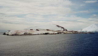
Petermann Island is a small, low and rounded island, lying off the northwest coast of Kyiv Peninsula in Graham Land, Antarctica, a short distance south of Booth Island and the Lemaire Channel. It is a popular tourist destination.

Booth Island is a rugged, Y-shaped island, 8 kilometres (5 mi) long and rising to 980 m (3,215 ft) off the northwest coast of Kyiv Peninsula in Graham Land, Antarctica in the northeastern part of the Wilhelm Archipelago. The narrow passage between the island and the mainland is the Lemaire Channel.

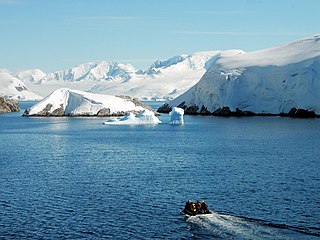
Palmer Archipelago, also known as Antarctic Archipelago, Archipiélago Palmer, Antarktiske Arkipel or Palmer Inseln, is a group of islands off the northwestern coast of the Antarctic Peninsula. It extends from Tower Island in the north to Anvers Island in the south. It is separated by the Gerlache and Bismarck straits from the Antarctic Peninsula and Wilhelm Archipelago, respectively.

Litchfield Island is a rocky island 0.9 kilometres (0.5 nmi) long and rising to 50 m (164 ft), lying in Arthur Harbour, 0.9 kilometres (0.5 nmi) south of Norsel Point, off the south-west coast of Anvers Island in the Palmer Archipelago of Antarctica.

Stonington Island is a rocky island lying 1.8 km (1.1 mi) northeast of Neny Island in the eastern part of Marguerite Bay off the west coast of Graham Land, Antarctica. It is 0.75 km (0.47 mi) long from north-west to south-east and 0.37 km (0.23 mi) wide, yielding an area of 20 ha. It was formerly connected by a drifted snow slope to Northeast Glacier on the mainland. Highest elevation is Anemometer Hill which rises to 25 m (82 ft).

Struma Glacier is a glacier in eastern Livingston Island in the South Shetland Islands, Antarctica situated south of lower Kaliakra Glacier and north of Huron Glacier. Bounded by Melnik Ridge to the north, Yankov Gap to the west and Bowles Ridge to the south, it is 4.8 km long and 1.5 km wide, and flows eastwards into Moon Bay south of Sindel Point.

Half Moon Island is a minor Antarctic island, lying in McFarlane Strait 1.35 km (0.84 mi) north of Burgas Peninsula, Livingston Island in the South Shetland Islands of the Antarctic Peninsula region. Its surface area is 171 hectares. The Argentine Cámara Base is located on the island. It is only accessible by sea and by helicopter; there is no airport of any kind. The naval base is operational occasionally during the summer, but is closed during the winter.

Smyley Island is an Antarctic island lying off the Antarctic Peninsula. The island is 61 km (38 mi) long and from 13 to 34 km wide, and lies about 20 km (12 mi) north of Case Island. It connects to the Stange Ice Shelf and is separated from Alexander Island by the Ronne Entrance. Smyley Island is one of the 27 islands of Palmer Land, Antarctica.
Emperor Island is a small island in Marguerite Bay, lying close north-east of the Courtier Islands in the Dion Islands. The islands in this group were discovered and roughly charted in 1909 by the French Antarctic Expedition. This island was surveyed in 1948 by the Falkland Islands Dependencies Survey and so named by the UK Antarctic Place-Names Committee because a low rock and shingle isthmus at the south-eastern end of the island was the winter breeding site of emperor penguins.

Endurance Glacier is a broad glacier north of Mount Elder, draining south-east to the south coast of Elephant Island in the South Shetland Islands of Antarctica, and is the main discharge glacier on the island. It was named by the UK Antarctic Place-Names Committee after HMS Endurance, which anchored off the glacier on several occasions in support of the Joint Services Expedition to Elephant Island, 1970–71.
Laws Glacier is a confluent glacier system which flows into Marshall Bay on the south coast of Coronation Island, in the South Orkney Islands off Antarctica. It was surveyed in 1948–49 by the Falkland Islands Dependencies Survey (FIDS), and was named by the UK Antarctic Place-Names Committee for Richard M. Laws of the FIDS, leader and biologist at Signy Research Station in 1948 and 1949, and at South Georgia in 1951.

Pirogov Glacier is a 5 km long and 1.5 km wide glacier situated south of Djerassi Glacier, west of the head of Mackenzie Glacier and northwest of Balanstra Glacier on Brabant Island in the Palmer Archipelago, Antarctica. It drains the south-southwest slopes of Mount Parry and flows westwards to enter Dallmann Bay south of Minot Point.
The Melchior Islands are a group of many low, ice-covered islands lying near the center of Dallmann Bay in the Palmer Archipelago, Antarctica. They were first seen but left unnamed by a German expedition under Eduard Dallmann, 1873–74. The islands were resighted and roughly charted by the Third French Antarctic Expedition under Jean-Baptiste Charcot, 1903–05.
Bellisime Glacier is a glacier about 4 nautical miles (7 km) long flowing south from Thurston Island east of Myers Glacier. It was named by the Advisory Committee on Antarctic Names after Lynda B. Bellisime of the United States Geological Survey (USGS), Flagstaff, Arizona, part of the USGS team that compiled the 1:5,000,000-scale Advanced Very High Resolution Radiometer maps of Antarctica and the 1:250,000-scale Landsat TM image maps of the Siple Coast area in the 1990s.
Bulbur Glacier is a glacier in south-central Thurston Island; it flows south along the west side of Boker Rocks into O'Dowd Cove. It was named by the Advisory Committee on Antarctic Names after E.R. Bulbur, Photographer's Mate in the Eastern Group of U.S. Navy Operation Highjump, which obtained aerial photographs of Thurston Island and adjacent coastal areas, 1946–47.

Moe Island is an island 2 km (1.2 mi) long in the South Orkney Islands off Antarctica, separated from the south-west end of Signy Island by Fyr Channel. It was charted by Captain Petter Sørlle in 1912–13, and named after M. Thoralf Moe of Sandefjord, Norway, a contemporary whaling captain who worked in this area. The northernmost point of the island is Spaull Point, named by United Kingdom Antarctic Place-Names Committee (UK-APC) after Vaughan W. Spaull, British Antarctic Survey (BAS) biologist on Signy Island, 1969.

Ball Glacier is a small glacier separating Redshaw Point from Hamilton Point, flowing north-east to Markham Bay on the south-east side of James Ross Island. It was named by the UK Antarctic Place-names Committee in 1995 after H. William Ball, Keeper of Paleontology, British Museum, 1966–86, and author of Falklands Islands Dependencies Survey Scientific Report No. 24 on fossils from the James Ross Island area. The region has a low frequency of winds mainly due to the orography of the Antarctic peninsula which affects airflow throughout the region along the eastern coast of the Antarctic Peninsula. The region is moderated by cold air masses passing through the area. They are of continental origins, coming mainly from the south and southwest but can be significantly reduced by the island's advection of oceanic air masses.
Lister Glacier is a glacier 5 nautical miles (9 km) long and 1 nautical mile (2 km) wide, draining the northeast slopes of Stribog Mountains and flowing into Bouquet Bay just south of Duclaux Point on the northeast side of Brabant Island, in the Palmer Archipelago, Antarctica.
