Razgrad Province is a province in Northeastern Bulgaria, geographically part of the Ludogorie region. It is named after its administrative and industrial centre - the town of Razgrad. As of December 2009, the Province has a total population of 132,740 inhabitants on a territory of 2,639.7 km2 (1,019.2 sq mi) that is divided into 7 municipalities.

Tervel Municipality is a municipality (obshtina) in Dobrich Province, Northeastern Bulgaria, located in Southern Dobruja geographical region, about 30 km south of Danube river. It is named after its administrative centre - the town of Tervel.

Svishtov Municipality is a municipality (obshtina) in Veliko Tarnovo Province, Central-North Bulgaria, located in the Danubian Plain along the right bank of Danube river. It is named after its administrative centre - the town of Svishtov.

Tutrakan Municipality is a municipality (obshtina) in Silistra Province, Northeastern Bulgaria, located along the right bank of Danube river in the Danubian Plain. It is named after its administrative centre - the town of Tutrakan.

Alfatar Municipality is a small municipality (obshtina) in Silistra Province, Northeastern Bulgaria, located in the Danubian Plain, in the area of the South Dobrudzha geographical region, about 15 km south of Danube river. It is named after its administrative centre - the town of Alfatar.
Slivo Pole Municipality is a municipality (obshtina) in Ruse Province, Northeastern Bulgaria, located along the right bank of Danube river in the Danubian Plain. It is named after its administrative centre - the town of Slivo Pole.

Borovo Municipality is a small municipality (obshtina) in Ruse Province, Central-North Bulgaria, located along the right bank of Danube river in the Danubian Plain. It is named after its administrative centre - the town of Borovo.
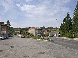
Vetovo Municipality is a municipality (obshtina) in Ruse Province, Central-North Bulgaria, located in the western parts of Ludogorie geographical region, part of the Danubian Plain. It is named after its administrative centre - the town of Vetovo.

Tsenovo Municipality is a small municipality (obshtina) in Ruse Province, Central-North Bulgaria, located along the right bank of Danube river in the Danubian Plain where Yantra river flows into the Danube. It is named after its administrative centre - the village of Tsenovo.

Ruse Municipality is a municipality (obshtina) in Ruse Province, Central-North Bulgaria, located along the right bank of Danube river in the Danubian Plain. It is named after its administrative centre - the city of Ruse which is also a capital of the province.

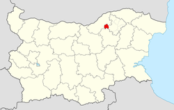
Kubrat Municipality is a municipality (obshtina) in Razgrad Province, Northeastern Bulgaria, located in the Danubian Plain about 10 km south of Danube river. It is named after its administrative centre - the town of Kubrat.

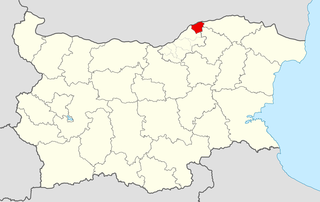
Zavet Municipality is a municipality (obshtina) in Razgrad Province, Northeastern Bulgaria, located in the Ludogorie geographical region part of the Danubian Plain. It is named after its administrative centre - the town of Zavet.

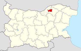
Isperih Municipality is a municipality (obshtina) in Razgrad Province, Northeastern Bulgaria, located in the Ludogorie geographical region part of the Danubian Plain. It is named after its administrative centre - the town of Isperih.

Loznitsa Municipality is a municipality (obshtina) in Razgrad Province, Northeastern Bulgaria, located in the Danubian Plain. It is named after its administrative centre - the town of Loznitsa.

Samuil Municipality is a municipality (obshtina) in Razgrad Province, Northeastern Bulgaria, located in the Ludogorie geographical region part of the Danubian Plain. It is named after its administrative centre - the village of Samuil.
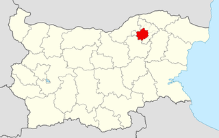
Razgrad Municipality is a municipality (obshtina) in Razgrad Province, Northeastern Bulgaria, located in the Ludogorie geographical region part of the Danubian Plain. It is named after its administrative centre - the city of Razgrad which is also the capital of the province.
Dimovo Municipality is a municipality (obshtina) in Vidin Province, Northwestern Bulgaria, located along the right bank of Danube river in the Danubian Plain. It is named after its administrative centre - the town of Dimovo.

Bregovo Municipality is a frontier municipality (obshtina) in Vidin Province, Northwestern Bulgaria, located along the right bank of Danube river in the Danubian Plain. It is named after its administrative centre - the town of Bregovo. The area borders on the Republic of Serbia to the west and Romania beyond the Danube to the north and it is the most northwestern part of the country.

Vidin Municipality is a municipality (obshtina) in Vidin Province, Northwestern Bulgaria, located along the right bank of Danube river in the Danubian Plain. It is named after its administrative centre - the city of Vidin which is also the capital of the province.

Lom Municipality is a frontier municipality (obshtina) in Montana Province, Northwestern Bulgaria, located along the right bank of Danube river in the Danubian Plain. It is named after its administrative centre — the town of Lom which is one of the important Bulgarian river ports. The area borders Romania across the Danube.