
Tigard is a city in Washington County, Oregon, United States. The population was 54,539 at the 2020 census, making it the 12th most populous city in Oregon. Incorporated in 1961, the city is located south of Beaverton and north of Tualatin, and is part of the Portland metropolitan area. Interstate 5 and Oregon Route 217 are the main freeways in the city, with Oregon Route 99W and Oregon Route 210 serving as other major highways. Public transit service is provided by TriMet, via several bus routes and the WES Commuter Rail line.
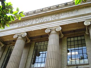
Washington County is one of 36 counties in the U.S. state of Oregon and part of the Portland metropolitan area. The 2020 census recorded the population as 600,372, making it the second most populous county in the state and most populous "Washington County" in the United States. Hillsboro is the county seat and largest city, while other major cities include Beaverton, Tigard, Cornelius, Banks, Gaston, Sherwood, North Plains, and Forest Grove, the county's oldest city. Originally named Twality when created in 1843, the Oregon Territorial Legislature renamed it for the nation's first president in 1849 and included the entire northwest corner of Oregon before new counties were created in 1854. The Tualatin River and its drainage basin lie almost entirely within the county, which shares its boundaries with the Tualatin Valley. It is bordered on the west and north by the Northern Oregon Coast Range, on the south by the Chehalem Mountains, and on the north and east by the Tualatin Mountains, or West Hills.

Cornelius is a city in Washington County, Oregon, United States. Located in the Portland metropolitan area, the city's population was 11,869 at the 2010 census. The city lies along Tualatin Valley Highway between Forest Grove to the west and Hillsboro to the east. Cornelius was incorporated in 1893 and is named for founder Thomas R. Cornelius.

Forest Grove is a city in Washington County, Oregon, United States, 25 miles (40 km) west of Portland. Originally a small farm town, it is now primarily a commuter town in the Portland metro area. Settled in the 1840s, the town was platted in 1850, then incorporated in 1872, making it the first city in Washington County. The population was 21,083 at the 2010 census, an increase of 19.1% over the 2000 figure (17,708).

The Tualatin River is a tributary of the Willamette River in Oregon in the United States. The river is about 83 miles (134 km) long, and it drains a fertile farming region called the Tualatin Valley southwest and west of Portland at the northwest corner of the Willamette Valley. There are approximately 500,000 people residing on 15 percent of the land in the river's watershed.

The Tualatin Valley is a farming and suburban region southwest of Portland, Oregon. The valley is formed by the meandering Tualatin River, a tributary of the Willamette River at the northwest corner of the Willamette Valley, east of the Northern Oregon Coast Range. Most of the valley is located within Washington County, separated from Portland by the Tualatin Mountains. Communities in the Tualatin Valley include Banks, Forest Grove, Cornelius, Hillsboro, Aloha, Beaverton, Sherwood, Tigard, and Tualatin.

The Portland metropolitan area is a metro area with its core in the U.S. states of Oregon and Washington. It has 5 principal cities the largest being Portland, Oregon. The U.S. Office of Management and Budget (OMB) identifies it as the Portland–Vancouver–Hillsboro, OR–WA Metropolitan Statistical Area, a metropolitan statistical area used by the United States Census Bureau (USCB) and other entities. The OMB defines the area as comprising Clackamas, Columbia, Multnomah, Washington, and Yamhill Counties in Oregon, and Clark and Skamania Counties in Washington. The area had a population of 2,512,859 at the 2020 census, an increase of over 12% since 2010.

Oregon Route 8, also known as Oregon Highway 8, is an Oregon state highway which serves the western suburbs of Portland. The road is locally known as Canyon Road and Tualatin Valley Highway, and travels through the center of the Tualatin Valley. Oregon 8 is located entirely within Washington County. The portion of the route from US 26 to Oregon Route 47 is part of the National Highway System, listed as a principal arterial.
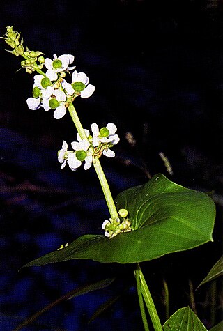
The AtfalatiIPA:[aˈtɸalati], also known as the Tualatin or Wapato Lake Indians are a tribe of the Kalapuya Native Americans who originally inhabited and continue to steward some 24 villages on the Tualatin Plains in the northwest part of the U.S. state of Oregon; the Atfalati also live in the hills around Forest Grove, along Wapato Lake and the north fork of the Yamhill River, and into areas of Southern Portland.
The Tualatin Valley Highway No. 29 is an Oregon highway which passes through the Tualatin Valley, between the cities of McMinnville and Beaverton. Between McMinnville and Forest Grove, the highway is signed as Oregon Route 47; between Forest Grove and Beaverton it is signed as Oregon Route 8. Oregon 8 becomes Canyon Road in Beaverton east of Hocken Road.
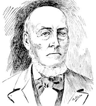
John Smith Griffin (1807–1899) was an American missionary in Oregon Country who participated at the Champoeg Meetings that created the Provisional Government of Oregon in 1843. In Oregon he served as a tutor at Fort Vancouver and later organized a church on the Tualatin Plains in the Tualatin Valley.

Harvey L. Clarke was an educator, missionary, and settler first on the North Tualatin Plains which would become Glencoe, Oregon, and then on the West Tualatin Plains that would become Forest Grove, Oregon. A native of Vermont, he moved to the Oregon Country in 1840 where he participated at the Champoeg Meetings, May 2, 1843, and helped to found Tualatin Academy that later became Pacific University. Clarke also worked for the Methodist Mission and was a chaplain for the Provisional Legislature of Oregon in 1845.

Glencoe is a neighborhood and former community in Washington County, Oregon, United States. Founded in 1842, the town, which was north of Hillsboro, died off after 1910 when neighboring North Plains was created to the west. Most of Glencoe is now a part of North Plains. Glencoe gives its name to the road connecting Hillsboro to North Plains, as well as the name of the second high school built in Hillsboro, Glencoe High School.

The Chehalem Mountains are a mountain range located in the Willamette Valley in the U.S. state of Oregon. Forming the southern boundary of the Tualatin Valley, the Chehalems are the highest mountains in the Willamette Valley. The range extends from the Willamette River east of Newberg northwest to the foothills of the Oregon Coast Range south of Forest Grove.

Laurel is an unincorporated community in Washington County, Oregon, United States. Settled in 1872, the community is located between Hillsboro and Newberg, in the southern portion of the Tualatin Valley in the foothills of the Chehalem Mountains. The community retains its agricultural heritage. Laurel is served by the Hillsboro School District and includes the century-old Laurel Valley Store building, which is in the process of being turned into a restaurant. As an unincorporated community, Laurel has no defined boundaries or population statistics of its own.

Dilley is an unincorporated community in Washington County, Oregon, United States. It is located south of Forest Grove and north of the city of Gaston on Oregon Route 47 in the Portland metropolitan area. Settled in the late 1840s, the community was platted in 1874 after the arrival of the railroad.

Alvin Thompson Smith was an American missionary and politician in what became the state of Oregon. A native of Connecticut, he lived in Illinois before moving to the Oregon Country to preach to the Native Americans in the Tualatin Valley. There he served in both the Provisional Government of Oregon and the government of the Oregon Territory, as well as helping to establish Tualatin Academy, later becoming Pacific University. Smith's former home, the Alvin T. Smith House in Forest Grove, is listed on the National Register of Historic Places.

Mountaindale is an unincorporated community in Washington County, Oregon, United States, about four miles northwest of North Plains. Settled in the 1850s, the small community was the longtime home of the Mountaindale Store. The area is part of Washington County Fire District 2.

The Willamette Valley is a 150-mile (240 km) long valley in Oregon, in the Pacific Northwest region of the United States. The Willamette River flows the entire length of the valley and is surrounded by mountains on three sides: the Cascade Range to the east, the Oregon Coast Range to the west, and the Calapooya Mountains to the south.

Tualatin Valley Fire & Rescue (TVF&R) is a special-purpose government fire fighting and emergency services district in the Portland metropolitan area of Oregon. Established in 1989 with a merger between Washington County Fire District 1 and the Tualatin Rural Fire Protection District, it primarily provides fire and emergency medical services in eastern Washington County, but also provides services in neighboring Multnomah, Clackamas, and Yamhill counties. It serves unincorporated areas along with the cities of Beaverton, Tigard, Tualatin, West Linn, Wilsonville, and Sherwood, among others. With over 400 firefighters and 27 fire stations, the district is the second largest fire department in the state and has an annual budget of $197 million.
