West Union, Oregon

Last updated
West Union, Oregon
Five Oaks at West Union - Hillsboro, Oregon.JPG
The five oaks that gave West Union its name
Hillsboro Beaverton Oregon - OpenStreetMap.png
Red pog.svg
West Union, Oregon
Location within the Hillsboro area
USA Oregon location map.svg
Red pog.svg
West Union, Oregon
West Union, Oregon (Oregon)
Usa edcp location map.svg
Red pog.svg
West Union, Oregon
West Union, Oregon (the United States)
Coordinates: 45°33′59″N122°53′38″W / 45.56639°N 122.89389°W / 45.56639; -122.89389 Coordinates: 45°33′59″N122°53′38″W / 45.56639°N 122.89389°W / 45.56639; -122.89389
Country United States
State Oregon
County Washington
Elevation
249 ft (76 m)
Time zone UTC-8 (Pacific (PST))
  Summer (DST) UTC-7 (PDT)
ZIP codes
97123
Area code(s) 503 and 971
GNIS feature ID1163344 [1]

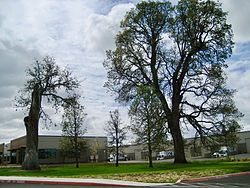
West Union is an unincorporated community in Washington County, Oregon, United States. Founded in 1851, the community had the first school district in the county; it also contains the oldest cemetery in the state and the oldest Baptist church west of the Rocky Mountains. It is located north of Hillsboro near the intersection of West Union Road and Cornelius Pass Road north of the Sunset Highway. The name comes from a grove of five oak trees that was used as a meeting place of early settlers, or the "union of the west." [2] West Union had a post office from 1874 to 1894. [3]

Contents

Geography

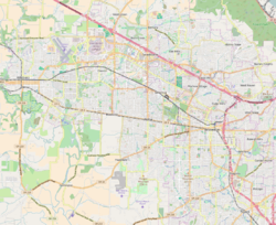
As defined by the county, the community is located south of West Union Road and north of the Sunset Highway (U.S. Route 26). [4] The eastern boundary is Cornelius Pass Road. [4] West Union is situated on small hills and flat plains with Dawson Creek and Waible Gulch draining the area, both part of the drainage area of the Tualatin River. [4] The community is located 249 feet (76 m) above sea level. [1]

The general community of West Union encompasses a larger area that includes areas to the north and east of the county-defined community area. Since 1983, portions of the community planning area have been annexed into the city of Hillsboro. [4] The population in 1983 was 35 people. [4]

Government

There is no community government for West Union. The community is served by Clean Water Services for municipal sewer, and fire protection is provided by Washington County Fire District 2. [4] West Union lies within District 4 of the Washington County Board of Commissioners and is represented by Andy Duyck. [5] Municipal water service is available from the Tualatin Valley Water District. [4]

School

West Union Elementary School West Union Elementary School - West Union, Oregon.JPG
West Union Elementary School
Former grocery store at West Union Road and Cornelius Pass Road Former grocery store - West Union, Oregon.JPG
Former grocery store at West Union Road and Cornelius Pass Road

West Union started the first school district in Washington County. The first meeting of the school board was on November 12, 1851. [6] School District No. 1 was directed by David Thomas Lenox, James W. Chamberlain, and Caleb Wilkens, and the school was built on the land claim of the Holcomb family. [7] Classes began in October 1852 after a school was completed on May 17, 1852. [6] Miss E. H. Lincoln was paid $100 for a 12-week term to be the first teacher at the school. [7]

In 1892, the original school was replaced; this second building remained in use until 1949. [6] The current school building opened in 1948. [8] The school district was merged into the Hillsboro School District in 1996. [9] Liberty High School was built in the area in 2003.

Church

West Union Baptist Church and cemetery West Union Baptist Church and Cemetery - Oregon.jpg
West Union Baptist Church and cemetery

West Union Baptist Church was founded in 1844 and the current building was completed in 1853, making it the oldest Baptist church west of the Rocky Mountains. The adjoining cemetery is the oldest in the state. The church was listed on the National Register of Historic Places in 1974.

Related Research Articles

Washington County, Oregon County in Oregon, United States

Washington County is one of 36 counties in the U.S. state of Oregon and part of the Portland metropolitan area. The 2020 census recorded the population as 600,372, making it the second most populous county in the state and most populous "Washington County" in the United States. Hillsboro is the county seat and largest city, while other major cities include Beaverton, Tigard, Cornelius, Banks, Gaston, Sherwood, North Plains, and Forest Grove, the county's oldest city. Originally named Twality when created in 1843, the Oregon Territorial Legislature renamed it for the nation's first president in 1849 and included the entire northwest corner of Oregon before new counties were created in 1854. The Tualatin River and its drainage basin lie almost entirely within the county, which shares its boundaries with the Tualatin Valley. It is bordered on the west and north by the Northern Oregon Coast Range, on the south by the Chehalem Mountains, and on the north and east by the Tualatin Mountains, or West Hills.

Cedar Mill, Oregon Unincorporated community in the State of Oregon, United States

Cedar Mill is a suburb in the Portland, Oregon metropolitan area of the United States; it is a census-designated place and an unincorporated community in Washington County, north of U.S. Route 26 and west of the Willamette Stone. It received its name from a sawmill on Cedar Mill Creek, which cut Western Redcedars that were once the dominant tree in the area. The mill's pond was near the intersection of 119th and Cornell Road, and could still be seen into the 1960s, although the mill itself had ceased operating in 1891. The name was established in 1874 with the opening of a U.S. post office named Cedar Mill. As of the 2010 census, the community population was 14,546.

Cornelius, Oregon City in Oregon, United States

Cornelius is a city in Washington County, Oregon, United States. Located in the Portland metropolitan area, the city's population was 11,869 at the 2010 census. The city lies along Tualatin Valley Highway between Forest Grove to the west and Hillsboro to the east. Cornelius was incorporated in 1893 and is named for founder Thomas R. Cornelius.

Hillsboro, Oregon City in Oregon, United States

Hillsboro is the fifth-largest city in the U.S. state of Oregon and is the county seat of Washington County. Situated in the Tualatin Valley on the west side of the Portland metropolitan area, the city hosts many high-technology companies, such as Intel, locally known as the Silicon Forest. At the 2020 census, the city's population was 106,447.

Oregon Route 8 Highway in Oregon

Oregon Route 8, also known as Oregon Highway 8, is an Oregon state highway which serves the western suburbs of Portland. The road is locally known as Canyon Road and Tualatin Valley Highway, and travels through the center of the Tualatin Valley. Oregon 8 is located entirely within Washington County. The portion of the route from US 26 to Oregon Route 47 is part of the National Highway System, listed as a principal arterial.

Orenco, Oregon Neighborhood in Washington County, Oregon, United States

Orenco is a former company town in Washington County, Oregon, United States, located between Hillsboro and Aloha. The former community of Orenco now forms the Orenco neighborhood in Hillsboro, which is the site of the Orenco Station housing development.

Hillsboro School District School district in Oregon, United States

The Hillsboro School District 1J is a unified school district located in Hillsboro, Oregon, United States. The district operates 26 elementary schools, four middle schools, and four high schools. Founded in 1851, the school district covers Hillsboro, Scholls, Reedville, North Plains, West Union, and other area communities. Total enrollment as of the 2019–2020 school year is 20,269 students, the fourth largest in the state.

Old Scotch Church Historic church in Oregon, United States

The Old Scotch Church, also known as the Tualatin Plains Presbyterian Church, is a church and national historic site located in an unincorporated part of Washington County, Oregon, near Hillsboro, Oregon, United States. The church dates to 1873 while the church structure with an eight-sided steeple dates to 1878. A cemetery on the church grounds holds the graves of church members and local pioneer settlers of the Tualatin Plains, including Joseph Meek.

George W. Ebbert

George Wood "Squire" Ebbert was a mountain man and early settler in the Oregon Country. Born in Kentucky, he settled on the Tualatin Plains in what became Oregon and participated in the Champoeg Meetings that created a government prior to the formation of the Oregon Territory. During the Cayuse War he traveled with Joseph Meek across the Rocky Mountains to ask Congress for assistance with the war.

Tualatin Plains Region in Oregon, United States

The Tualatin Plains are a prairie area in central Washington County, Oregon, United States. Located around the Hillsboro and Forest Grove areas, the plains were first inhabited by the Atfalati band of the Kalapuya group of Native Americans. Euro-American settlement began in the 1840s.

West Union Baptist Church Historic church in Oregon, United States

West Union Baptist Church is a Baptist congregation and historic church structure in West Union, Oregon, United States.

Glencoe, Oregon Unincorporated community in the State of Oregon, United States

Glencoe is a neighborhood and former community in Washington County, Oregon, United States. Founded in 1842, the town, which was north of Hillsboro, died off after 1910 when neighboring North Plains was created to the west. Most of Glencoe is now a part of North Plains. Glencoe gives its name to the road connecting Hillsboro to North Plains, as well as the name of the second high school built in Hillsboro, Glencoe High School.

Cornelius Pass Road is an arterial road over Cornelius Pass in the Tualatin Mountains west of Portland, Oregon, United States, also extending several miles to the south. Running north–south, the road stretches between U.S. Route 30 (US 30) on the north and Kinnaman Street, just south of Oregon Route 8 (OR 8), on the south. The road passes through Washington and Multnomah counties, crossing the Tualatin Mountains at Cornelius Pass, 581 feet (177 m) above sea level. TriMet's MAX Light Rail line travels over the road on a bridge. The section between US 30 in Burlington and U.S. Route 26 in Hillsboro is Oregon Route 127 , known in the Oregon state highway system as Cornelius Pass Highway No. 127.

Laurel, Oregon Unincorporated community in the State of Oregon, United States

Laurel is an unincorporated community in Washington County, Oregon, United States. Settled in 1872, the community is located between Hillsboro and Newberg, in the southern portion of the Tualatin Valley in the foothills of the Chehalem Mountains. The community retains its agricultural heritage. Laurel is served by the Hillsboro School District and includes the century-old Laurel Valley Store building, which is in the process of being turned into a restaurant. As an unincorporated community, Laurel has no defined boundaries or population statistics of its own.

Roy, Oregon Unincorporated community in the State of Oregon, United States

Roy is an unincorporated historical community in Washington County, Oregon, United States. It is located south of the Sunset Highway and southeast of the city of Banks.

Dilley, Oregon Unincorporated community in the State of Oregon, United States

Dilley is an unincorporated community in Washington County, Oregon, United States. It is located south of Forest Grove and north of the city of Gaston on Oregon Route 47 in the Portland metropolitan area. Settled in the late 1840s, the community was platted in 1874 after the arrival of the railroad. The population of the area in 2000 was approximately 2,000.

David Thomas Lenox American judge

David Thomas Lenox was an American pioneer who settled in the Oregon Country where he organized the first Baptist Church west of the Rocky Mountains. A native of New York, he lived in Illinois and Missouri before he was captain of the first wagon train over the Oregon Trail to what became the state of Oregon. He also organized several schools and churches, and served as a judge and justice of the peace. In Oregon, he settled on the Tualatin Plains near what is now Hillsboro and later lived in Eastern Oregon.

Mountaindale, Oregon Unincorporated community in the State of Oregon, United States

Mountaindale is an unincorporated community in Washington County, Oregon, United States, about four miles northwest of North Plains. Settled in the 1850s, the small community was the longtime home of the Mountaindale Store. The area is part of Washington County Fire District 2.

Sonrise Church Church in Oregon, United States

Sonrise Church is a non-denominational Christian church in Hillsboro in the U.S. state of Oregon. Founded in 1980 as Sonrise Baptist Church, the church is located in the Orenco neighborhood and has about 1,200 worshipers at its main campus, a former industrial building. The main church grounds also house a winter homeless shelter and a community garden.

Cornell Road Street in Portland, Oregon, United States

Cornell Road is an east–west street and traffic corridor in the Portland metropolitan area, in Multnomah and Washington counties in the U.S. state of Oregon. It crosses the Tualatin Mountains between the Willamette Valley and the city of Portland on the east and the Tualatin Valley and the city of Hillsboro on the west.

References

  1. 1 2 "West Union". Geographic Names Information System . United States Geological Survey. 1980-11-28. Retrieved 2010-01-14.
  2. West Union celebrates 125th year. The Hillsboro Argus , October 19, 1976.
  3. Post offices, zip codes listed. The Hillsboro Argus, October 19, 1976.
  4. 1 2 3 4 5 6 7 "West Union Community Plan". Washington County, Oregon. Archived from the original on March 25, 2008. Retrieved December 17, 2007.
  5. "Map of Commissioner Districts". Washington County, Oregon. Archived from the original on December 13, 2007. Retrieved December 17, 2007.
  6. 1 2 3 West Union claims oldest county school. The Hillsboro Argus , October 19, 1976.
  7. 1 2 Buan, Carolyn M. This Far-Off Sunset Land: A Pictorial History of Washington County, Oregon. Donning Company Publishers, 1999.
  8. "West Union Elementary School". Hillsboro School District. Archived from the original on September 3, 2007. Retrieved December 17, 2007.
  9. Franzen, Robin. Leaving nothing to chance. The Oregonian , May 30, 1996.