As of the 2020 census, West Slope had a population of 7,223.[6]
In a plan agreed to by the county and Beaverton, West Slope was scheduled for annexation to Beaverton by 2010.[7]
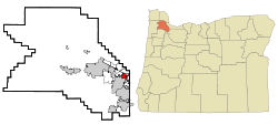
Geography
According to the United States Census Bureau, the neighborhood has a total area of 1.7 square miles (4.4km2), all land.
Education
West Sylvan Middle School is located in West Slope south of U.S. Route 26. In the public school district, most children will attend either Raleigh Park Elementary, Ridgewood Elementary, or William Walker Elementary schools. Tweens will mostly enter either Whitford Middle school or Cedar Park middle school. Teens will typically attend Beaverton high school. These schools are all a part of the Beaverton school district.
As of the census[4] of 2000, there were 6,442 people, 2,873 households, and 1,643 families residing in the neighborhood. The population density was 3,727.1 inhabitants per square mile (1,439.0/km2). There were 3,057 housing units at an average density of 1,768.7 per square mile (682.9/km2). The racial makeup of the neighborhood was 88.70% White, 4.30% Asian, 1.44% African American, 0.70% Native American, 0.16% Pacific Islander, 2.22% from other races, and 2.48% from two or more races. Hispanic or Latino of any race were 4.77% of the population.
There were 2,873 households, out of which 26.2% had children under the age of 18 living with them, 45.9% were married couples living together, 7.8% had a female householder with no husband present, and 42.8% were non-families. 32.1% of all households were made up of individuals, and 8.4% had someone living alone who was 65 years of age or older. The average household size was 2.22 and the average family size was 2.85.
In the neighborhood the population was spread out, with 21.2% under the age of 18, 8.5% from 18 to 24, 30.8% from 25 to 44, 25.9% from 45 to 64, and 13.6% who were 65 years of age or older. The median age was 39 years. For every 100 females, there were 95.8 males. For every 100 females age 18 and over, there were 95.8 males.
The median income for a household in the neighborhood was $50,984, and the median income for a family was $66,974. Males had a median income of $46,232 versus $35,890 for females. The per capita income for the neighborhood was $32,514. About 6.8% of families and 8.1% of the population were below the poverty line, including 10.1% of those under age 18 and 0.6% of those age 65 or over.
This page is based on this Wikipedia article Text is available under the CC BY-SA 4.0 license; additional terms may apply. Images, videos and audio are available under their respective licenses.