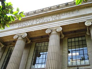
Washington County is one of 36 counties in the U.S. state of Oregon and part of the Portland metropolitan area. The 2020 census recorded the population as 600,372, making it the second most populous county in the state and most populous "Washington County" in the United States. Hillsboro is the county seat and largest city, while other major cities include Beaverton, Tigard, Cornelius, Banks, Gaston, Sherwood, North Plains, and Forest Grove, the county's oldest city. Originally named Twality when created in 1843, the Oregon Territorial Legislature renamed it for the nation's first president in 1849 and included the entire northwest corner of Oregon before new counties were created in 1854. The Tualatin River and its drainage basin lie almost entirely within the county, which shares its boundaries with the Tualatin Valley. It is bordered on the west and north by the Northern Oregon Coast Range, on the south by the Chehalem Mountains, and on the north and east by the Tualatin Mountains, or West Hills.
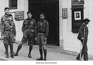
Scouting in Washington has a long history, from the 1910s to the present day, serving thousands of youth in programs that suit the environment in which they live.

Norwood is a village located in St. Lawrence County, New York, United States. As of the 2010 census, the village had a total population of 1,560. The village is located partly in two towns, Potsdam and of Norfolk, and located is east of the village of Potsdam.
The Territory of Oregon was an organized incorporated territory of the United States that existed from August 14, 1848, until February 14, 1859, when the southwestern portion of the territory was admitted to the Union as the State of Oregon. Originally claimed by several countries, the region was divided between the British Empire and the US in 1846. When established, the territory encompassed an area that included the current states of Oregon, Washington, and Idaho, as well as parts of Wyoming and Montana. The capital of the territory was first Oregon City, then Salem, followed briefly by Corvallis, then back to Salem, which became the state capital upon Oregon's admission to the Union.
The Territory of Washington was an organized incorporated territory of the United States that existed from March 2, 1853, until November 11, 1889, when the territory was admitted to the Union as the State of Washington. It was created from the portion of the Oregon Territory north of the lower Columbia River and north of the 46th parallel east of the Columbia. At its largest extent, it also included the entirety of modern Idaho and parts of Montana and Wyoming, before attaining its final boundaries in 1863.

The Willamette Stone was a small stone obelisk originally installed by the Department of Interior in 1885 in the western hills of Portland, Oregon in the United States to mark the intersection and origin of the Willamette meridian and Willamette baseline. It replaced a cedar stake placed by the Surveyor General of the Oregon Territory in 1851; this stake defined the grid system of sections and townships from which all real property in the states of Oregon and Washington has been measured following the Donation Land Claim Act of 1850. The Willamette meridian runs north–south, and the Willamette baseline runs east–west through the marker. The easternmost northeast corner of Washington County is sited on the marker.

The Portland metropolitan area is a metro area with its core in the U.S. states of Oregon and Washington. It has 5 principal cities the largest being Portland, Oregon. The U.S. Office of Management and Budget (OMB) identifies it as the Portland–Vancouver–Hillsboro, OR–WA Metropolitan Statistical Area, a metropolitan statistical area used by the United States Census Bureau (USCB) and other entities. The OMB defines the area as comprising Clackamas, Columbia, Multnomah, Washington, and Yamhill Counties in Oregon, and Clark and Skamania Counties in Washington. The area had a population of 2,512,859 at the 2020 census, an increase of over 12% since 2010.

Massachusetts's 9th congressional district is located in eastern Massachusetts. It is represented by Democrat William R. Keating. The 9th district is the least Democratic congressional district in Massachusetts, according to the Cook Partisan Voting Index.

Massachusetts's 11th congressional district is an obsolete congressional district in eastern Massachusetts. It was eliminated in 1993 after the 1990 U.S. census. Its last congressman was Brian Donnelly; its most notable were John Quincy Adams following his term as president, eventual president John F. Kennedy and Speaker of the House Tip O'Neill.
Modoc traditional narratives include myths, legends, tales, and oral histories preserved by the Modoc and Klamath people of northern California and southern Oregon.
Northern Paiute traditional narratives include myths, legends, tales, and oral histories preserved by the Northern Paiute people of the Great Basin deserts of western Nevada, eastern California, and southeastern Oregon in the United States of America.
Tolowa traditional narratives include myths, legends, tales, and oral histories preserved by the Tolowa people of Smith River area of northwestern California and southwestern Oregon.

The Umatilla National Forest, in the Blue Mountains of northeast Oregon and southeast Washington, covers an area of 1.4 million acres (5,700 km2). In descending order of land area the forest is located in parts of Umatilla, Grant, Columbia, Morrow, Wallowa, Union, Garfield, Asotin, Wheeler, and Walla Walla counties. More than three-quarters of the forest lies in the state of Oregon. Forest headquarters are located in Pendleton, Oregon. There are local ranger district offices in Heppner and Ukiah in Oregon, and in Pomeroy and Walla Walla in Washington.

The Willamette Valley is a 150-mile (240 km) long valley in Oregon, in the Pacific Northwest region of the United States. The Willamette River flows the entire length of the valley and is surrounded by mountains on three sides: the Cascade Range to the east, the Oregon Coast Range to the west, and the Calapooya Mountains to the south.

North Cove is an unincorporated community in Pacific County, Washington. North Cove is mostly residential, with some vacation rentals and a general store being the only commercial properties. The community suffers from the extreme coastal erosion of Cape Shoalwater, which has been diminished drastically in size, with the ocean claiming dozens of structures over the last 100 years and remaining a substantial threat.


