Rockcreek, Oregon

Last updated

Rockcreek, Oregon
Rock Creek Powerline Park.JPG
Rock Creek Powerline Park
Washington County Oregon Incorporated and Unincorporated areas Rockcreek Highlighted.svg
Location of Rockcreek, Oregon
Coordinates: 45°33′04″N122°52′30″W / 45.55111°N 122.87500°W / 45.55111; -122.87500
Country United States
State Oregon
County Washington
Area
[1]
  Total1.97 sq mi (5.09 km2)
  Land1.97 sq mi (5.09 km2)
  Water0.00 sq mi (0.00 km2)
Elevation
[2]
171 ft (52 m)
Population
 (2020) [3]
  Total9,862
  Density5,016.28/sq mi (1,936.31/km2)
Time zone UTC-8 (Pacific (PST))
  Summer (DST) UTC-7 (PDT)
ZIP code
97229
Area code(s) 503 and 971
FIPS code 41-63010 [4]
GNIS feature ID2409195 [2]

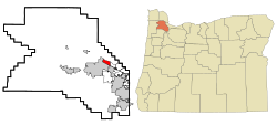
Rockcreek is a census-designated place in Washington County, Oregon, United States, north of U.S. Route 26. It is named for the Rock Creek neighborhood in the area. As of the 2010 census, the CDP population was 9,316. Named for Rock Creek, a tributary of the Tualatin River, that flows north to south through the neighborhood.

Contents

Geography

The community is bordered on the south and west by Hillsboro, with Cornelius Pass Road dividing the two on the west and the Sunset Highway as the dividing line on the south. According to the United States Census Bureau, the CDP has a total area of 2.0 square miles (5.2 km2), all land.

Government

An unincorporated community, Rockcreek does not have a municipal government. Government services are provided by a variety of regional districts.

Fire protection is provided by Tualatin Valley Fire & Rescue, Hillsboro Fire & Rescue, and Washington County Fire District 2. Law enforcement comes from the Washington County Sheriff. Rockcreek is within the Portland metropolitan area's regional government, Metro, while parks are provided by the Tualatin Hills Park & Recreation District. [5]

Lenox Elementary School Lenox Elementary School.JPG
Lenox Elementary School

Demographics

Historical population
CensusPop.Note
2020 9,862
U.S. Decennial Census [6] [3]

As of the census [4] of 2010, there were 9,316 people, 3,674 households, and 2,584 families residing in the CDP. The population density was 4,689.8 inhabitants per square mile (1,810.7/km2). There were 3,609 housing units at an average density of 1,799.8 per square mile (694.9/km2). The racial makeup of the CDP was 72.7% European American, 1.4% African American, 0.3% Native American, 19.1% Asian American, 0.2% Pacific Islander, 2.10% from other races, and 4.10% from two or more races. Hispanic or Latino of any race were 5.8% of the population.

There were 3,501 households, out of which 39.6% had children under the age of 18 living with them, 62.3% were married couples living together, 7.8% had a female householder with no husband present, and 26.9% were non-families. 20.3% of all households were made up of individuals, and 3.4% had someone living alone who was 65 years of age or older. The average household size was 2.69 and the average family size was 3.15.

In the CDP, the population was spread out, with 28.6% under the age of 18, 7.5% from 18 to 24, 31.5% from 25 to 44, 25.6% from 45 to 64, and 6.7% who were 65 years of age or older. The median age was 35 years. For every 100 females, there were 102.5 males. For every 100 females age 18 and over, there were 100.9 males.

The median income for a household in the CDP was $63,958, and the median income for a family was $71,377. Males had a median income of $51,257 versus $34,591 for females. The per capita income for the CDP was $30,102. About 4.2% of families and 6.5% of the population were below the poverty line, including 9.3% of those under age 18 and 2.0% of those age 65 or over.

Education

Most of Rockcreek is in the Beaverton School District while a portion is in the Hillsboro School District. [7]

Construction began on Liberty High School in 2001. [8]

Related Research Articles

<span class="mw-page-title-main">Washington County, Oregon</span> County in Oregon, United States

Washington County is one of 36 counties in the U.S. state of Oregon and part of the Portland metropolitan area. The 2020 census recorded the population as 600,372, making it the second most populous county in the state and most populous "Washington County" in the United States. Hillsboro is the county seat and largest city, while other major cities include Beaverton, Tigard, Cornelius, Banks, Gaston, Sherwood, North Plains, and Forest Grove, the county's oldest city. Originally named Twality when created in 1843, the Oregon Territorial Legislature renamed it for the nation's first president in 1849 and included the entire northwest corner of Oregon before new counties were created in 1854. The Tualatin River and its drainage basin lie almost entirely within the county, which shares its boundaries with the Tualatin Valley. It is bordered on the west and north by the Northern Oregon Coast Range, on the south by the Chehalem Mountains, and on the north and east by the Tualatin Mountains, or West Hills.

Hillsboro Pines is a census-designated place (CDP) in Broward County, Florida, United States. The population was 496 at the 2020 census.

Hillsboro Ranches was a census-designated place (CDP) in Broward County, Florida, United States in 2000. The population was 47 at the 2000 census. Hillsboro Ranches was not designated a CDP in the 2010 census. As of 2018, Hillsboro Ranches remains an unincorporated neighborhood, part of the Broward Municipal Services District, Northern County.

<span class="mw-page-title-main">Aloha, Oregon</span> Unincorporated community in the state of Oregon, United States

Aloha is a census-designated place and unincorporated community in Washington County, Oregon, United States. By road it is 10.9 miles (17.5 km) west of downtown Portland. As of the 2020 Census, the population was 53,828. Fire protection and EMS services are provided through Tualatin Valley Fire and Rescue and Metro West Ambulance.

<span class="mw-page-title-main">Cedar Hills, Oregon</span> Unincorporated community in the state of Oregon, United States

Cedar Hills is a census-designated place and neighborhood in Washington County, Oregon, United States south of U.S. Route 26 and west of Oregon Route 217 and within the Portland metropolitan area. Construction began in 1946.

<span class="mw-page-title-main">Cedar Mill, Oregon</span> Unincorporated community in the state of Oregon, United States

Cedar Mill is a suburb in the Portland, Oregon metropolitan area of the United States; it is a census-designated place and an unincorporated community in Washington County, north of U.S. Route 26 and west of the Willamette Stone. It received its name from a sawmill on Cedar Mill Creek, which cut Western Redcedars that were once the dominant tree in the area. The mill's pond was near the intersection of 119th and Cornell Road, and could still be seen into the 1960s, although the mill itself had ceased operating in 1891. The name was established in 1874 with the opening of a U.S. post office named Cedar Mill. As of the 2020 census, the community population was 17,259.

<span class="mw-page-title-main">Cornelius, Oregon</span> City in Oregon, United States

Cornelius is a city in Washington County, Oregon, United States. Located in the Portland metropolitan area, the city's population was 11,869 at the 2010 census. The city lies along Tualatin Valley Highway between Forest Grove to the west and Hillsboro to the east. Cornelius was incorporated in 1893 and is named for founder Thomas R. Cornelius.

<span class="mw-page-title-main">Durham, Oregon</span> City in Oregon, United States

Durham is a city in Washington County, Oregon, United States. Incorporated in 1966, the city is surrounded by Tigard and Tualatin and is adjacent to the Bridgeport Village shopping complex. The population was 1,351 at the 2010 census.

<span class="mw-page-title-main">Forest Grove, Oregon</span> City in Oregon, United States

Forest Grove is a city in Washington County, Oregon, United States, 25 miles (40 km) west of Portland. Originally a small farm town, it is now primarily a commuter town in the Portland metro area. Settled in the 1840s, the town was platted in 1850, then incorporated in 1872, making it the first city in Washington County. The population was 21,083 at the 2010 census, an increase of 19.1% over the 2000 figure (17,708).

<span class="mw-page-title-main">Garden Home–Whitford, Oregon</span> CDP in Oregon, United States

Garden Home-Whitford is a census-designated place (CDP) consisting of the neighborhoods of Garden Home and the smaller Whitford area in Washington County, Oregon, United States. They are located in the southwest hills of Portland, near Beaverton. As of the 2020 census, the CDP population was 7,081.

<span class="mw-page-title-main">Gaston, Oregon</span> City in Oregon, United States

Gaston is a city in Washington County, Oregon, United States. Located between Forest Grove to the north and Yamhill to the south, the city straddles Oregon Route 47 and borders the Tualatin River. Named after railroad executive Joseph Gaston, its population was 637 as of the 2010 census.

<span class="mw-page-title-main">Hillsboro, Oregon</span> City in Oregon, United States

Hillsboro is a city in the U.S. state of Oregon and is the county seat of Washington County. Situated in the Tualatin Valley on the west side of the Portland metropolitan area, the city hosts many high-technology companies, such as Intel, locally known as the Silicon Forest. The population was 106,447 at the 2020 census, making Hillsboro the 5th most populous city in Oregon.

<span class="mw-page-title-main">King City, Oregon</span> City in Oregon, United States

King City is a city in Washington County, Oregon, United States. Its name was picked by the Tualatin Development Company, Inc., which used a royalty theme in naming the city streets. The population was 5,184 at the 2020 census. Fire protection and EMS services are provided through Tualatin Valley Fire and Rescue.

<span class="mw-page-title-main">Metzger, Oregon</span> Unincorporated community in the state of Oregon, United States

Metzger is a census-designated place and unincorporated community, in Washington County, Oregon, United States. As of the 2010 census, the CDP population was 3,765. It is named for Herman Metzger, who platted the community. It is a suburb located within Portland, Oregon.

<span class="mw-page-title-main">Oak Hills, Oregon</span> Unincorporated community in the state of Oregon, United States

Oak Hills is a census-designated place (CDP) and neighborhood in Washington County, Oregon, United States. The CDP population was 11,903 at the 2020 census. It is on unincorporated land north of Beaverton, west of Cedar Mill, and south/southeast of Bethany. The CDP is roughly bounded by the Sunset Highway on the south, West Union Road on the north, Northwest 174th Avenue on the west, and Northwest 143rd Avenue on the east. The U.S. Postal Service has assigned Beaverton addresses to the area. Fire protection and EMS services are provided through Tualatin Valley Fire and Rescue.

<span class="mw-page-title-main">Raleigh Hills, Oregon</span> Unincorporated community in the state of Oregon, United States

Raleigh Hills is a census-designated place and neighborhood in Washington County, Oregon within the metropolitan area of Portland, Oregon, United States. It is located in the southwest hills in Washington County, with Beaverton to the west, West Slope to the north, and Progress and Garden Home to the south. As of the 2000 census, the census-designated place had a total population of 5,865.

<span class="mw-page-title-main">West Haven-Sylvan, Oregon</span> CDP in Oregon, United States

West Haven-Sylvan is a census-designated place (CDP) in Washington and Multnomah counties, Oregon, United States, north of U.S. Route 26. As of the 2020 census, the CDP population was 9,299.

<span class="mw-page-title-main">West Slope, Oregon</span> Unincorporated community in the state of Oregon, United States

West Slope is an unincorporated suburb of Portland, Oregon, United States and a census-designated place. It is in Washington County, to the west of Portland's West Hills neighborhood, to the northwest of Raleigh Hills and south of U.S. Route 26. Fire protection and EMS services are provided through Tualatin Valley Fire and Rescue.

<span class="mw-page-title-main">Graham, Washington</span> CDP in Washington, United States

Graham is a census-designated place (CDP) in Pierce County, Washington, United States. It is located 16.2 miles southeast of Tacoma. The population was 23,491 at the 2010 census and grew to 32,658 at the 2020 census.

<span class="mw-page-title-main">Tualatin, Oregon</span> City in Oregon, United States

Tualatin is a city located primarily in Washington County in the U.S. state of Oregon. A small portion of the city is also located in neighboring Clackamas County. It is a southwestern suburb in the Portland Metropolitan Area that is located south of Tigard. The population was 27,942 at the 2020 census.

References

  1. "ArcGIS REST Services Directory". United States Census Bureau. Retrieved October 12, 2022.
  2. 1 2 U.S. Geological Survey Geographic Names Information System: Rockcreek, Oregon
  3. 1 2 "Census Population API". United States Census Bureau. Retrieved October 12, 2022.
  4. 1 2 "U.S. Census website". United States Census Bureau . Retrieved January 31, 2008.
  5. Anderson, David R. (June 20, 2002). "District negotiates transfer of parks". The Oregonian. pp. B2.
  6. "Census of Population and Housing". Census.gov. Retrieved June 4, 2016.
  7. "2020 CENSUS - SCHOOL DISTRICT REFERENCE MAP: Washington County, OR" (PDF). U.S. Census Bureau . Retrieved March 24, 2024.
  8. Gunderson, Laura (November 8, 2001). "Liberty High boundary talks opening". The Oregonian. pp. B1. - From here