Cornelius Pass Road

Last updated

Cornelius Pass Road
Route information
Maintained by Washington County, ODOT
Length13 mi [1]  (21 km)
Component
highways
OR 127.svg OR 127 between US 26 and US 30
Major junctions
South endSE Deline Street in Hillsboro
Major intersections
North endUS 30.svg US 30 near Portland
Location
Country United States
State Oregon
Counties Washington, Multnomah
Highway system
OR 126.svg OR 126 OR 130.svg OR 130

Cornelius Pass Road is an arterial road in the Portland metropolitan area of Oregon, United States. The north-south road serves as an arterial connection between Burlington and Hillsboro. It intersects with several main roads throughout its route.

Contents

The road is almost 13 miles (21 km) long and connects to U.S. Route 30 (US 30) at its northern terminus and Southeast Kinnaman Street in Hillsboro at its southern terminus. The road is signed as Oregon Route 127 (OR 127) between U.S. Route 26 (US 26) and US 30, and named the Cornelius Pass Highway No. 127 (see Oregon highways and routes).

Route description

Cornelius Pass at Baseline Road in 2009 Cornelius Pass Road at Baseline 2.JPG
Cornelius Pass at Baseline Road in 2009

Cornelius Pass Road begins at an intersection with Southeast Deline Street in southern Hillsboro, just 1.3 miles south of the Tualatin Valley Highway (OR 8). It travels north across the bridge over Butternut Creek and Reed's Crossing towards a set of railroad tracks that are owned by PNWR and intersects OR 8 before continuing into Hillsboro's suburban neighborhoods. The street passes under a viaduct carrying light rail trains on the Blue Line near Quatama station near the Orenco Woods Nature Park. [2]

From the undercrossing, the highway travels through several business parks on the east side of Intel's main factory, connected by the intersecting Cornell Road and Evergreen Parkway. Cornelius Pass Road then reaches an interchange with U.S. Route 26 (the Sunset Highway) and turns northeast as it leaves Hillsboro. The highway winds its way around farms and forestland as it ascends into the Tualatin Mountains, reaching its highest point at Cornelius Pass, elevation 581 feet (177 m). [3] The narrow road then descends from the mountains along McCarthy Creek and approaches the Multnomah Channel of the Columbia River, terminating at an intersection with U.S. Route 30 northwest of Portland. [2]

Traffic volume on Cornelius Pass Road in Washington County
LocationVolume
201020142018
Near TV Highway16,29415,34717,000
Near Baseline Road18,20825,67428,435
Near Quatama Road24,33825,67431,910
Near Cornell Road26,54228,76138,762
Near Imbrie Drive38,86043,346no data
Near West Union Road17,94720,41726,156
Near Germantown Road8,1039,77716,431
  • Volume: Daily traffic (Tuesday, Wednesday, or Thursday)
  • Source: 2010 [4] 2014 [5] 2018 [6]

Cornelius Pass is one of only two main north–south connecting roads in Hillsboro. [7] The former country road handles 11,000 drivers each day and is an arterial route from the Tualatin Valley between Hillsboro to the Columbia River north of Portland. [8] A mountainous road at points, 1,500 of the 11,000 vehicles each day are tractor-trailers on the road designed to handle up to 10,000 vehicles per day. [9]

The section between US 26 and US 30 is signed as Oregon Route 127 (OR 127) and maintained by the Oregon Department of Transportation (ODOT). [10] A portion of the road, from US 26 to Cornell, is part of the National Highway System. [11]

History

The road was built by Thomas R. Cornelius in the 19th century. [12] The interchange with the Sunset Highway (US 26) was rebuilt and widened in 1989, and the road widened to five lanes from the freeway to Cornell Road the following year. [13] [14] In 1996, the road was extended southward when 216th and 219th avenues were renamed and became the southern section of the road, [15] terminating at Tualatin Valley Highway. At that time, the intersection with Baseline Road was re-aligned, [15] but most of the extension was simply a renaming of 216th Avenue. The intersection with US 26 was altered in 2005 with new on- and off-ramps extending from Cornelius Pass to the east, where a railroad overpass had previously been located. [16] [17] In 2008, the entire Multnomah County section was changed to a no-passing zone on the winding road over the Tualatin Mountains. [8]

Looking north on Cornelius Pass Road from Blanton Street, July 2018 End of Cornelius Pass Road in South Hillsboro - Oregon.jpg
Looking north on Cornelius Pass Road from Blanton Street, July 2018

A one-mile section from Lois to Wilkins streets closed for eight months in 2010 in order to widen the road in that area to five lanes as well as add bike lanes and sidewalks. [18] The $12 million project included a new 182-foot (55 m) bridge over Beaverton Creek. [19] The county hoped to widen the remaining portion of the road to five lanes between Walbridge/Aloclek and Wilkins. [20] Announced in 2011, the expected cost was $10.1 million and would include a new bridge over Rock Creek. [20] Construction closed the section for six months, with the new bridge opening on December 31, 2012; at that time, the remaining widening was expected to continue until the middle of 2013. [21]

Hillsboro also began preliminary work in 2011 to extend Cornelius Pass south of Tualatin Valley Highway to prepare for the development of South Hillsboro. [22] The Oregon Legislature approved $9.5 million in 2012 to fund safety improvements such as guardrails. [23] Hillsboro also announced plans in 2012 to widen the road to seven lanes between Cornell and US 26. [24] The widening project was completed in March 2017 at a total cost of $18.3 million. [25]

Construction began in 2016 on the extension of Cornelius Pass Road south of Tualatin Valley Highway. The extension, approximately one-third mile (540 m) long, was opened to traffic in July 2018. [26] The new section crosses Portland & Western Railroad tracks and takes Cornelius Pass Road into the under-construction South Hillsboro area. [26]

In July 2019, a five-mile (8.0 km) stretch of Cornelius Pass Road between US 30 and NW Germantown Road began an 11-week closure. This stretch of road had experienced a high rate of crashes in preceding years, and Multnomah County closed the road so that safety improvements could be carried out, including curve realignment and widening of shoulders. [27] [28] [29]

Work continued on an extension of the road to a newly-built intersection with Kinnaman Road through 2021. [30]

Southern terminus of OR 127 Southern terminus of Oregon Route 127.jpg
Southern terminus of OR 127

The section of the road between US 26 and US 30 was transferred to the Oregon Department of Transportation on March 1, 2021, becoming Oregon Route 127. [10] The transfer had been approved by the state legislature in 2017. [31]

A $29.5 million project started in March 2022 and expected to complete in December 2023 widened the road to 5 lanes between Francis and Tualatin Valley Highway from three lanes, alongside installing a 45-inch drinking water pipeline beneath the road. [32] [33]

On February 16, 2021, the Washington County Board of Commissioners approved the reallocation of $8 million, previously reserved for a bridge replacement project on nearby Century Blvd, to partially fund the construction of a 5-lane bridge carrying Cornelius Pass over Butternut Creek. [34] [35] This $14.1 million project further extends the road south from its current terminus and allows further extensions southward toward Farmington Road to proceed. Construction on the single-span concrete bridge commenced in April 2023 and is expected to finish in June 2024. [36] A pedestrian bridge is to be suspended underneath. [37]

Major intersections

CountyLocationmi [2] kmDestinationsNotes
Washington Hillsboro 0.00.0Southeast Deline StreetRoad starts at Butternut Creek community.
0.71.1Southeast Kinnaman StreetRoad starts at Reed's Crossing.
1.42.3OR 8.svg OR 8 (TV Highway)
2.94.7 Cornell Road
4.06.4US 26.svg US 26  Seaside, Portland Interchange; southern terminus of OR 127
Multnomah 13.020.9US 30.svg US 30 (St. Helens Road) Scappoose, St. Helens, Portland Northern terminus of OR 127
1.000 mi = 1.609 km; 1.000 km = 0.621 mi

See also

Related Research Articles

<span class="mw-page-title-main">Washington County, Oregon</span> County in Oregon, United States

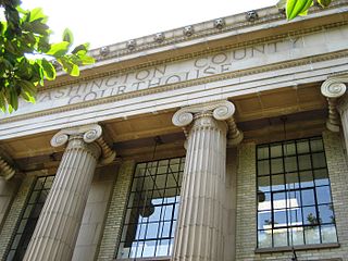
Washington County is one of 36 counties in the U.S. state of Oregon and part of the Portland metropolitan area. The 2020 census recorded the population as 600,372, making it the second most populous county in the state and most populous "Washington County" in the United States. Hillsboro is the county seat and largest city, while other major cities include Beaverton, Tigard, Cornelius, Banks, Gaston, Sherwood, North Plains, and Forest Grove, the county's oldest city. Originally named Twality when created in 1843, the Oregon Territorial Legislature renamed it for the nation's first president in 1849 and included the entire northwest corner of Oregon before new counties were created in 1854. The Tualatin River and its drainage basin lie almost entirely within the county, which shares its boundaries with the Tualatin Valley. It is bordered on the west and north by the Northern Oregon Coast Range, on the south by the Chehalem Mountains, and on the north and east by the Tualatin Mountains, or West Hills.

<span class="mw-page-title-main">Hillsboro, Oregon</span> City in Oregon, United States

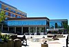
Hillsboro is a city in the U.S. state of Oregon and is the county seat of Washington County. Situated in the Tualatin Valley on the west side of the Portland metropolitan area, the city hosts many high-technology companies, such as Intel, locally known as the Silicon Forest. The population was 106,447 at the 2020 census, making Hillsboro the fifth-most populous city in Oregon.

<span class="mw-page-title-main">Historic Columbia River Highway</span> Highway in Oregon, USA

The Historic Columbia River Highway is an approximately 75-mile-long (121 km) scenic highway in the U.S. state of Oregon between Troutdale and The Dalles, built through the Columbia River Gorge between 1913 and 1922. As the first planned scenic roadway in the United States, it has been recognized in numerous ways, including being listed on the National Register of Historic Places, being designated as a National Historic Landmark by the U.S. Secretary of the Interior, being designated as a National Historic Civil Engineering Landmark by the American Society of Civil Engineers, and being considered a "destination unto itself" as an All-American Road by the U.S. Secretary of Transportation. The historic roadway was bypassed by the present Columbia River Highway No. 2 from the 1930s to the 1950s, leaving behind the old two-lane road. The road is now mostly owned and maintained by the state through the Oregon Department of Transportation as the Historic Columbia River Highway No. 100 or the Oregon Parks and Recreation Department as the Historic Columbia River Highway State Trail.

<span class="mw-page-title-main">Tualatin River</span> River in Oregon, United States

The Tualatin River is a tributary of the Willamette River in Oregon in the United States. The river is about 83 miles (134 km) long, and it drains a fertile farming region called the Tualatin Valley southwest and west of Portland at the northwest corner of the Willamette Valley. There are approximately 500,000 people residing on 15 percent of the land in the river's watershed.

<span class="mw-page-title-main">Portland metropolitan area, Oregon</span> Metropolitan statistical area in the US

The Portland metropolitan area is a metro area with its core in the U.S. states of Oregon and Washington. It has 5 principal cities the largest being Portland, Oregon. The U.S. Office of Management and Budget (OMB) identifies it as the Portland–Vancouver–Hillsboro, OR–WA Metropolitan Statistical Area, a metropolitan statistical area used by the United States Census Bureau (USCB) and other entities. The OMB defines the area as comprising Clackamas, Columbia, Multnomah, Washington, and Yamhill Counties in Oregon, and Clark and Skamania Counties in Washington. The area had a population of 2,512,859 at the 2020 census, an increase of over 12% since 2010.

<span class="mw-page-title-main">Oregon Route 8</span> Highway in Oregon

Oregon Route 8, also known as Oregon Highway 8, is an Oregon state highway which serves the western suburbs of Portland. The road is locally known as Canyon Road and Tualatin Valley Highway, and travels through the center of the Tualatin Valley. Oregon 8 is located entirely within Washington County. The portion of the route from US 26 to Oregon Route 47 is part of the National Highway System, listed as a principal arterial.

<span class="mw-page-title-main">Oregon Route 217</span> Freeway in the Portland, OR, metro area


Oregon Route 217 (OR 217), also known as the Beaverton-Tigard Highway No. 144, is a north-south controlled-access state highway in Washington County, Oregon. The route travels along the west suburbs of Portland, starting at US Route 26 (US 26) in Beaverton and ending at Interstate 5 (I-5) in Tigard.

<span class="mw-page-title-main">Interstate 205 (Oregon–Washington)</span> Interstate Highway in Oregon and Washington

Interstate 205 (I-205) is an auxiliary Interstate Highway in the Portland metropolitan area of Oregon and Washington, United States. The north–south freeway serves as a bypass route of I-5 along the east side of Portland, Oregon, and Vancouver, Washington. It intersects several major highways and serves Portland International Airport.

<span class="mw-page-title-main">MAX Blue Line</span> Light rail line in Portland, Oregon

The MAX Blue Line is a light rail line serving the Portland metropolitan area in the U.S. state of Oregon. Operated by TriMet as part of the MAX Light Rail system, it connects Hillsboro, Beaverton, Portland, and Gresham. The Blue Line is the longest in the network; it travels approximately 33 miles (53 km) and serves 48 stations from Hatfield Government Center to Cleveland Avenue. It is the busiest of the five MAX lines, having carried an average 55,370 riders each day on weekdays in September 2018. Service runs for 2212 hours per day from Monday to Thursday, with headways of between 30 minutes off-peak and five minutes during rush hour. It runs later in the evening on Fridays and Saturdays and ends earlier on Sundays.

<span class="mw-page-title-main">Oregon Route 210</span> Highway in Oregon

Oregon Route 210 is a state highway which runs between the community of Scholls, Oregon and the Raleigh Hills neighborhood west of Portland, terminating at the Sylvan overpass on Highway 26. It has become an important route for both commuters and agriculture through Washington County. Oregon Route 210 is signed from east-to-west; though in actuality it runs in a northeast-to-southwest direction.

<span class="mw-page-title-main">Oregon Route 219</span> Highway in Oregon

Oregon Route 219 is an Oregon state highway which runs between the cities of Hillsboro and Woodburn, Oregon, in the United States. The Hillsboro-Silverton Highway continues further south to Silverton, signed as OR 214. The highway mainly serves local residents and agricultural traffic, despite its proximity to the Portland area it lies outside the Portland Urban Growth Boundary, and maintains its character as a country road.

<span class="mw-page-title-main">Oregon Route 43</span> Highway in Oregon

Oregon Route 43 is an Oregon state highway that runs between the cities of Oregon City and Portland, mostly along the western flank of the Willamette River. While it is technically known by the Oregon Department of Transportation as the Oswego Highway No. 3, on maps it is referred to by its route number or by the various street names it has been given.

The Tualatin Valley Highway No. 29 is an Oregon highway which passes through the Tualatin Valley, between the cities of McMinnville and Beaverton. Between McMinnville and Forest Grove, the highway is signed as Oregon Route 47; between Forest Grove and Beaverton it is signed as Oregon Route 8. Oregon 8 becomes Canyon Road in Beaverton east of Hocken Road.

<span class="mw-page-title-main">Reedville, Oregon</span> Unincorporated community in the state of Oregon, United States

Reedville is an unincorporated community in Washington County, Oregon, United States, located between Hillsboro and Aloha. Oregon Route 8 runs through the area. The community is served by the Hillsboro School District, with some portions of the area within the city limits of Hillsboro.

<span class="mw-page-title-main">Interstate 5 in Oregon</span> Interstate highway in Oregon

Interstate 5 (I-5) in the U.S. state of Oregon is a major Interstate Highway that traverses the state from north to south. It travels to the west of the Cascade Mountains, connecting Portland to Salem, Eugene, Medford, and other major cities in the Willamette Valley and across the northern Siskiyou Mountains. The highway runs 308 miles (496 km) from the California state line near Ashland to the Washington state line in northern Portland, forming the central part of Interstate 5's route between Mexico and Canada.

<span class="mw-page-title-main">Interstate 84 in Oregon</span> Interstate highway in Oregon

Interstate 84 (I-84) in the U.S. state of Oregon is a major Interstate Highway that traverses the state from west to east. It is concurrent with U.S. Route 30 (US 30) for most of its length and runs 376 miles (605 km) from an interchange with I-5 in Portland to the Idaho state line near Ontario. The highway roughly follows the Columbia River and historic Oregon Trail in northeastern Oregon, and is designated as part of Columbia River Highway No. 2 and all of the Old Oregon Trail Highway No. 6; the entire length is also designated as the Vietnam Veterans Memorial Highway. I-84 intersects several of the state's main north–south roads, including US 97, US 197, I-82, and US 395.

<span class="mw-page-title-main">West Union, Oregon</span> Unincorporated community in the state of Oregon, United States

West Union is an unincorporated community in Washington County, Oregon, United States. Founded in 1851, the community had the first school district in the county; it also contains the oldest cemetery in the state and the oldest Baptist church west of the Rocky Mountains. It is located north of Hillsboro near the intersection of West Union Road and Cornelius Pass Road north of the Sunset Highway. The name comes from a grove of five oak trees that was used as a meeting place of early settlers, or the "union of the west." West Union had a post office from 1874 to 1894.

<span class="mw-page-title-main">U.S. Route 26 in Oregon</span> Section of U.S. Highway in Oregon, United States

U.S. Route 26 (US 26) is a major cross-state United States Numbered Highway with its western terminus in the U.S. state of Oregon, connecting US 101 on the Oregon Coast near Seaside with the Idaho state line east of Nyssa. Local highway names include the Sunset Highway No. 47, Mount Hood Highway No. 26, and John Day Highway No. 5 before continuing into Idaho and beyond.

<span class="mw-page-title-main">Washington County Fire District 2</span>

Washington County Fire District 2 (WCFD2) was a special-purpose government fire fighting and emergency services district in Washington County on the west side of the Portland metropolitan area of Oregon. Established in 1952, it primarily provided fire and emergency medical services in the central portion of the county surrounding Hillsboro, including the city of North Plains. The District had two fire stations when it was absorbed by Tualatin Valley Fire and Rescue in 2017.

<span class="mw-page-title-main">Cornell Road</span> Street in Portland and Washington County, Oregon, United States

Cornell Road is an east–west street and traffic corridor in the Portland metropolitan area, in Multnomah and Washington counties in the U.S. state of Oregon. It crosses the Tualatin Mountains between the Willamette Valley and the city of Portland on the east and the Tualatin Valley and the city of Hillsboro on the west.

References

  1. This map was generated by OpenStreetMap contributors using GPS data, and other 'free' sources. (see )
    • In data : OSM mapping is licensed under the Open Database Licence and Database Contents Licence
    • In tiles:
  2. 1 2 3 "Cornelius Pass Road" (Map). Google Maps . Google. April 30, 2021. Retrieved April 30, 2021.
  3. "Cornelius Pass". Geographic Names Information System . United States Geological Survey, United States Department of the Interior . Retrieved August 8, 2018.
  4. "2010 Washington County Traffic Volume Table" (PDF). Washington County Department of Land Use and Transportation. April 2010. Retrieved January 3, 2021.
  5. "2010 Washington County Traffic Volume Table" (PDF). Washington County Department of Land Use and Transportation. 2014. Retrieved January 3, 2021.
  6. "2010 Washington County Traffic Volume Table" (PDF). Washington County Department of Land Use and Transportation. 2018. Retrieved January 3, 2021.
  7. Bermudez, Esmeralda (February 23, 2006). "Hillsboro seeks money for new north–south road". The Oregonian .[ page needed ]
  8. 1 2 Malkin, Whitney (April 12, 2008). "Family hopes to keep road from claiming another life". The Oregonian.[ page needed ]
  9. Starke, Amy Martinez (January 26, 2008). "Family wants more than roadside marker". The Oregonian.[ page needed ]
  10. 1 2 "Cornelius Pass Road Jurisdictional Transfer Complete". Oregon Department of Transportation. March 2021. Retrieved March 1, 2021.
  11. Oregon Department of Transportation. Oregon Transportation Map: Washington County (PDF) (Map). Salem: Oregon Department of Transportation. Retrieved June 3, 2008.
  12. Baron, Connie; Trappen, Michelle (March 6, 2008). "Paths linking past and present". The Oregonian. Archived from the original on August 8, 2019. Retrieved August 8, 2019.
  13. "Sunset lanes to close". The Oregonian. July 11, 1989.[ page needed ]
  14. "Road projects prompt county to ask state aid". The Oregonian. April 2, 1989.[ page needed ]
  15. 1 2 Hamilton, Don (June 6, 1996). "Road work ahead". The Oregonian.[ page needed ]
  16. "US 26 Work Continues". The Oregonian. January 10, 2005.[ page needed ]
  17. Anderson, David R. (February 20, 2003). "Help in sight for Sunset interchange". The Oregonian.[ page needed ]
  18. Parks, Casey (January 19, 2010). "Hillsboro section of Cornelius Pass Road will close for eight months, $12 million in improvements". The Oregonian. Archived from the original on June 8, 2011. Retrieved August 8, 2019.
  19. Eckert, Kurt (December 7, 2010). "New Cornelius Pass Road set to ring in a New Year". The Hillsboro Argus. Archived from the original on August 8, 2019. Retrieved August 8, 2019.
  20. 1 2 Eckert, Kurt (September 27, 2011). "County looks to finish Corn Pass with existing road funds". The Hillsboro Argus. Archived from the original on August 8, 2019. Retrieved March 9, 2012.
  21. Driessen, Katherine (December 31, 2012). "Cornelius Pass Road between Quatama Road and Cherry Drive in Hillsboro to reopen Monday evening". The Oregonian. Archived from the original on August 8, 2019. Retrieved August 8, 2019.
  22. Parks, Casey (July 26, 2011). "Hillsboro will begin work on Cornelius Pass Road expansion". The Oregonian. Archived from the original on October 26, 2013. Retrieved August 8, 2019.
  23. Theen, Andrew (May 18, 2012). "Scappoose family turns grief into political action, secures state money to improve dangerous road". The Oregonian. Retrieved May 23, 2012.
  24. Theen, Andrew (September 25, 2012). "Hillsboro planning commission seeks public comment on future road projects". The Oregonian. Retrieved January 3, 2013.
  25. Howard, John William (November 16, 2017). "Cornelius Pass Road project wins award". Hillsboro Tribune . Archived from the original on December 1, 2017. Retrieved November 18, 2017.
  26. 1 2 Pursinger, Geoff (July 12, 2018). "Cornelius Pass Road extension offers glimpse of South Hillsboro". Hillsboro Tribune . Archived from the original on August 7, 2018. Retrieved August 7, 2018.
  27. Del Savio, Anna (July 26, 2019). "Commuters deal with Cornelius Pass Road closure". Portland Tribune . Retrieved August 9, 2019.
  28. Theen, Andrew (July 30, 2019). "Lengthy Cornelius Pass closure gets off to rocky start with at least two 'significant' crashes, detour changes". OregonLive . Retrieved August 9, 2019.
  29. "Cornelius Pass Road Safety Improvements". Multnomah County. Retrieved August 9, 2019.
  30. "South Hillsboro | City of Hillsboro, OR". www.hillsboro-oregon.gov. City of Hillsboro. Archived from the original on March 16, 2021. Retrieved April 30, 2021.
  31. McGinness, Chris (March 2, 2021). "A steep, curvy road prone to crashes in the West Hills is now ODOT's problem". KGW. Retrieved March 2, 2021.
  32. "Ribbon cuttings celebrate three Washington County transportation projects". Washington County. Archived from the original on January 4, 2024. Retrieved January 3, 2024.
  33. "Cornelius Pass Road (Frances to TV Hwy)". Washington County. Archived from the original on May 1, 2021. Retrieved April 30, 2021.
  34. "Washington County Board of Commissioners Minutes Tuesday February 16, 2021" (PDF). Washington County. Archived (PDF) from the original on May 1, 2021.
  35. Washington County (February 16, 2021). "Washington County Board of Commissioners" (PDF). p. 57. Archived (PDF) from the original on May 1, 2021. Retrieved April 30, 2021.
  36. Dorsey, Hilary. "Bridge construction poised to begin in Hillsboro". DJC Oregon. BridgeTower Media. Archived from the original on January 4, 2024. Retrieved January 3, 2024.
  37. Bishop, Lauren (November 22, 2023). "Gargantuan girders: Work trucking along on new Cornelius Pass Road bridge". Hillsboro News Times. Archived from the original on January 4, 2024. Retrieved January 3, 2024.