Tubrid

Last updated

Tubrid
Tiobraid
Civil parish
Ruins at Tubrid, County Tipperary June 2010.jpg
View of two church ruins at Tubrid.
Ireland adm location map.svg
Red pog.svg
Tubrid
Location in Ireland
Coordinates: 52°18′54″N7°57′00″W / 52.315°N 7.95°W / 52.315; -7.95
Country Ireland
Province Munster
County County Tipperary
Time zone UTC+0 (WET)
  Summer (DST) UTC-1 (IST (WEST))

Tubrid or Tubbrid (Irish : Tiobraid) [1] is a civil and former ecclesiastical parish situated between the towns of Cahir and Clogheen in County Tipperary, Ireland. A cluster of architectural remains at the old settlement still known as Tubrid includes an ancient cemetery and two ruined churches of regional historical significance.

Contents

Location

Tubrid is located about 4 kilometres (2.5 mi) from the village of Ballylooby, adjacent to an old stone bridge near Burgess. In 1841, the mail-road between Cork and Dublin via Cahir still passed through the village. [2]

Tubrid Mortuary Chapel

The Mortuary Chapel at Tubrid, reportedly built in 1644, [3] in what is now the modern Catholic parish of Ballylooby, is long roofless. The structure shows some evidence of restoration work, notably steel tie-rods securing the gable walls. This work was carried out in 1911-12, due mainly to the efforts of the historian Fr. Patrick Power. [4]

It is of particular historical significance as the burial site of many Counter-Reformation ecclesiastics including John Brenan Archbishop of Cashel, Eugene Duhy (O'Duffy) and most notably Geoffrey Keating. [5]

Over the entrance door to the chapel is a Latin inscription which translates into English as : [6] [7]

Pray for the souls of Father Eugenius Duhy, Vicar of Tybrud,
and of Geoffrey Keating, D.D., Founders of this Chapel ; and also
for all others, both Priests and Laics whose bodies lie in the same
chapel. In the year of our Lord 1644.

St. John's, Tubrid

Memorial commissioned by both denominations to Dr. Valentine Flood, who died of Typhus contracted in the Tubrid 'fever sheds' during the Great Famine. Headstone to Valentine Flood, Church of Ireland cemetery, Tubrid, County Tipperary, Ireland.jpg
Memorial commissioned by both denominations to Dr. Valentine Flood, who died of Typhus contracted in the Tubrid 'fever sheds' during the Great Famine.

On the same site is the considerably larger 19th-century Protestant church, also now roofless and in a deteriorating condition. Completed in 1820, it functioned as the place of worship for the local Church of Ireland community until 1919, when it was abandoned. [8]

The Catholic community eventually built a new church some 2.5k to the north-west, adjacent to which developed the village of Ballylooby.

Sites of local interest

St. Ciaran's Well

According to Power, the parish derives its name from the well (Irish Tobraid Chiaráin) at which St. Declan baptised a local infant named Ciaran, who in time became a noted holy figure. [9] It was said of Ciarán (Ciaran Mac Eochaidh) that he founded a monastery in the locality and that:

He worked many miracles and holy signs and this is the name of his monastery Tiprut [Tubrid] and this is where it is:--in the western part of the Decies in Ui Faithe between Slieve Grot (Galtee) and Sieve Cua and it is within the bishopric of Declan. [10]

This holy well near the site, was in previous times a place of pilgrimage. St. Ciaran is remembered in the name of the church at Ballylooby. There was also, until recent times, an annual mass celebrated at this location.

Old Protestant Schoolhouse

To the front of the site is the former local schoolhouse which was completed soon after the construction of St. John's and is in danger of falling into a dilapidated condition. [11]

Geoffrey Keating Monument

A commemorative monument was erected to the memory of Geoffrey Keating by the local community in 1990 beside the bridge at nearby Burgess, formerly believed to be his birthplace. Modern scholarship regards Moorstown Castle in the parish of Inishlounaght, Tipperary, as his probable birthplace. [12]

Roosca Castle

The remains of Roosca (Ruscoe) castle may still be seen nearby. [13] Its occupant during the 1641 Rebellion, James Butler, was hanged at Clonmel on 10 May 1653, in retaliation for attacks by his followers on Golden [14] and his household transplanted to Connaught. [15]

Related Research Articles

<span class="mw-page-title-main">County Tipperary</span> County in Ireland

County Tipperary is a county in Ireland. It is in the province of Munster and the Southern Region. The county is named after the town of Tipperary, and was established in the early 13th century, shortly after the Norman invasion of Ireland. It is Ireland's largest inland county and shares a border with eight counties, more than any other. The population of the county was 167,895 at the 2022 census. The largest towns are Clonmel, Nenagh and Thurles.

<span class="mw-page-title-main">Cahir</span> Town in County Tipperary, Ireland

Cahir is a town in County Tipperary in Ireland. It is also a civil parish in the barony of Iffa and Offa West.

<span class="mw-page-title-main">South Tipperary</span> Former Irish county (1899–2014)

South Tipperary was a county in Ireland in the province of Munster. It was named after the town of Tipperary and consisted of 52% of the land area of the traditional county of Tipperary. South Tipperary County Council was the local authority for the county. The population of the county was 88,433 according to the 2011 census. It was abolished on 1 June 2014, and amalgamated with North Tipperary to form County Tipperary under a new Tipperary County Council.

<span class="mw-page-title-main">Cashel, County Tipperary</span> Town in County Tipperary, Ireland

Cashel is a town in County Tipperary in Ireland. Its population was 4,422 in the 2016 census. The town gives its name to the ecclesiastical province of Cashel. Additionally, the cathedra of the Roman Catholic Archdiocese of Cashel and Emly was originally in the town prior to the English Reformation. It is part of the parish of Cashel and Rosegreen in the same archdiocese. One of the six cathedrals of the Anglican Bishop of Cashel and Ossory, who currently resides in Kilkenny, is located in the town. It is in the civil parish of St. Patricksrock which is in the historical barony of Middle Third.
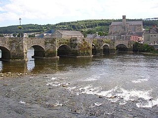
<span class="mw-page-title-main">Carrick-on-Suir</span> Town in County Tipperary, Ireland

Carrick-on-Suir is a town in County Tipperary, Ireland. It lies on both banks of the River Suir. The part on the north bank of the Suir lies in the civil parish of "Carrick", in the historical barony of Iffa and Offa East. The part on the south bank lies in the civil parish of Kilmolerin in the barony of Upperthird, County Waterford.

Geoffrey Keating was an Irish historian. He was born in County Tipperary, Ireland, and is buried in Tubrid Graveyard in the parish of Ballylooby-Duhill. He became a Catholic priest and a poet.

<span class="mw-page-title-main">Synod of Ráth Breasail</span> Irish Catholic synod in 1111

The Synod of Ráth Breasail was a synod of the Catholic Church in Ireland that took place in Ireland in 1111. It marked the transition of the Irish church from a monastic to a diocesan and parish-based church. Many present-day Irish dioceses trace their boundaries to decisions made at the synod.
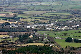
<span class="mw-page-title-main">Clogheen, County Tipperary</span> Village in Munster, Ireland

Clogheen is a village in County Tipperary, Ireland. The census of 2016 recorded the population at 478 people.

<span class="mw-page-title-main">Bansha</span> Village in Munster, Ireland

Bansha is a village in County Tipperary in Ireland. The village is part of the parish of "Bansha and Kilmoyler" in the Roman Catholic Archdiocese of Cashel and Emly. It is in the historical barony of Clanwilliam. Bansha is co-extensive with the pre-Reformation parish of Templeneiry of which the townland name of Templenahurney is thought to be a corruption. While the village is the focal point of the area, there is also an outlying hamlet in the parish, located at Rossadrehid where a rural creamery once serviced the dairy industry.

<span class="mw-page-title-main">Ballylooby</span> Village in County Tipperary, Ireland

Ballylooby is a village in County Tipperary in Ireland. It is in the barony of Iffa and Offa West, and is also a parish in the Roman Catholic Diocese of Waterford and Lismore.

<span class="mw-page-title-main">R639 road (Ireland)</span> Road in Ireland

The R639 road is one of Ireland's regional roads. Once designated the N8 national primary road, it was reclassified in stages as the R639 following the progressive opening of sections of the M8 motorway, which rendered the single carriageway N8 redundant as a national primary road. By-passed sections of the old N8 were generally reclassified as R639 as soon as a new section of M8 opened, thereby increasing the length of the R639. With the completion of the M8 on 28 May 2010, the R639 now stretches from Durrow, County Laois to Cork, running through counties Laois, Kilkenny, Tipperary, Limerick and Cork.

<span class="mw-page-title-main">Kilsheelan</span> Village in County Tipperary, Ireland

Kilsheelan is a village and civil parish within the barony of Iffa and Offa East in County Tipperary, Ireland. A part of the civil parish is in neighbouring County Waterford. It is also one half of the Roman Catholic parish of Kilsheelan & Kilcash in the Roman Catholic Diocese of Waterford and Lismore.
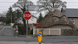
<span class="mw-page-title-main">R668 road (Ireland)</span> Road in Ireland

The R668 road is a regional road in Ireland from Lismore, County Waterford to Cahir in County Tipperary, through Clogheen and Ballylooby. The Lismore–Clogheen section is a scenic route through the Vee Gap in the Knockmealdown Mountains, between Sugarloaf Hill and Knockshanahullion.
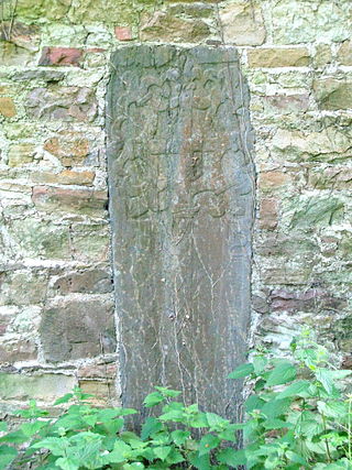
<span class="mw-page-title-main">Inislounaght Abbey</span> 12th-century Cistercian settlement in Ireland

Inislounaght Abbey, also referred to as Innislounaght, Inislounacht and De Surio, was a 12th-century Cistercian settlement on the river Suir, near Clonmel in County Tipperary, Ireland. It was originally dedicated to the Blessed Virgin.

Iffa and Offa West is a barony in County Tipperary, Ireland. This geographical unit of land is one of 12 baronies in County Tipperary. Its chief town is Cahir. The barony lies between Clanwilliam to the north-west, Middle Third to the north-east and Iffa and Offa East to the east. The area is currently administered by Tipperary County Council. The barony is within the geographic remit of the Roman Catholic Diocese of Waterford and Lismore.
<span class="mw-page-title-main">Knockgraffon</span> Civil parish in County Tipperary, Ireland

Knockgraffon is a townland in the civil parish of the same name in County Tipperary, Ireland. The civil parish lies in the barony of Middle Third. The townland is around 5 km north of Cahir. It is also part of the ecclesiastical parish of New Inn & Knockgraffon in the Roman Catholic Archdiocese of Cashel and Emly. Interesting features include a fine motte, a church and a castle.

<span class="mw-page-title-main">Ballymacarbry</span> Village in County Waterford, Ireland

Ballymacarbry or Ballymacarberry is a village in County Waterford, Ireland with an approximate population of 140 people. It is situated on the R671 regional road, approximately 17 km from Clonmel and 24 km from Dungarvan. The local Gaelic games club is The Nire–Fourmilewater.

<span class="mw-page-title-main">Burncourt</span> Village in Munster, Ireland

Burncourt is a village in County Tipperary, Ireland with an approximate population of 138 people.

<span class="mw-page-title-main">Moorstown Castle</span> Tower house and bawn in County Tipperary, Ireland

Moorstown Castle is a late 15th-century stone structure consisting of an enclosed circular keep near Clonmel, County Tipperary, Ireland.

Tybroughney, statutory spelling Tibberaghny, is a civil parish in the barony of Iverk, County Kilkenny in Ireland. The parish comprises a single townland, also called Tibberaghny. It lies on the north bank of the River Suir facing County Waterford, while the Lingaun river separates it from County Tipperary to the west.

References

  1. "Tiobraid/Tubbrid". Placenames Database of Ireland . Retrieved 23 August 2024.
  2. The Parliamentary Gazetteer of Ireland...'as Existing in 1814-45'. A. Fullarton and co. 1846. Retrieved 21 June 2009.p407
  3. O'Reilly, Edward; A O'Neil (1820). Transactions of the Iberno-Celtic Society for 1820. Vol. I-Part. I. Minerva Printing-Office, Chancery-Lane: Iberno-Celtic Society. p. cxciii.
  4. "Notes and Queries - Dr. Geoffrey Keating Memorial" (PDF). Journal of the Waterford and South-East of Ireland Archaeological Society. XV: 158–160, 200. 1912. Retrieved 22 June 2009.
  5. Hazard, Benjamin; Bernadette Cunningham (February 2003). "Life and Work of Geoffrey Keating (Seathrún Céitinn)". Corpus of Electronic Texts (UCC) 1997–2009. Retrieved 22 June 2009.
  6. Power, P. :Waterford and Lismore-A Compendious History of the United Dioceses: Cork University Press, Cork, Ireland: 1937
  7. p14: Cunningham, B.: The World of Geoffrey Keating- History, Myth and Tradition in Seventeenth-Century Ireland Four Courts Press, Dublin : 2004
  8. Saint John's Church, Tipperary South. National Inventory of Architectural Heritage. Retrieved on 6 August 2009.
  9. Power, Patrick (1907). The place-names of Decies. London: David Nutt.p345
  10. Power, P. "Life of St. Declan of Ardmore". Fullbooks.com. par. 37. Retrieved 22 June 2009.
  11. "Tubbrid School, TUBBRID, Tubbrid, TIPPERARY SOUTH - Buildings of Ireland".
  12. "A review of some placename material from Foras Feasa ar Éireann", Diarmuid Ó Murchadha, Éigse, A Journal of Irish Studies, Vol. XXXV, page 81. National University of Ireland, 2005.
  13. Lewis, Samuel (1837). A Topographical Dictionary of Ireland . Retrieved 22 June 2009.
  14. Butler, David J. (2005). South Tipperary, 1570-1841: religion, land and rivalry. Four Courts Press. p. 88. ISBN   978-1-85182-891-3 . Retrieved 22 June 2009.
  15. . Burke, William P (1907). History of Clonmel. N. Harvey & co. for Clonmel Library Committee. p. 86.