
Turnpike Lane is a street in Haringey, north London.

Turnpike Lane is a street in Haringey, north London.
Turnpike Lane forms part of the A504 route, running roughly east–west for less than one mile.
The road is characterised by independent retailers with flats above the shops. It is also a local transport hub: Turnpike Lane Underground station and Turnpike Lane bus station are both situated near the eastern end of the street.
A small park named Ducketts Common is situated at the eastern end of the road, opposite the Underground and bus stations. It was once an area of common land where people had the right to graze their animals.
Turnpike Lane is a busy cosmopolitan shopping street and an important traffic thoroughfare. Speciality shops remain open until late at night, and there are a number of restaurants.
The name Turnpike Lane is also used to refer more generally to the area at the southern end of Wood Green High Road and its surroundings.

Hornsey is a district of north London, England, in the London Borough of Haringey. It is an inner-suburban, for the most part residential, area centred 10 km (6.2 mi) north of Charing Cross. It adjoins green spaces Queen's Wood to the west and Alexandra Park to the north, and lies in the valley of the now-culverted River Moselle. The central core of the area is known as Hornsey Village.

Muswell Hill is a suburban district of the London Borough of Haringey, north London. The hill, which reaches over 100 m (330 ft) above sea level, is situated 5+1⁄2 miles north of Charing Cross.

Wood Green is a suburban district in the borough of Haringey in London, England. Its postal district is N22, with parts in N8 or N15. The London Plan identifies it as one of the metropolitan centres in Greater London, and today it forms a major commercial district of north London.

The London Borough of Haringey is a London borough in north London, classified by some definitions as part of Inner London, and by others as part of Outer London. It was created in 1965 by the amalgamation of three former boroughs. It shares borders with six other London boroughs. Clockwise from the north, they are: Enfield, Waltham Forest, Hackney, Islington, Camden, and Barnet.
Seven Sisters is a district of Tottenham, north London, England, at the eastern end of Seven Sisters Road, which runs from Tottenham High Road to join the A1 in Holloway.
The A24 is a major road in England that runs for 53.2 miles (85.6 km) from Clapham in south-west London to Worthing on the English Channel in West Sussex via the suburbs of south-west London, as well as through the counties of Surrey and West Sussex.
Harringay is a district of north London, England, within the London Borough of Haringey. It is centred on the section of Green Lanes running between the New River, where it crosses Green Lanes by Finsbury Park, and Duckett's Common, near Turnpike Lane.

Wood Green is a London Underground station. It is on the Piccadilly line between Turnpike Lane and Bounds Green stations and is in Travelcard Zone 3. It is located at the junction of High Road, Wood Green and Lordship Lane. It serves Wood Green Shopping City and the nearby Haringey Council administrative complex as well as a densely populated residential area. It is also the closest tube station to Alexandra Palace.
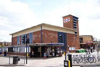
Turnpike Lane is a London Underground station at Turnpike Lane in the London Borough of Haringey in north London, England. The station is on the northeastern part of the Piccadilly line between Manor House and Wood Green. The station was opened on 19 September 1932 as part of the Cockfosters extension. It is in Travelcard Zone 3.
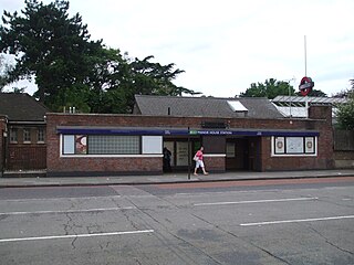
Manor House is a London Underground station. It is on the Piccadilly line between Finsbury Park and Turnpike Lane stations, and is on the boundary between Travelcard Zone 2 and Zone 3. It straddles the border between the London Boroughs of Hackney and Haringey, the postal address and three of the entrances being in the former, and one entrance in the latter.
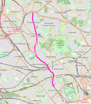
Finchley Road is a designated 4.5-mile (7-kilometre) arterial road in north-west London, England. The Finchley Road starts in St John's Wood near central London as part of the A41; its southern half is a major dual carriageway with high traffic levels often frequented by lorries and long-distance coaches as it connects central London, via the A41 Hendon Way, to the M1 motorway at Brent Cross and other roads at that interchange.
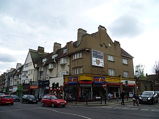
Green Lanes is a main road in North London which forms part of the A105 road. Covering a distance of 6.3 miles (10.1 km) between Newington Green and Winchmore Hill, it is one of the longest streets in the capital, passing through the N16, N4, N8, N13 and N21 postcode areas. Green Lanes is recognised as one of the longest roads in the world, and can be seen from space.

Bounds Green is a suburb to the north of Wood Green, in the London Borough of Haringey and London Borough of Enfield in north London. Parts of it are also known as New Southgate, but most of New Southgate lies in the London Borough of Enfield to the north-west.
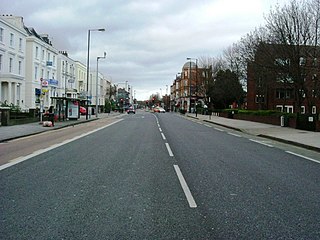
Uxbridge Road is the name of the A4020 road in West London. The 12-mile (19 km) route starts at Shepherd's Bush Green and goes west towards Uxbridge. It passes through Acton, Ealing, Hanwell, Southall, Hayes, and Hillingdon.
The area around Hornsey railway station in Hornsey has been the site of several railway maintenance facilities from the mid 19th century onwards.

The Mall Wood Green is a large shopping centre and residential complex in Wood Green, north London. It was originally known as Wood Green Shopping City.

West Green is a district in north London, England, in the United Kingdom; within the London Borough of Haringey. It is located 5.7 miles (9.22 km) north of Charing Cross.

Noel Park in north London is a planned community built in the late 19th and early 20th centuries consisting of 2,200 model dwellings, designed by Rowland Plumbe. It was developed as the Noel Park Estate on a tract of land on the edge of north London as part of the fast growing development of Wood Green. It is one of four developments on the outskirts of London built by the Artizans, Labourers & General Dwellings Company. From 2003 to sometime in 2009, the name was also given to a small park near the southern edge of Noel Park, formerly known – and now known again – as Russell Park.

Duckett's Common, together with Green Gate Common, form a public park in Harringay, in the London Borough of Haringey. The park is located opposite Turnpike Lane Underground station, on Green Lanes. It offers several amenities including an outdoor gym and basketball courts.
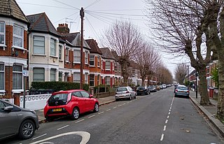
Duckett's Green is an area of north London, England in the United Kingdom and part of the London Borough of Haringey. It is an inner-suburban area located 5.8 miles (9.4 km) north of Charing Cross.