Turtmann-Unterems

Last updated
Turtmann-Unterems
Unterems.jpg
Unterems village in Turtmann-Unterems
Flag of Turtmann.gif
Turtmann.gif
Location of Turtmann-Unterems
Turtmann-Unterems
Switzerland adm location map.svg
Red pog.svg
Turtmann-Unterems
Reliefkarte Wallis blank.png
Red pog.svg
Turtmann-Unterems
Coordinates: 46°17′N7°42′E / 46.283°N 7.700°E / 46.283; 7.700
Country Switzerland
Canton Valais
District Leuk
Government
   Mayor Johann Tscherrig
Area
[1]
  Total42.42 km2 (16.38 sq mi)
Elevation
1,003 m (3,291 ft)
Highest elevation
(Massoltern)
1,200 m (3,900 ft)
Lowest elevation
800 m (2,600 ft)
Population
 (31 December 2018) [2]
  Total1,111
  Density26/km2 (68/sq mi)
Time zone UTC+01:00 (Central European Time)
  Summer (DST) UTC+02:00 (Central European Summer Time)
Postal code(s)
3948/3946
SFOS number 6119
Surrounded by Agarn, Ergisch, Oberems, Turtmann
Website www.turtmann-unterems.ch
SFSO statistics

Turtmann-Unterems is a municipality in the district of Leuk in the canton of Valais in Switzerland. The municipalities of Turtmann and Unterems merged on 1 January 2013 into the new municipality of Turtmann-Unterems. [3]

Contents

Geography

Turtmann village 20150816-Tourtemagne.jpg
Turtmann village

Turtmann-Unterems had an area, (as of the 2004/09 survey) of 42.42 km2 (16.38 sq mi). [4] Of this area, about 14.2% is used for agricultural purposes, while 12.4% is forested. Of the rest of the land, 3.1% is settled (buildings or roads) and 70.2% is unproductive land. Over the past two decades (1979/85-2004/09) the amount of land that is settled has increased by 27 ha (67 acres) and the agricultural land has decreased by 57 ha (140 acres). [5]

Before the merger, Turtmann had an area, as of 2011, of 6.8 square kilometers (2.6 sq mi). Of this area, 46.2% is used for agricultural purposes, while 36.4% is forested. Of the rest of the land, 14.2% is settled (buildings or roads) and 3.2% is unproductive land. [6] It was located in the Leuk district, south of the Rhone river down in the Rhone valley at the entrance to the Turtmann valley. It consists of the village of Turtmann and the hamlets of Tännu and Ried.

Before the merger, Unterems had an area, as of 2011, of 1.4 square kilometers (0.54 sq mi). Of this area, 39.1% is used for agricultural purposes, while 53.6% is forested. Of the rest of the land, 7.2% is settled (buildings or roads) and 0.0% is unproductive land. [6] It was located in the Leuk district, high on the left side of the Rhone valley. It consists of the village of Unterems and the hamlets of Ze Schmidu, Feldishaus and Prupräsu.

Demographics

Turtmann-Unterems has a population (as of December 2020) of 1,094. [7] As of 2013, 10.1% of the population are resident foreign nationals. Over the last 3 years (2010-2013) the population has changed at a rate of -2.77%. The birth rate in the municipality, in 2013, was 14.2 while the death rate was 8.0 per thousand residents. [5]

As of 2013, children and teenagers (0–19 years old) make up 17.4% of the population, while adults (20–64 years old) are 63.6% and seniors (over 64 years old) make up 18.9%. [5]

Historic Population

The historical population is given in the following chart: [8]

Turtmann-Unterems

Sights

The entire village of Turtmann is designated as part of the Inventory of Swiss Heritage Sites. [9]

Economy

Turtmann train station 20150816-TourtemagneGare.jpg
Turtmann train station

As of  2012, there were a total of 530 people employed in the municipality. Of these, a total of 94 people worked in 36 businesses in the primary economic sector. The secondary sector employed 204 workers in 22 separate businesses. Finally, the tertiary sector provided 232 jobs in 61 businesses. In 2013 a total of 4.5% of the population received social assistance. [5]

Crime

In 2014 the crime rate, of the over 200 crimes listed in the Swiss Criminal Code (running from murder, robbery and assault to accepting bribes and election fraud), in Turtmann-Unterems was 13.3 per thousand residents. This rate is lower than average, at only 31.4% of the cantonal rate and 20.6% of the average rate in the entire country. During the same period, the rate of drug crimes was 7.1 per thousand residents, which is only 71.7% of the national rate. The rate of violations of immigration, visa and work permit laws was 0 per thousand residents. [10]

Related Research Articles

<span class="mw-page-title-main">Beckenried</span> Municipality in Nidwalden, Switzerland

Beckenried is a municipality in the canton of Nidwalden in Switzerland.

<span class="mw-page-title-main">Stansstad</span> Municipality in Nidwalden, Switzerland

Stansstad is a municipality in the canton of Nidwalden in Switzerland.

<span class="mw-page-title-main">Leuk</span> Municipality in Valais, Switzerland

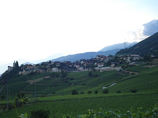
Leuk is a municipality in the district of Leuk in the canton of Valais in Switzerland. On 1 January 2013, the former municipality of Erschmatt merged into the municipality of Leuk.

<span class="mw-page-title-main">Wil</span> City in St. Gallen, Switzerland

Wil is the capital of the Wahlkreis (constituency) of Wil in the canton of St. Gallen in Switzerland.

<span class="mw-page-title-main">Isenthal</span> Municipality in Uri, Switzerland

Isenthal is a municipality in the canton of Uri in Switzerland.

<span class="mw-page-title-main">Attinghausen</span> Municipality in Uri, Switzerland

Attinghausen is a village and a municipality in the canton of Uri in Switzerland.

<span class="mw-page-title-main">Bever, Switzerland</span> Municipality in Graubünden, Switzerland

Bever is a municipality in the Maloja Region in the Swiss canton of Graubünden.

<span class="mw-page-title-main">Schwanden bei Brienz</span> Municipality in Bern, Switzerland

Schwanden bei Brienz is a municipality in the Interlaken-Oberhasli administrative district in the canton of Bern in Switzerland.

<span class="mw-page-title-main">Realp</span> Municipality in Uri, Switzerland

Realp is a municipality in the canton of Uri in Switzerland.

<span class="mw-page-title-main">Gettnau</span> Former municipality in Lucerne, Switzerland

Gettnau is a former municipality in the district of Willisau in the canton of Lucerne in Switzerland. On 1 January 2021 the former municipality of Gettnau merged into Willisau.

<span class="mw-page-title-main">Ergisch</span> Municipality in Valais, Switzerland

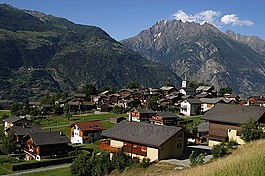
Ergisch is a municipality in the district of Leuk in the canton of Valais in Switzerland.

<span class="mw-page-title-main">Turtmann</span> Former municipality in Valais, Switzerland

Turtmann is a former municipality in the district of Leuk in the canton of Valais in Switzerland. The municipalities of Turtmann and Unterems merged on 1 January 2013 into the new municipality of Turtmann-Unterems.

<span class="mw-page-title-main">Unterems</span> Former municipality in Valais, Switzerland

Unterems is a former municipality in the district of Leuk in the canton of Valais in Switzerland. The municipalities of Turtmann and Unterems merged on 1 January 2013 into the new municipality of Turtmann-Unterems.

<span class="mw-page-title-main">Varen, Switzerland</span> Municipality in Valais, Switzerland

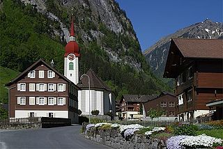
Varen is a municipality in the district of Leuk in the canton of Valais in Switzerland.

Le Flon is a municipality in the district of Veveyse in the canton of Fribourg in Switzerland. It was created in 2004 through the merger of Bouloz, Pont (Veveyse) and Porsel.

<span class="mw-page-title-main">Sils im Domleschg</span> Municipality in Graubünden, Switzerland

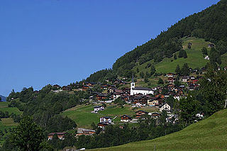
Sils im Domleschg is a municipality in the Viamala Region in the Swiss canton of Graubünden.

<span class="mw-page-title-main">Clos du Doubs</span> Municipality in Jura, Switzerland

Clos du Doubs is a municipality in the district of Porrentruy in the canton of Jura in Switzerland. It was founded on January 1, 2009 by the former municipalities of Epauvillers, Epiquerez, Montenol, Montmelon, Ocourt, Saint-Ursanne and Seleute. Soubey voted not to join the merger.

<span class="mw-page-title-main">Gampel-Bratsch</span> Municipality in Valais, Switzerland

Gampel-Bratsch is a municipality in the district of Leuk in the canton of Valais in Switzerland. It was formed on January 1, 2009. The voters of the municipalities of Gampel and Bratsch decided to merge on January 20, 2008.

<span class="mw-page-title-main">Mettauertal</span> Municipality in Aargau, Switzerland

Mettauertal is a municipality in the district of Laufenburg in the canton of Aargau in Switzerland. On 1 January 2010 the municipalities of Hottwil, Etzgen, Mettau, Oberhofen and Wil merged to form the new municipality of Mettauertal.

<span class="mw-page-title-main">Drei Höfe</span> Municipality in Solothurn, Switzerland

Drei Höfe is a municipality in the district of Wasseramt in the canton of Solothurn in Switzerland. On 1 January 2013 the former municipalities of Heinrichswil-Winistorf and Hersiwil merged to form the new municipality of Drei Höfe.

References

  1. "Arealstatistik Standard - Gemeinden nach 4 Hauptbereichen". Federal Statistical Office. Retrieved 13 January 2019.
  2. "Ständige Wohnbevölkerung nach Staatsangehörigkeitskategorie Geschlecht und Gemeinde; Provisorische Jahresergebnisse; 2018". Federal Statistical Office. 9 April 2019. Retrieved 11 April 2019.
  3. Amtliches Gemeindeverzeichnis der Schweiz published by the Swiss Federal Statistical Office (in German) accessed 2 January 2013
  4. Arealstatistik Standard - Gemeindedaten nach 4 Hauptbereichen
  5. 1 2 3 4 Swiss Federal Statistical Office - Regional portraits accessed 2 May 2016
  6. 1 2 Swiss Federal Statistical Office accessed 4 January 2013
  7. "Ständige und nichtständige Wohnbevölkerung nach institutionellen Gliederungen, Geburtsort und Staatsangehörigkeit". bfs.admin.ch (in German). Swiss Federal Statistical Office - STAT-TAB. 31 December 2020. Retrieved 21 September 2021.
  8. Federal Statistical Office STAT-TAB Bevölkerungsentwicklung nach Region, 1850-2000 Archived 2012-03-17 at the Wayback Machine (in German) accessed 29 January 2011
  9. "Kantonsliste A-Objekte". KGS Inventar (in German). Federal Office of Civil Protection. 2009. Archived from the original on 28 June 2010. Retrieved 25 April 2011.
  10. Statistical Atlas of Switzerland accessed 5 April 2016