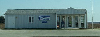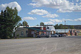
Wheatland County is a county in the U.S. state of Montana. As of the 2020 census, the population was 2,069. Its county seat is Harlowton. Wheatland County was established on February 22, 1917, with areas partitioned from Meagher and Sweet Grass counties. It was named for the abundant wheat-growing areas across the center portion of the new county's area.

Murray County is a county in the Northwest region of the U.S. state of Georgia. As of the 2020 census, the population was 39,973. The county seat is Chatsworth. Murray County is part of the Dalton, GA Metropolitan Statistical Area, which is also included in the Chattanooga-Cleveland-Dalton, TN-GA-AL Combined Statistical Area.

Somerset Township is a civil township of Hillsdale County in the U.S. state of Michigan. The population was 4,532 at the 2020 census.

Harlowton is a city in and the county seat of Wheatland County, Montana, United States. The population was 955 at the 2020 census.

Westerville is an unincorporated community and census-designated place in Custer County, Nebraska, United States. It is located at the intersection of U.S. Route 183 and Nebraska Highway 70. As of the 2010 census it had a population of 39.

Springfield is an unincorporated community and census-designated place in the town of Lyons, in Walworth County, Wisconsin, United States. As of the 2020 census, its population was 168. Located just northeast of Lake Geneva, it contains a mere eight streets. Springfield has an area of 0.673 square miles (1.74 km2), all of it land.

Collins is an unincorporated census-designated place in the town of Rockland, Manitowoc County, Wisconsin, United States, in the east central part of the state. Its zip code is 54207, although its post office is being studied for closure. As of the 2010 census, its population is 164.

Martinsdale is an unincorporated community and census-designated place in southeastern Meagher County, Montana, United States. As of the 2020 census, the population was 43. The town was a station stop on the now-abandoned transcontinental main line of the Chicago, Milwaukee, St. Paul and Pacific Railroad, and is a community center for nearby ranches and farms. Martinsdale was the home of the poet Grace Stone Coates, author of Black Cherries,Mead & Mangel-Wurzel, and Portulacas in the Wheat. It was also the home of Charles M. Bair, one of the largest and most successful sheep ranchers in the United States, and the former Bair family home is now a museum.
Haugan is an unincorporated community and census-designated place in Mineral County, Montana, United States. Haugan is situated 16 miles (26 km) east of the Idaho border and 90 miles (140 km) west of Missoula on Interstate 90 at the Haugan Exit #16. The St. Regis River flows through the community. As of the 2020 census, the population of Haugan was 58.

Shelby is a census-designated place and unincorporated community in Shelby County, Alabama, United States. Its population was 1,044 as of the 2010 census. The area is near Lay Lake and Waxahatchee Creek. Shelby Iron Park is located at the heart of the area. Two sites in Shelby, The Brick House and the Old Shelby Hotel, are listed on the Alabama Register of Landmarks and Heritage.
Turner is a Census-designated place village in Blaine County, Montana, United States. Turner is located on Montana State Highway 241, 41.5 miles (66.8 km) east-northeast of Chinook. It is 12 miles south of the Canadian border. Its population was 61 as of the 2010 census.

Huson is a census-designated place and unincorporated community in Missoula County, Montana, United States. Its population was 256 as of the 2020 census, up from 210 in 2010.
Pray is a census-designated place and unincorporated community in Park County, Montana, United States, in the Paradise Valley. The town was founded in 1907 by Valentine Eggar, an entrepreneur. He named it after Congressman Charles Nelson Pray. Its population was 681 as of the 2010 census. Pray has a post office with ZIP code 59065, which opened on December 8, 1909.
Shawmut is a census-designated place and unincorporated community in Wheatland County, Montana, United States. Its population was 42 as of the 2010 census. Shawmut has a post office with ZIP code 59078, which opened on October 27, 1885. The community is located along U.S. Route 12 and Montana Highway 3.

Dupuyer is a census-designated place and unincorporated community in Pondera County, Montana, United States. Its population was 86 as of the 2010 census. The community is located along U.S. Route 89 and Dupuyer Creek. Dupuyer has a post office with ZIP code 59432.
Stockett is a census-designated place and unincorporated community in Cascade County, Montana, United States. Its population was 169 as of the 2010 census. Stockett has a post office with ZIP code 59480.
Marion is a census-designated place and unincorporated community in Flathead County, Montana, United States. Its population was 1,119 as of the 2020 census. Marion has a post office with ZIP code 59925.
Olney is a census-designated place and unincorporated community in Flathead County, Montana, United States. Its population was 186 as of the 2020 census. Olney has a post office with ZIP code 59927. The most recent 2020 census states the population is 146 according to census.gov. The community is located along U.S. Route 93.
Duncan Ranch Colony is a Hutterite community and census-designated place (CDP) in Wheatland County, Montana, United States. It is in the west-central part of the county, on the south side of U.S. Route 12, 9 miles (14 km) west of Harlowton, the county seat, and 3 miles (5 km) east of Twodot. The Musselshell River flows eastward through the colony.
Harlowton Public Schools is a school district headquartered in Harlowton, Montana. It operates two schools: Hillcrest Elementary School and Harlowton High School.


