Typhoon Hester was a severe typhoon that formed in the 1952 Pacific typhoon season and continued into January 1953. As the twenty-ninth storm and twentieth typhoon of the season,it was first tracked by Joint Typhoon Warning Center (JTWC) near the Marshall Islands as a tropical storm on December 27. Hester quickly became a typhoon and rapidly intensified. Near the end of the year,Hester became a Category 5 typhoon on the modern-day Saffir–Simpson hurricane wind scale south of Guam. The typhoon soon weakened quickly as it curved eastward and sped up. It weakened into a tropical storm on January 4,and JTWC ceased tracking it hours later.
In preparations for the storm,shelters were opened in Guam,and all government buildings and businesses were closed. In Marshall Islands,Enewetak experienced significant flooding,and buildings were damaged by the wind. Eighteen people were injured on the island. In Guam,the only damages reported were destroyed crops due to waves and washed out roads. There were no fatalities caused by the storm.
Meteorological history
Map plotting the storm's track and intensity,according to the Saffir–Simpson scale
Hester was first tracked by the JTWC and the Japan Meteorological Agency (JMA) at 1800 UTC of December 27, 1952.[1] According to JTWC, the storm was located southeast of Majuro,[2] and had winds of 100km/h (60mph).[1] JMA located the storm south of Ebeye, as a tropical depression with a surface pressure of 1,000 hectopascals (30inHg), and upgraded it to a tropical storm six hours later at 0000 UTC of December 28.[3] JTWC upgraded the storm to a typhoon at the same time, with winds of 75mph (120km/h). On the next day, Hester strengthened to 90mph (145km/h) west of Marshall Islands. The storm began to rapidly intensify, as it moved north of the Caroline Islands. At 0000 UTC of December 30, Hester became a Category 5 typhoon on the Saffir–Simpson hurricane wind scale, with winds up to 160mph (255km/h).[1] It soon peaked in intensity on the next day at 1200 UTC, just south of the Mariana Islands. The storm had winds at 185mph(295km/h) and began to turn northwest.[2][1] On New Year's Day, the JMA recorded Hester's lowest pressure of 905hPa (26.7inHg).[3]
Hester began to weaken later that day, with winds down to 170mph (275km/h). By 0600 UTC of January 2, the winds lowered down to 150mph (240km/h), equivalent of a Category 4 typhoon.[1] Hester began to curve eastward and weaken rapidly.[2] On January 3, Hester continued to weaken to 110mph (175km/h), and eighteen hours later, it was down to 80mph (130km/h). It soon became a tropical storm on January 4, and soon dropped to a tropical depression later that day.[1] JTWC ceased tracking the storm near Minami-Tori-shima.[2] JMA downgraded the system to a tropical depression at 1200 UTC of January 5, and declared it extratropical twelve hours later. At 0600 UTC of January 6, JMA stopped tracking the cyclone northeast of Wake Island.[2][3]
Preparations and impact
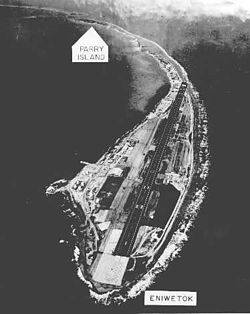
Enewetak Atoll in the 1950s
In Guam, underground shelters were open to residents, and hospitals were evacuated by December 31. All government offices and businesses were closed on the island. Roadblocks were placed by the police to keep vehicles off the road. A gale alert was issued for the Mariana Islands.[4] Due to the storm, a Pan American flight flew directly from Wake Island to Manila instead of stopping at Guam.[5] Four days later, shipping was warned for the area southeast of Formosa, as Hester approached the area.[6]
The northwest quadrant of Hester passed over Enewetak at 5:13 p.m in Marshall Islands Time (5:13 a.m UTC) on December 28, 1952. The United States Navy estimated that Hester generated winds around 70mph (110km/h), and generated waves up to 30 feet (9.1m) high on Enewetak. There were no direct reports on the island, where it was mostly underwater when the storm passed it. The hospital, mess halls, and clubs were damaged by the winds. Tents on the island were also destroyed.[7] A Coast GuardLORAN station on the island suffered extensive damage.[8] Overall, eighteen people were injured on Enewetak, and there were no fatalities.[9] The nearby atoll of Ujelang, received stronger winds than Enewetak, as it was closer to the center of Hester.[7] Hester passed south of Guam by 130 miles (210km), and no damage to military facilities were reported.[8] Storm surge reached 200 feet (61m) inland, to about 10 feet (3.0m) above sea level.[10] The only damage reported were crops being lashed by the waves on the south side of the island,[8] and a new section of highway near Ylig River was washed away. Two shore wave recorders installed by the University of California, Berkeley, located in Tarague Beach and Ylig River, were destroyed.[10] There were no casualties on the island.[8]
1 2 3 4 5 Knapp, Kenneth R.; Kruk, Michael C.; Levinson, David H.; Diamond, Howard J.; Neumann, Charles J. (2010). 1952 28W:HESTER (1952363N06171). Bulletin of the American Meteorological Society (Report). The International Best Track Archive for Climate Stewardship (IBTrACS): Unifying tropical cyclone best track data. Archived from the original on April 16, 2018. Retrieved April 15, 2018.
1 2 3 4 "Typhoon Barely Damages Guam". The Times. San Mateo, California. United Press International. December 31, 1952. p.14. Retrieved October 21, 2014– via Newspapers.com.
↑ "126 Mile-An-Hour Winds Lashes Guam". Lubbock Morning Avalanche. Lubbock, Texas. United Press International. December 31, 1952. p.8. Retrieved August 14, 2014– via Newspapers.com.
Moore, Frank; Moore, Bill (January 9, 1953). "With a Grain of Salt". Redlands Daily Facts. Redlands, California. Redlands Daily Facts. p.8. Retrieved November 20, 2014– via Newspapers.com.
This page is based on this Wikipedia article Text is available under the CC BY-SA 4.0 license; additional terms may apply. Images, videos and audio are available under their respective licenses.