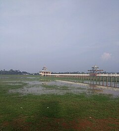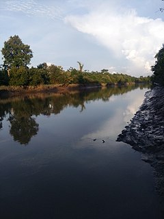
The Wardha River (Varada River, is a major river in Vidarbha region of Maharastra in India. The Wardha River joins the Wainganga River at Chaprala in Gadchiroli district and forms the Pranahita River which ultimately flows into Godavari.

Varzob is a settlement in Varzob District, Districts of Republican Subordination, Tajikistan, in central Asia. It is the administrative center for the Varzob District.

The Varada River is a river in central Karnataka, India. It is a tributary of the Tungabhadra River.

Falam Township is a township of Falam District in the Chin State of Burma (Myanmar). Its administrative seat is the town of Falam.

Rashida (Rasceda) is a desert village in the Jalo oasis of the Al Wahat District in the Cyrenaica region in northeastern Libya. It is about 3.7 kilometres (2.3 mi) southwest of the town of Jalu. In 1951, the population was reported as about 600.

The Chiloango River is a river in western Central Africa. It forms the westernmost part of the border between the Democratic Republic of the Congo and the Republic of Congo, and then forms approximately half of the border between the DRC and Cabinda, Angola passing just south of the town of Necuto. The river then bisects Cabinda, making it the most important river in the province. It enters the Atlantic Ocean just north of the town of Cacongo.

Cacongo is a town, with a population of 15,000 (2014), in Cacongo municipality, Cabinda Province, in Angola. The former Lândana municipality is now known as Cacongo, and the town is sometimes still known as Lândana. It is located on Lândana Bay about a kilometer south of the mouth of the Chiloango River.

Karabiga (Karabuga) is a town in Biga District, Çanakkale Province, in the Marmara region of Turkey. It is located at the mouth of the Biga River, on a small east-facing bay, known as Karabiga Bay. Its ancient name was Priapus or Priapos.
The Kyaw River is a river of upper Burma (Myanmar) in Magway Division. It is a major tributary of the Yaw River which it enters just below the town of Pauk.

Taze is a town in Shwebo District, Sagaing Division in Myanmar.

Yazagyo is the northernmost village in Kale Township, Kale District, of western Burma (Myanmar).

Siyin is a village in Kale Township, Kale District, in the Sagaing Region of western Burma. It is located about 10 kilometres (6.2 mi) west of Kalemyo on the Kalemyo – Theizang road. It lies at the mouth of the Siyin Valley where it debouches into the Kale Valley.

Jumayl is a town in central Nuqat al Khams District of western Libya. It is located about 10 kilometres (6 mi) southwest of the port of Zuwara. As of 2010, Jumayl had an estimated population of 102,000.

Lumë is a village in the former Shtiqën Municipality, Kukës County, Albania, beside the Kirit River. At the 2015 local government reform it became part of the municipality Kukës. It is about 21 kilometres (13 mi) northwest of Shkodër by road.
The Simiyu River is a river in Tanzania. It flows into Lake Victoria in the African Great Lakes region. As one of the six main inlets to Lake Victoria, it forms part of the upper headwaters of the Nile.

Mpanda is a city in Katavi Region of Tanzania, East Africa with a postcode number 50100. It is the administrative centre of Katavi Region, Mpanda District and is itself one of the four districts of the region.

Micheweni District is one of the two districts in the North Pemba Region of Tanzania. The administrative seat is the town of. As of 2002, Micheweni District had a population of 83,531.
Shinga Deuxième is a village in Sankuru province of the Democratic Republic of the Congo. It lies at an elevation of 611 meters along highway A807 fifty kilometers by road northwest of the town of Katako-Kombe, and just east of the Tshuapa River.

Tagundaing or Ta Khun Taing is a large village in the Kayin State of south-eastern Myanmar, located near the west bank of the Winyaw River and the west of the Kyain Seikgyi Township, Kawkareik District.The population as of the 2014 census was 4,994. Most of the residents are of the Karen (Kayin) ethnic group.

The Winyaw River is a river in southern part of Myanmar. It originates in Tenasserim Range and empties into the Ataran River at the village of Chaunghanakwa. Death Railway crosses the river near Anankwin village.


