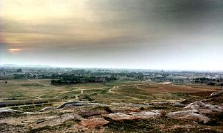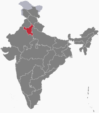
Mewat is a historical and cultural region which encompasses parts of the modern-day states of Haryana, Rajasthan, and Uttar Pradesh in northwestern India.

Nuh district, formerly known as the Mewat district, is one of the 22 districts of the northern Indian state of Haryana. The district is known for having the largest Muslim population in Haryana. It lies within the National Capital Region as well as the historical Mewat region and Braj region of India.
Ferozepur Jhirka is a town and historical settlement in the Ferozepur Jhirka sub-division of the Nuh district in the Indian state of Haryana.
Hathin is a town and a Municipal Committee in Palwal district of Haryana in India. It has the highest Muslim population in the Palwal district. It lies within the National Capital Region as well as the historical Mewat and Braj region of India
Nuh is a city and administrative headquarters of the Nuh district, located in the state of Haryana within the National Capital Region of India.
Punhana is a town in the Nuh district in the Indian state of Haryana. It is also the origin place of Chaudhary Rahim Khan. It lies within the National Capital Region as well as the Braj region of India.

Taoru or Tauru is a town, near Nuh city in Nuh district in the Indian state of Haryana.
Tijara is a city and a municipality in Khairthal-Tijara district of the Indian state of Rajasthan. Tijara comes under the NCR area and is situated 55 km to the northeast of Alwar. The nearest railway station to Tijara is Khairthal. Bhiwadi is a census town in Tijara. It is the biggest industrial area of Rajasthan and part of the historical Ahirwal Mewat region. Tijara is dominated by Ahir and Meo community. The new political map has not erased the ancient Ahirwal-Mewat boundaries.Ahirwal was a post-Mughal principality ruled by Ahirs or Yadavs.

Haryana, formed on 1 November 1966, is a state in North India. For the administrative purpose, Haryana is divided into 6 revenue divisions which are further divided into 22 districts. For Law and Order maintenance, it is divided into 5 Police Ranges and 4 Police Commissionerates.

Palwal district was created on 15 August 2008. It is the 21st district of Haryana state in Delhi NCR region of northern India. Palwal City is the headquarters of the district. It is part of the Braj region.

The following outline is provided as an overview of and topical guide to Haryana.
Khanpur Ghati is a village located in Nuh district in the state of Haryana, India. The Khanpur Ghati village has a population of 4225 of which 2188 are males while 2037 are females as per Population Census 2011.
Bisahan is a village in the Beri tehsil of Jhajjar district of Haryana, India. The village lies roughly 5 kilometres (3.1 mi) from the town of Beri.
Bhadas is a village, near Nuh city in Nuh district of Haryana state of India. It lies in the Mewat region of Delhi NCR and Delhi–Mumbai Industrial Corridor. It is located on the MDR135 to Hathin–Palwal and is also adjacent to the Delhi–Mumbai Expressway. It is 20 km from the Ferozepur Jhirka subdivision and 20 km from the Nuh city, district headquarter, 100 km far from national capital New Delhi and 355 km from state capital Chandigarh. It falls on the southern border of Haryana, near Alwar and Bharatpur Districts of Rajasthan. This lies in one of the most backward areas of the nation.
Moolthan is a village in Ferozepur Jhirka sub-division of Nuh district in Haryana state, India. The village lies in the Mewat region of Delhi NCR. It is located on Delhi–Mumbai Expressway on the Haryana-Rajasthan border.
Kolgaon is a village in the Ferozepur Jhirka sub-division of Nuh District, Haryana state, India.
Bhirawati is a village in Ferozepur Jhirka sub-division of Nuh district of Haryana state of India. It lies in the Mewat region of Delhi NCR and Delhi–Mumbai Industrial Corridor. It lies 10 km east of Sohna adjacent to the NH 919 and Delhi–Mumbai Expressway.
Mamman Khan is an Indian politician from the Indian National Congress, who was elected as a member of the Haryana Legislative Assembly in 2019 from Ferozepur Jhirka in the Nuh district of Haryana. He is a member of the All India Congress Committee and also served as former Working President of the District Congress Committee, Nuh.
The 2023 Haryana riots commonly referred to as the Nuh violence were a series of clashes in northern India that originated in the state of Haryana and have subsequently spread to nearby regions. On 31 July 2023, communal violence erupted in the Nuh district of Haryana between Muslims and Hindus during an annual Brajmandal Yatra pilgrimage organised by the Vishva Hindu Parishad (VHP). By the evening of the same day, fresh incidents of communal violence were reported from Gurugram and Sohna. As of 3 August 2023, the situation had resulted in at least seven fatalities and over 200 reported injuries.

Chaudhary Rahim Khan was an Indian politician, who served as a Member of Parliament representing the Faridabad constituency in the Lok Sabha, the lower house of the Indian Parliament. He died before he was to complete his term as Member of Parliament. He served as the Minister of Power and Irrigation, Waqf, and Fisheries in the Government of Haryana and was also elected as a Member of the Haryana Legislative Assembly three times.


