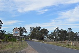
Jumbunna is a town in South Gippsland, Victoria, Australia. The name is taken from the eastern Kulin language of the Bunnerong tribe and means "a place to meet and talk".
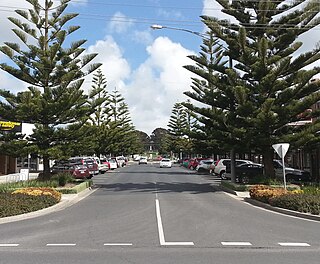
Wonthaggi is a seaside town located 132 kilometres (82 mi) south east of Melbourne via the South Gippsland and Bass Highways, in the Bass Coast Shire of Gippsland, Victoria, Australia. Known originally for its coal mining, it is now the largest town in South Gippsland, a regional area with extensive tourism, beef and dairy industries.

Werris Creek is a small town in New South Wales, Australia, near Tamworth, in Liverpool Plains Shire. It is north of Quirindi and is at the junction of the Main North railway line to Armidale and Moree. At the 2011 census, Werris Creek had a population of 1,437.

Muswellbrook railway station is a heritage-listed railway station located on the Main Northern line in Muswellbrook, in the Muswellbrook Shire local government area of New South Wales, Australia. The station serves the town of Muswellbrook and was designed by John Whitton, the Chief Engineer of NSW Railways. It is also known as Muswellbrook Railway Station and yard group and Musclebrook Railway Station. The property was added to the New South Wales State Heritage Register on 2 April 1999.
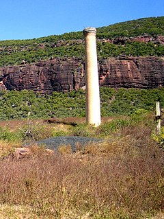
Mount Mulligan is a former mining town and rural locality in Shire of Mareeba, Queensland, Australia. It is the site of the Mount Mulligan mine disaster, Queensland's worst mining disaster.

Galong is a village in New South Wales, Australia, in Hilltops Council. At the 2016 census, the Galong State Suburb, that includes the village, had a population of 224. It is a typical Australian village located 1 hour's drive from the Australian Capital Territory (ACT).

Helensburgh is a small town in New South Wales, Australia. Helensburgh is located 45 kilometres south of the Sydney central business district and 34 kilometres (21 mi) north of Wollongong. Helensburgh is in the local government area of Wollongong City Council and marks the northern end of the Illawarra region. It is approximately halfway between Sydney and Wollongong, at the southern end of the Royal National Park.

Sandy Hollow is a small rural town in New South Wales, Australia in Muswellbrook Shire. The town is located on the Golden Highway in the far west of the Upper Hunter Region, about 260 km north of Sydney.

The Merriwa Branch Railway Line is in the Huhter Valley of Northern New South Wales, Australia.
The line branches from the Main North line at Muswellbrook and travels southwest to Denman then generally northwest through Sandy Hollow to the town of Merriwa, a distance of approximately 80 kilometres (50 mi). The line was completed to Merriwa on 29 October 1917, however the section north west of Sandy Hollow closed in 1988.
There are 2 mines, Bengalla, just southwest of Muswellbrook & Mangoola, 1/2 way to Denman with Ballon Loops of this line & a number of Passing Sidings have been built with the traffic to / from the 3 mines @ Ulan near Gulgong.
The section between Muswellbrook and Sandy Hollow, combined with the Sandy Hollow – Gulgong railway line forms the Australian Rail Track Corporation's Ulan line between Muswellbrook and Gulgong on the Gwabegar railway line.
The Sandy Hollow–Gulgong railway line is a railway line in eastern New South Wales, Australia. The line forms a cross country connection from the Main North line in the Upper Hunter region to the Gwabegar line in the Central West region. The line is approximately 125 kilometres in length. From the Gwabegar line, trains can then ultimately reach the Main West line creating a circuitous bypass of Sydney for freight traffic heading between the west and north of New South Wales. The line was opened in 1985.

Jennings is a town on the Northern Tablelands region of New South Wales, Australia. The town is located in the Tenterfield Shire local government area, 718 kilometres (446 mi) from the state capital, Sydney and 256 kilometres (159 mi) from Brisbane. It is separated by the state border from its neighbouring town of Wallangarra in Queensland. At the 2011 census, Jennings had a population of 211. The New England Highway and the Main North railway line cross the state border at Jennings. The town was named for Sir Patrick Jennings, the first Roman Catholic Premier of New South Wales.
Antiene is a rural locality of the Muswellbrook Shire local government area in the Hunter Region of New South Wales, Australia. Named after County Antrim in Northern Ireland, the locality was registered as "Antiene" because the request was made in illegible handwriting.

Gilgai is a town in the Northern Tablelands region of New South Wales, Australia The village is situated 10 km south of Inverell, New South Wales on Thunderbolts Way and is in Inverell Shire. At the 2006 census, Gilgai had a population of 289 people. The name Gilgai is an Aboriginal word meaning 'waterhole'.

Abermain is a town 8 km ENE of Cessnock and 3 km west of Weston, in New South Wales, Australia. Abermain is adjacent to Werakata National Park.
Marinna is a locality in Junee Shire in southern New South Wales, Australia. Its main feature is a grain silo on the Main South railway line. A station was opened in the locality between 1897 and 1975.

Acland is a rural town and locality in the Toowoomba Region, Queensland, Australia. In the 2016 census, Acland had a population of 32 people.
Outtrim is a locality in Victoria, Australia. It is located south of Korumburra off the Korumburra to Wonthaggi Road and is southeast of Melbourne.
Lilyvale is a locality most of whose area is within the Royal National Park, south of Sydney, New South Wales, Australia. Helensburgh railway station was within the southern populated part of the locality. A Lilyvale railway station was open from 1890 until 1983.
Bulga is a locality in the Singleton Council region of New South Wales, Australia. It had a population of 354 as of the 2016 census. The name is derived from an Aboriginal word for "mountain" or "isolated hill or mountain".
Warkworth is a locality in the Singleton Council region of New South Wales, Australia. It had a population of 49 as of the 2016 census.