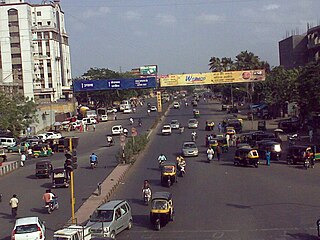
Chalthan is a census town in Surat City in the state of Gujarat, India.
Chhaprabhatha is a part of the Katargam zone in Surat Municipal Corporation
Gandevi is a City and a Municipality in Navsari district in the state of Gujarat, India.
Ichchhapor is a town in Surat district in the Indian state of Gujarat. The town comes under Hazira Urban Agglomerations.
Kadodara is a Suburban area and Municipality in the Surat City in the Indian state of Gujarat. Kadodra is a junction of NH 6 and NH8 HIGHWAY and kadodara is the middle way on Surat-Bardoli road. The civil agency of Kadodara. A boom in kadodara's real estate attracted many industrialists and due to its proximity to Surat. Many residential projects are under construction in Kadodara.
Limla is a census town in Surat district in the Indian state of Gujarat.
Parvat was City and a Municipality in Surat district in the Indian state of Gujarat. The town is roughly 8 km from Surat. As in 2006 Eight Municipalities Amalgamated in Surat and Parvat is one of those which was added to Limbayat Zone.
Utran is a census town situated in Surat district alongside Tapi river in the Indian state of Gujarat. Utran's Nearest airport is Surat. Nearest railway station is Utran Railway station.the first railway in Gujarat started from Utran to ankleshwar.
Vijalpor is a city and a municipality in Navsari district in the Indian state of Gujarat. The city is under Surat Metropolitan Region. The town is located at a distance of 7 km south of Navsari City off Udhana-Nasik Highway.
Vyara is a town and the district headquarters of the Tapi district in the Indian state of Gujarat. It is 65 kilometres from Surat.

Udhna is a Suburban area of Surat, located primarily on Surat-Navsari Highway in the Indian state of Gujarat. Udhna is an Industrial Area in city of Surat, India. It is about 9 km from Surat central Railway Station and 14 km from Surat Airport.
Bamroli was a city and a Municipality in Surat district in the Indian state of Gujarat. The town is located 15 km south of Surat near Pandesara. The city comes under Surat Metropolitan Region. The city is one of the eight amalgamated Municipalities in Surat City. Now it is an Accommodates more than 4 lacs or 0.4 million people. The city is cosmopolitan neighbourhood in Surat. The majority of population are from Bihar, Uttar Pradesh, Odisha, Maharashtra, South India, Rajasthan, etc.
Godadra was a city and a Municipality in Surat City in the Indian state of Gujarat. The town comes under Greater Surat. Godadara is one of the eight amalgamated municipalities in Surat and was added to Limbayat Zone.
Puna is a suburb of Surat in the Indian state of Gujarat. The city is located 9 km east of Surat on the Surat-Bardoli highway NH6. Puna comes under the Surat Metropolitan Region.
Kanakpur-Kansad is a town in Surat Municipal Corporation in Surat district in the Indian state of Gujarat. The town is located 25 km south of Surat off the Surat-Navsari highway near Sachin. The town is situated on the banks of Mindhola River. Due to its proximity to Industrial town of Sachin many labors and workers from textile industry reside here. The majority of the population reside here are native Kolis.
Amroli is a suburb in around Surat state of gujarat in India. The nearest airport is surat airport.
Kosad is a town and municipality in Surat city in the Indian state of Gujarat.
Tarasadi is a city and municipality in Surat district in the Indian state of Gujarat. The town is located 45 km North-East of Surat on Surat-Mumbai highway near Kosamba.
Vijalpore is a city and Municipality in the Navsari district in the Indian state of Gujarat. The town is located 5 km south-west of Navsari near Surat-Nasik Highway. The town comes under the purview of Surat Metropolitan Region.
Maroli is a town in the state of Gujarat, India. The town is also one of the satellite towns of Surat Metropolitan Region. It is located 25 kilometers from Surat on Surat-Navsari Highway.


